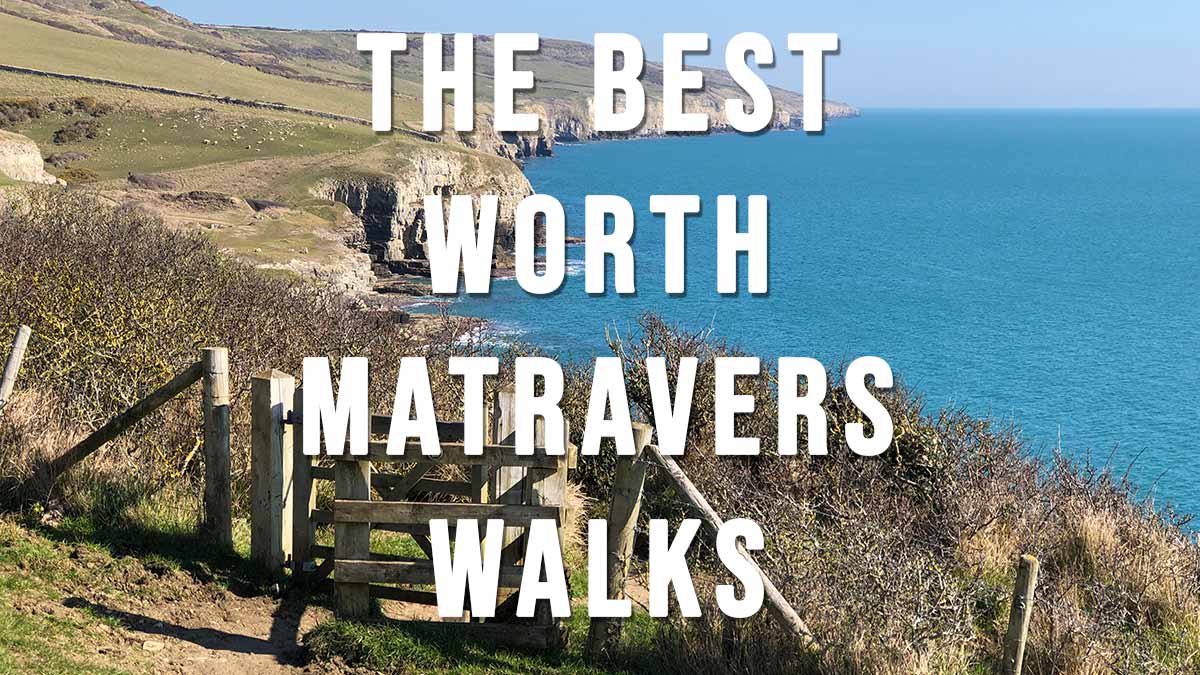
The Best Worth Matravers Walks covers 10 of my favourite walks starting in the picturesque village of Worth Matravers which is located 4 miles west of Swanage and 4 miles south of Corfe Castle.
Worth Matravers is a great base for undertaking many walks in the Purbeck Hills because it has two large car parks, a lovely village green and duckpond, a beautiful old church and one of the best pubs in Dorset – The Square and Compass that serves real ale and a selection of tasty pasties. What more could you want? Further details and photos of the village can be found on our post Worth Matravers
The majority of the walks listed below start at the main Worth Matravers Car Park Sat Nav postcode BH19 3LE (Google map)(what3words). This is a large car park with public toilets well maintained by the Worth Matravers Parish Council. The car park charge is £2 all day which is paid into an honesty box. Please do not park in the village especially around the village green as it causes congestion and many large farm vehicles need constant access through these narrow lanes.
An alternative car park is located 1 mile further west just beyond Weston Farm at Renscombe. This car park can be accessed by driving through the village and past the church. Renscombe Car Park is more convenient for walks to St Aldhelm’s Head and Chapman’s Pool. The Sat Nav postcode of the car park is BH19 3LL (Google map) (what3words)
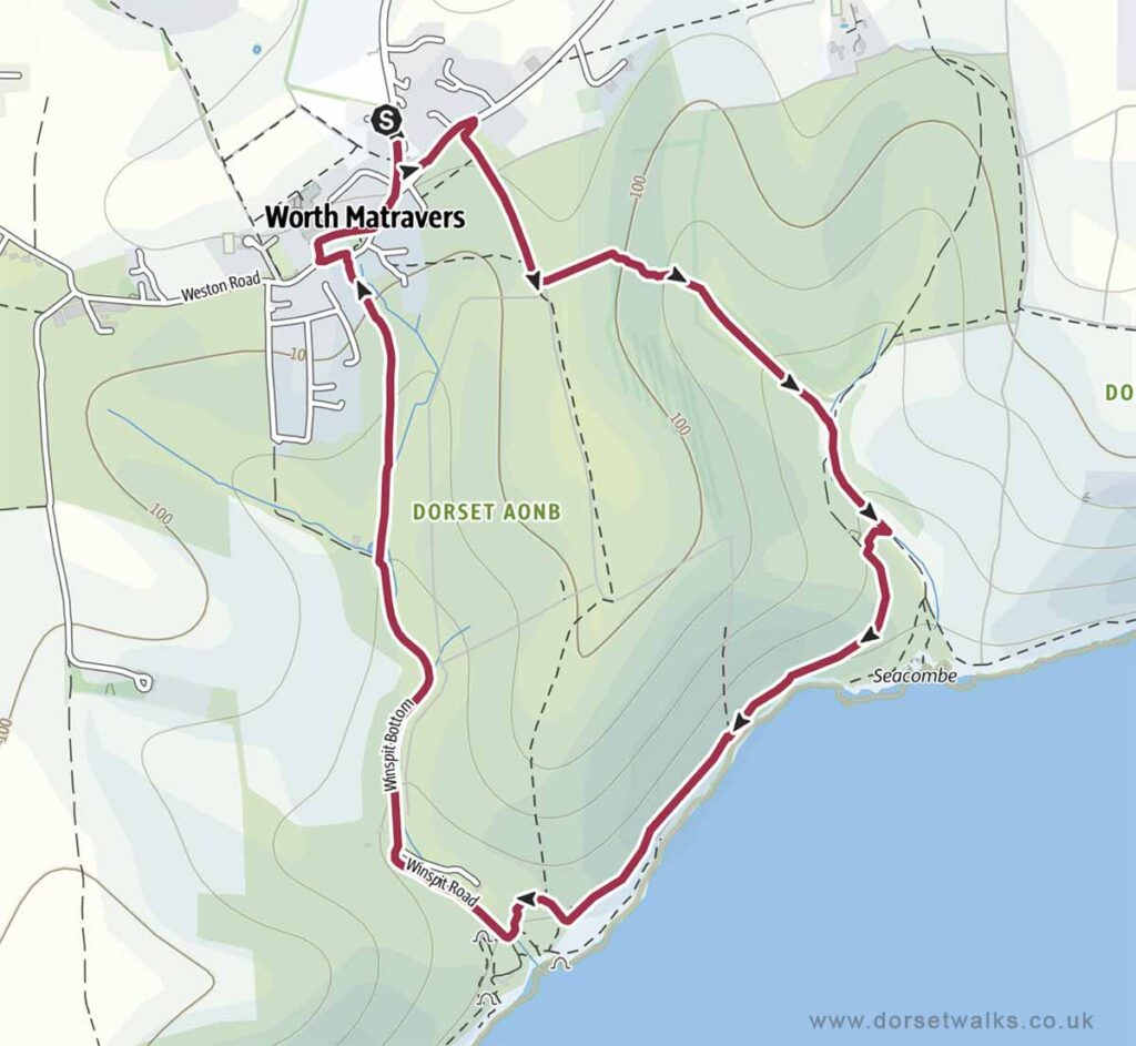
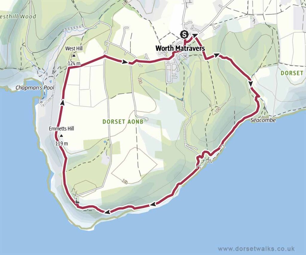
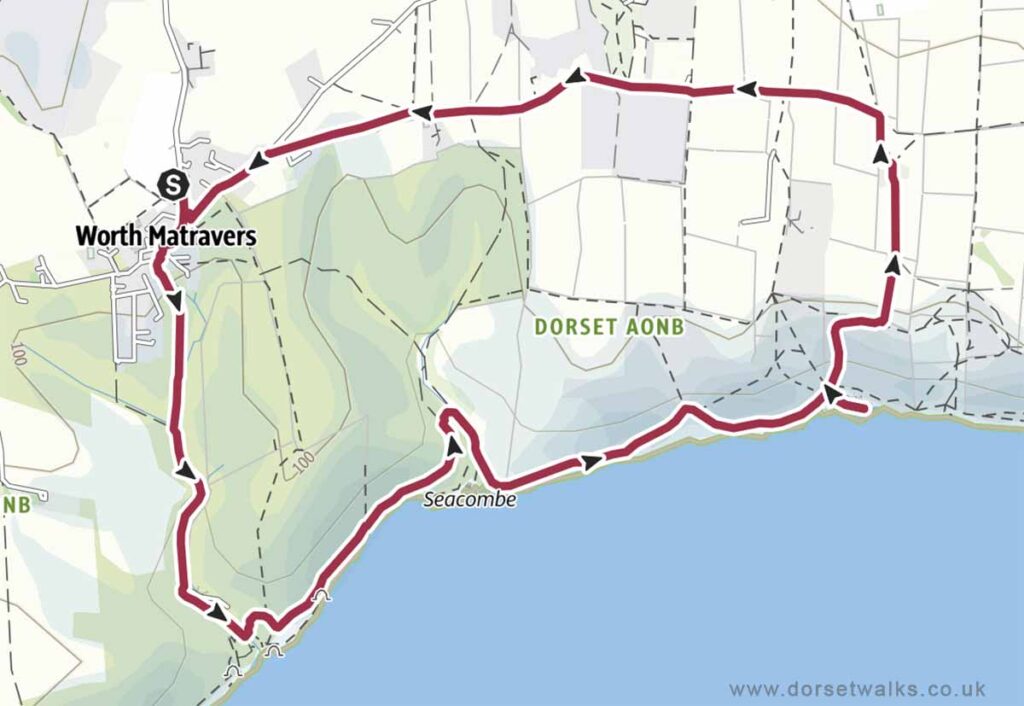
1. Worth Matravers to Seacombe & Winspit Walk
Distance: 3 miles (circular)
Difficulty: Easy
Estimated time: 1 hour 30 minutes
Total ascent 443ft, Highest point 440ft
OS Map: Explorer OL15 Purbeck & South Dorset
*** Route description and photos ***
Link to GPS route map
https://www.outdooractive.com/
https://www.alltrails.com/
https://explore.osmaps.com/
https://www.google.com/maps/
Base map © OpenStreetMap
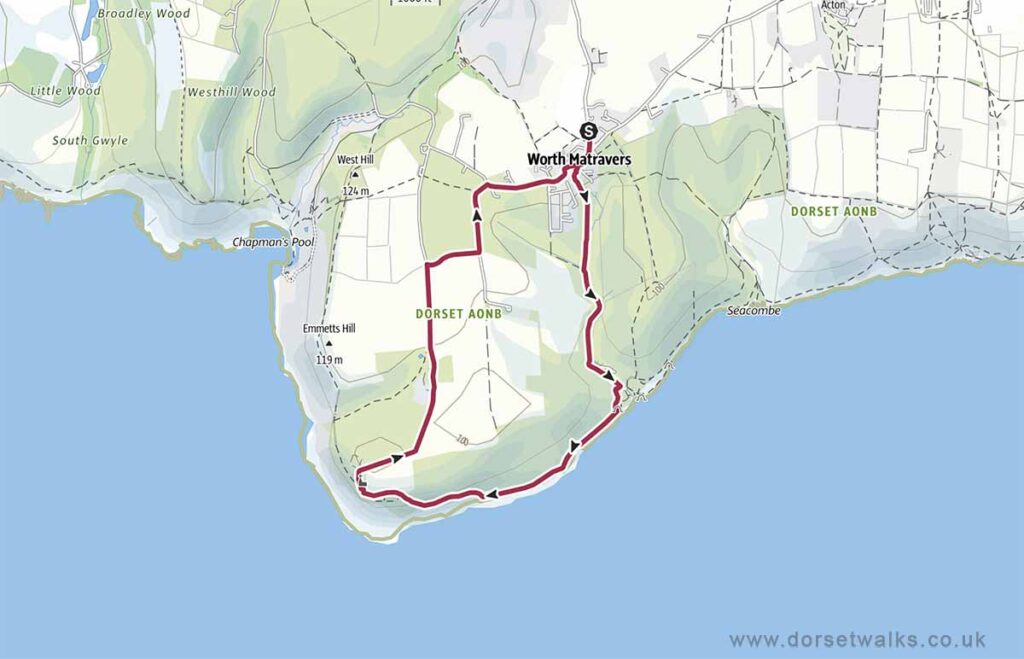
2. Worth Matravers to Winspit & St Aldhelm’s Head Walk
Distance: 4.4 miles (circular)
Difficulty: Easy
Estimated time: 2 hours 15 minutes
Total ascent 558ft, Highest point 440ft
OS Map: Explorer OL15 Purbeck & South Dorset
*** Route description and photos ***
Link to GPS route map
https://www.outdooractive.com/
https://www.alltrails.com/
https://explore.osmaps.com/
https://www.google.com/maps/
Base map © OpenStreetMap
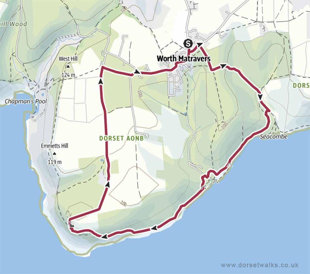
3. Worth Matravers to Seacombe & St Aldhelm’s Head Walk
Distance: 5.2 miles (circular)
Difficulty: Easy
Estimated time: 2 hours 45 minutes
Total ascent 689ft, Highest point 440ft
OS Map: Explorer OL15 Purbeck & South Dorset
Link to GPS route map
https://www.outdooractive.com/
https://www.alltrails.com/
https://explore.osmaps.com/
https://www.google.com/maps/
Base map © OpenStreetMap
4. Worth Matravers to Seacombe & Chapman’s Pool Walk
Distance: 5.3 miles (circular)
Difficulty: Medium
Estimated time: 2 hours 55 minutes
Total ascent 906ft, Highest point 440ft
OS Map: Explorer OL15 Purbeck & South Dorset
Link to GPS route map
https://www.outdooractive.com/
https://www.alltrails.com/
https://explore.osmaps.com/
https://www.google.com/maps/
Base map © OpenStreetMap
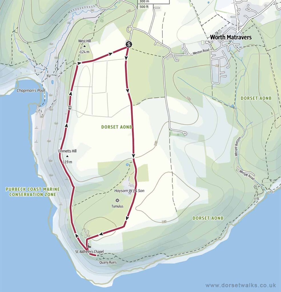
5. Worth Matravers to St Aldhelm’s Head & Chapman’s Pool Walk
Distance: 2.9 miles (circular)
Difficulty: Moderate
Estimated time: 1 hour 25 minutes
Total ascent 394ft, Highest point 427ft
OS Map: Explorer OL15 Purbeck & South Dorset
*** Route description and photos ***
Link to GPS route map
https://www.outdooractive.com/
https://www.alltrails.com/
https://explore.osmaps.com/
https://www.google.com/maps/
Base map © OpenStreetMap
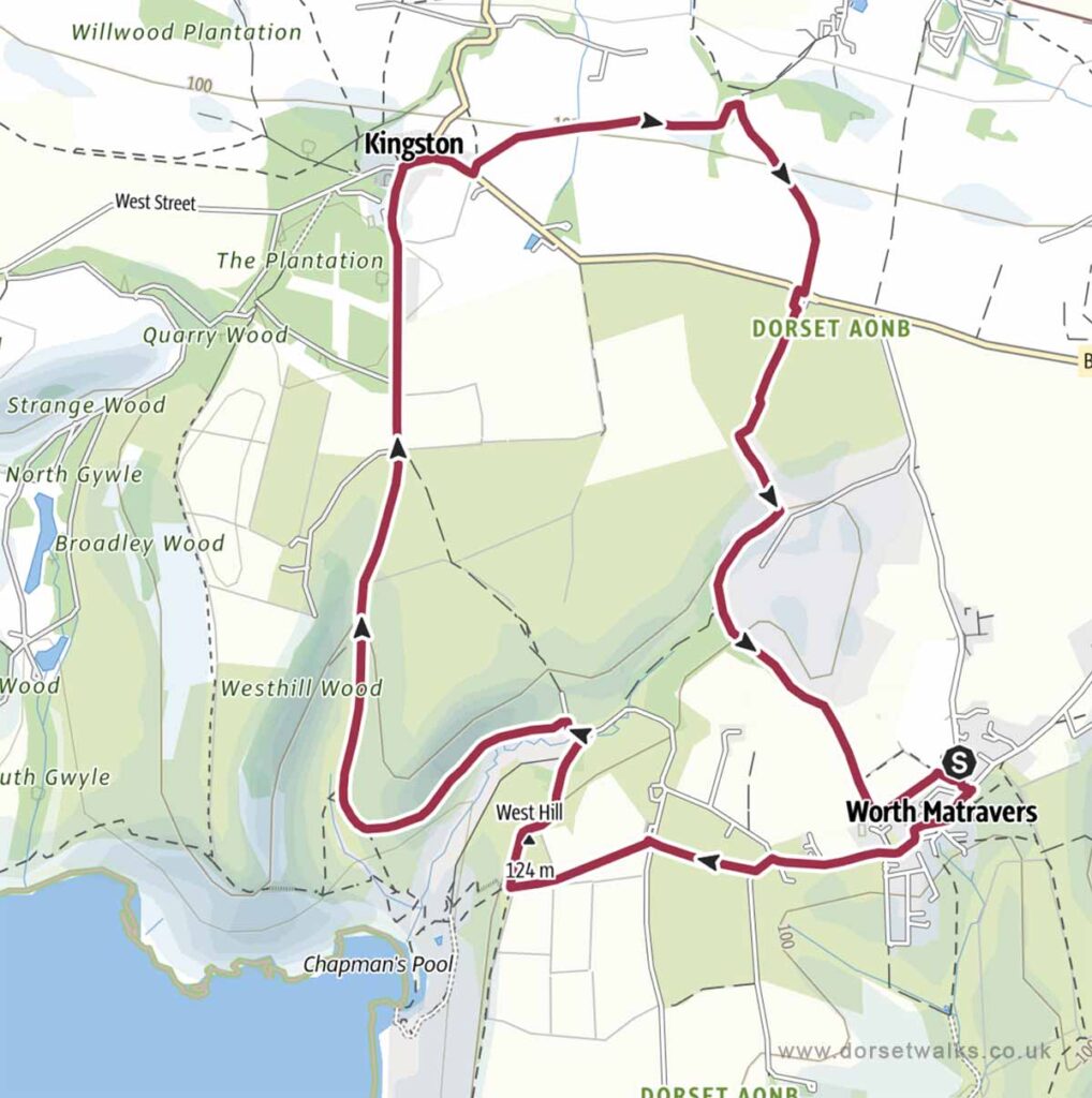
6. Worth Matravers to Chapman’s Pool & Kingston Walk
Distance: 6.2 miles (circular)
Difficulty: Easy
Estimated time: 2 hours 45 minutes
Total ascent 768ft, Highest point 502ft
OS Map: Explorer OL15 Purbeck & South Dorset
Link to GPS route map
https://www.outdooractive.com/
https://www.alltrails.com/
https://explore.osmaps.com/
https://www.google.com/maps/
Base map © OpenStreetMap
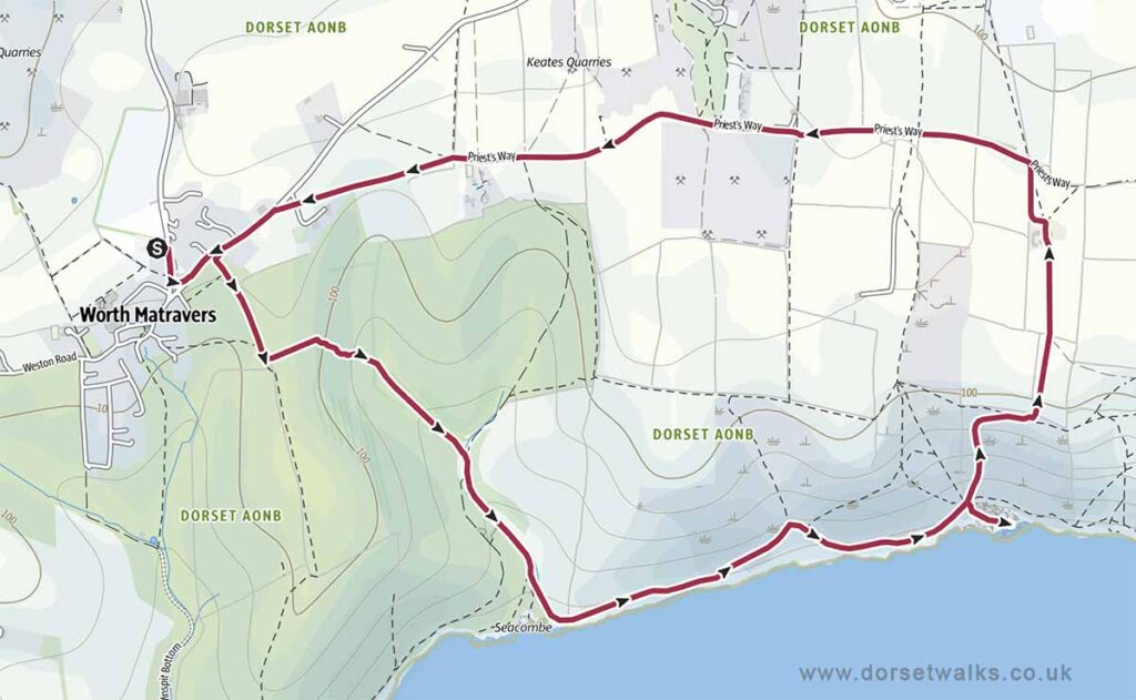
7. Worth Matravers to Seacombe & Dancing Ledge Walk
Distance: 4.5 miles (circular)
Difficulty: Moderate
Estimated time: 2 hours 20 minutes
Total ascent 833ft, Highest point 456ft
OS Map: Explorer OL15 Purbeck & South Dorset
Link to GPS route map
https://www.outdooractive.com/
https://www.alltrails.com/
https://explore.osmaps.com/
https://www.google.com/maps/
Base map © OpenStreetMap
8. Worth Matravers to Winspit & Dancing Ledge Walk
Distance: 5.5 miles (circular)
Difficulty: Moderate
Estimated time: 2 hours 55 minutes
Total ascent 988ft, Highest point 456ft
OS Map: Explorer OL15 Purbeck & South Dorset
Link to GPS route map
https://www.outdooractive.com/
https://www.alltrails.com/
https://explore.osmaps.com/
https://www.google.com/maps/
Base map © OpenStreetMap
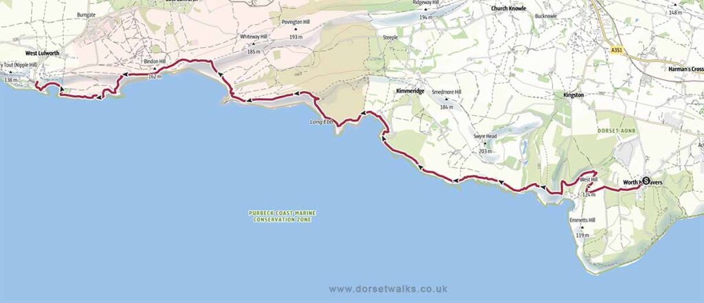
9. Worth Matravers to Lulworth Cove Walk (SWCP)
Distance: 13.1 miles (one-way)
Difficulty: Difficult
Estimated time: 7 hours 15 minutes
Total ascent 2192ft, Highest point 561ft
OS Map: Explorer OL15 Purbeck & South Dorset
The section of the South West Coast Path between the west of Kimmeridge and east of Lulworth Cove lies within the Lulworth Firing Range and can only be visited when the range is open which is usually most weekends and school holidays. However, to avoid disappointment, it’s always best to check opening dates in advance on the government website https://www.gov.uk/
Link to GPS route map
https://www.outdooractive.com/
https://www.alltrails.com/
https://explore.osmaps.com/
https://www.google.com/maps/
Base map © OpenStreetMap
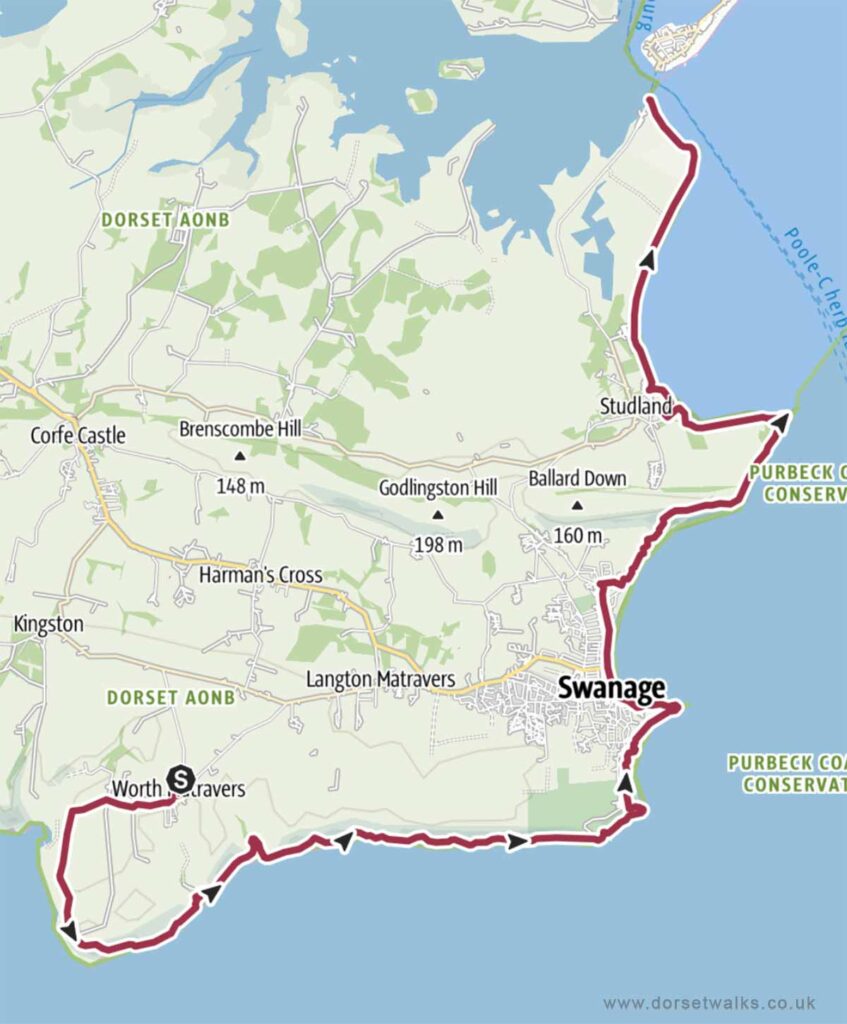
10. Worth Matravers to South Haven Point Walk (SWCP)
Distance: 17.3 miles (one-way)
Difficulty: Difficult
Estimated time: 9 hours 30 minutes
Total ascent 3537ft, Highest point 427ft
OS Map: Explorer OL15 Purbeck & South Dorset
Link to GPS route map
https://www.outdooractive.com/
https://www.alltrails.com/
https://explore.osmaps.com/
https://www.google.com/maps/
Base map © OpenStreetMap