
Dorset Country Walks is a selection of inland walking routes across Dorset, including hill forts, woodland paths and open countryside. These walks are generally quieter and less exposed than coastal routes, with easier terrain and a higher proportion of circular routes.
Each walk includes distance, route type and a short description, with links to detailed route pages including maps, parking and route guidance.
Colmers Hill Walk
1.6 miles, Circular, Easy
Description: Short but distinctive walk with a steady climb to Colmers Hill, offering wide views over the surrounding countryside and fields.
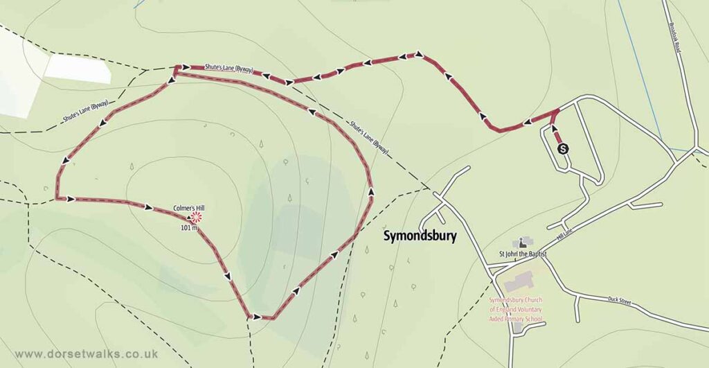
Base map © OpenStreetMap
Manswood Cranborne Chase
3.5 miles Circular, Easy
Description: Quiet woodland and farmland walk through Cranborne Chase, with gentle terrain and a mix of forest tracks and open countryside.
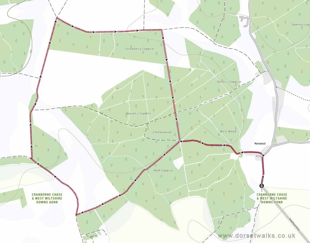
Base map © OpenStreetMap
Maiden Castle Dorchester
1.9 miles, Circular, Easy
Route: Maiden Castle car park (English Heritage) – Maiden Castle Hill Fort
Description: Circular walk around one of the largest Iron Age hill forts in Britain, with elevated views over Dorchester and the surrounding landscape.
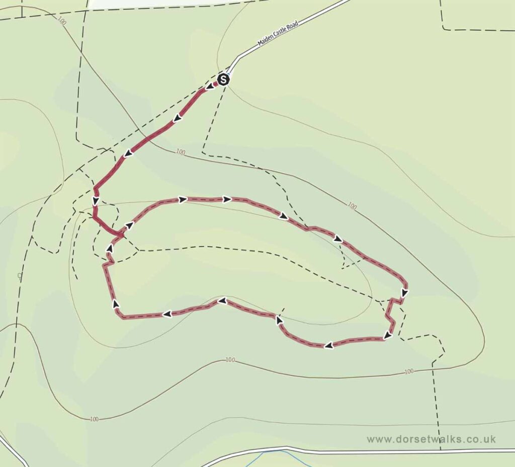
Base map © OpenStreetMap
Badbury Rings Hill Fort
1.2 miles, Circular, Easy
Route: Badbury Rings car park (National Trust) – Badbury Rings
Description: Short circular walk around a well-preserved hill fort, with woodland paths and open views across the Dorset countryside.
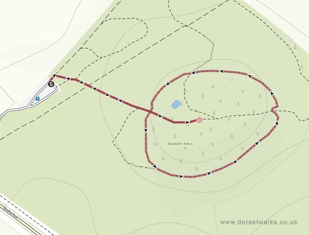
Base map © OpenStreetMap
Hod Hill
1.6 miles, Circular, Easy
Route: Hod Hill car park – Hod Hill
Description: Elevated walk around Hod Hill fort with views over the River Stour and surrounding farmland, combining open ground and historic earthworks.
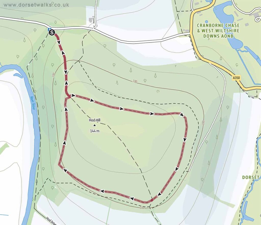
Base map © OpenStreetMap
Hambledon Hill
2.7 miles, Circular, Easy
Route: Duck Street lay-by – Hambledon Hill – Child Okeford
Description: Prominent hilltop walk with expansive views across North Dorset, featuring open chalk downland and steady climbs.
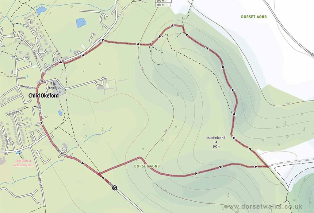
Base map © OpenStreetMap
Cranborne Estate
4.8 miles, Circular, Easy
Route: Cranborne Garden Centre – Cranborne Village – Jubilee Trail – Jack’s Hedge Corner – Boveridge – Burwood – Return
Description: Longer circular walk through mixed woodland and farmland, with gentle terrain and a varied rural landscape.
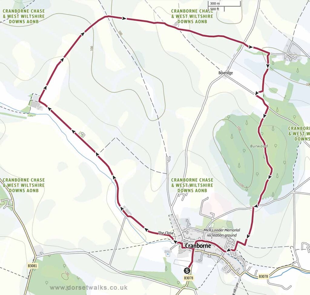
Base map © OpenStreetMap