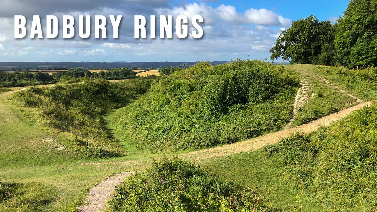
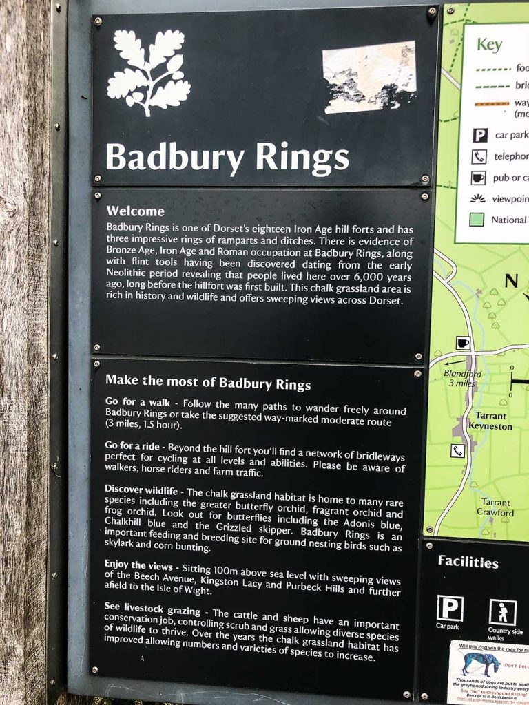
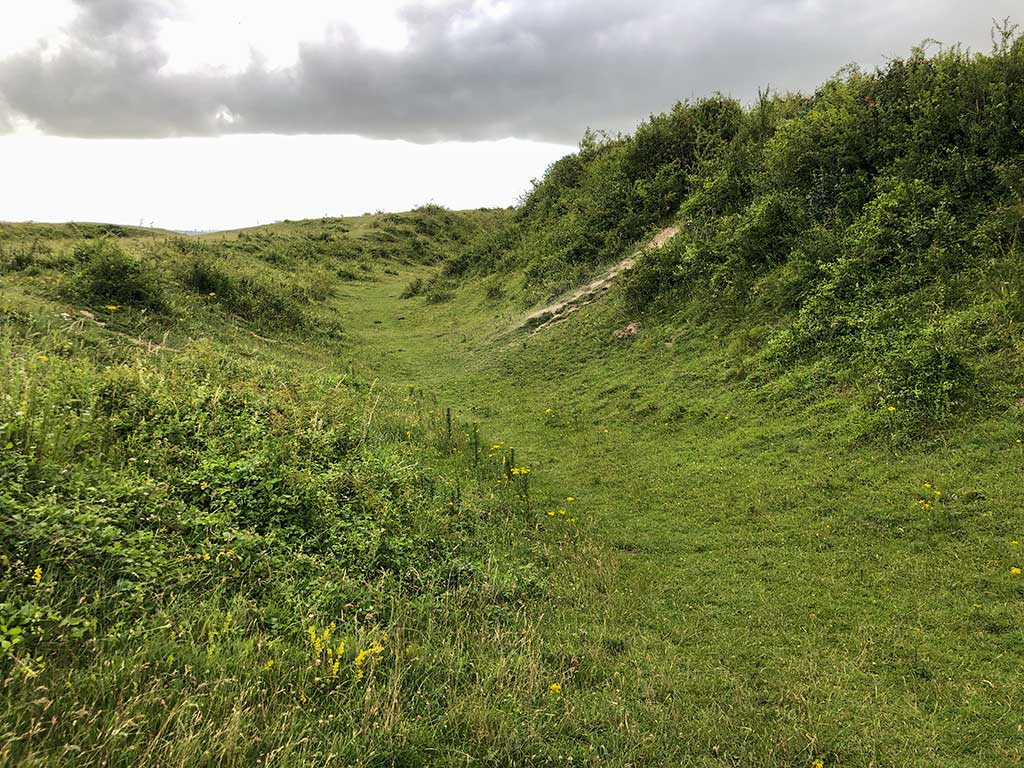
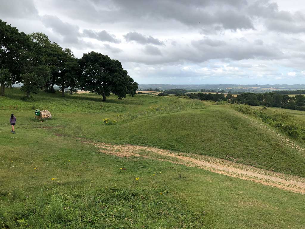
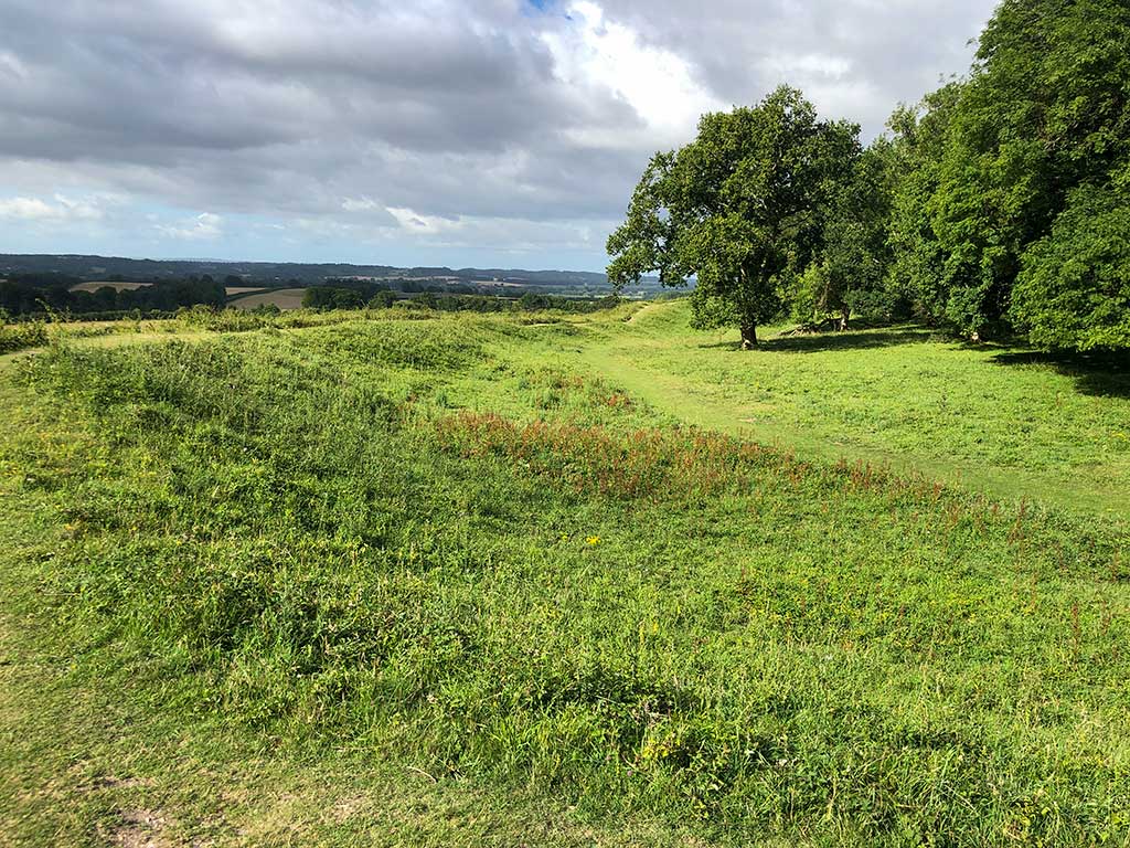
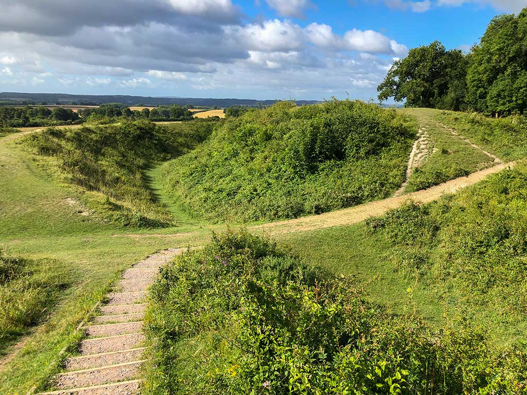
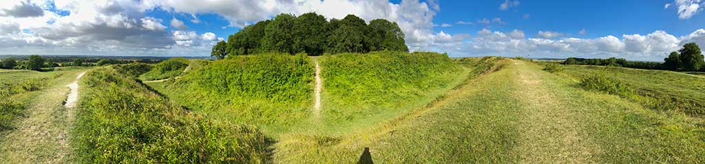
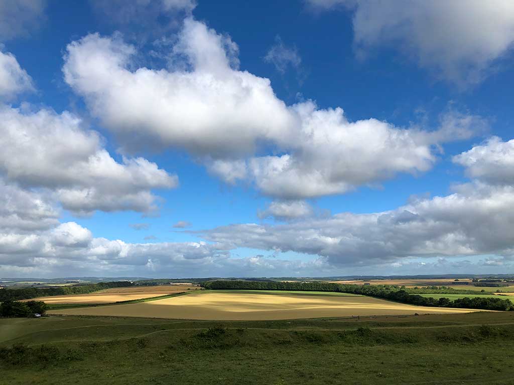
Badbury Rings is an impressive Iron Age hill fort that has three rings of ramparts and ditches. From May to July you’ll find yourself surrounded by fields of wild flowers as well as butterflies and birds.
Distance: 1.2 mile (circular walk) Difficulty: very easy Estimated time: 30 minutes Total ascent 49ft, Max elevation 280ft
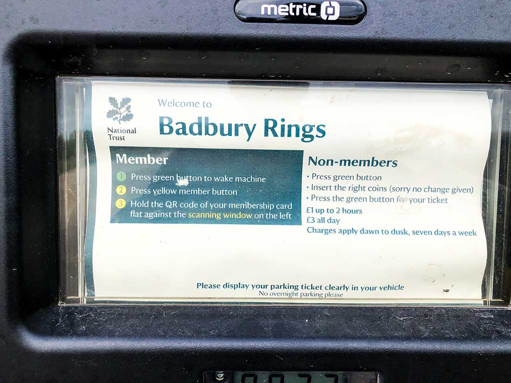
The land is owned and managed by the National Trust. Entry is free but there is a car park charge for non-members.
The walk described below is the easiest of more than a dozen in the area and takes just 30 minutes.
This is more of a stroll around Badbury Rings hill fort rather than a full-on walk. The route offers a nice introduction to the area for those with limited time or who just need to escape the house/office for a while to relax and absorb some positive energy. During the summer months you’ll find yourself surrounded by colourful wild flowers and butterflies. At certain times of the year you may also be lucky enough to see rare orchids hidden amongst the grass including the greater butterfly orchid, fragrant orchid and frog orchid.
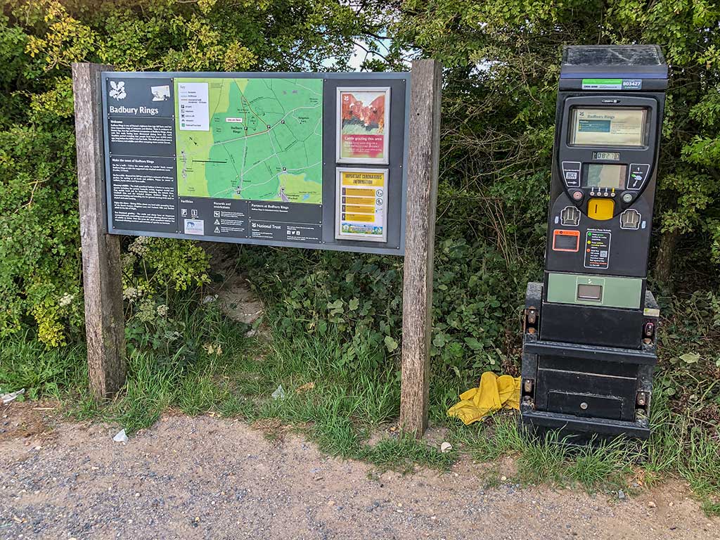
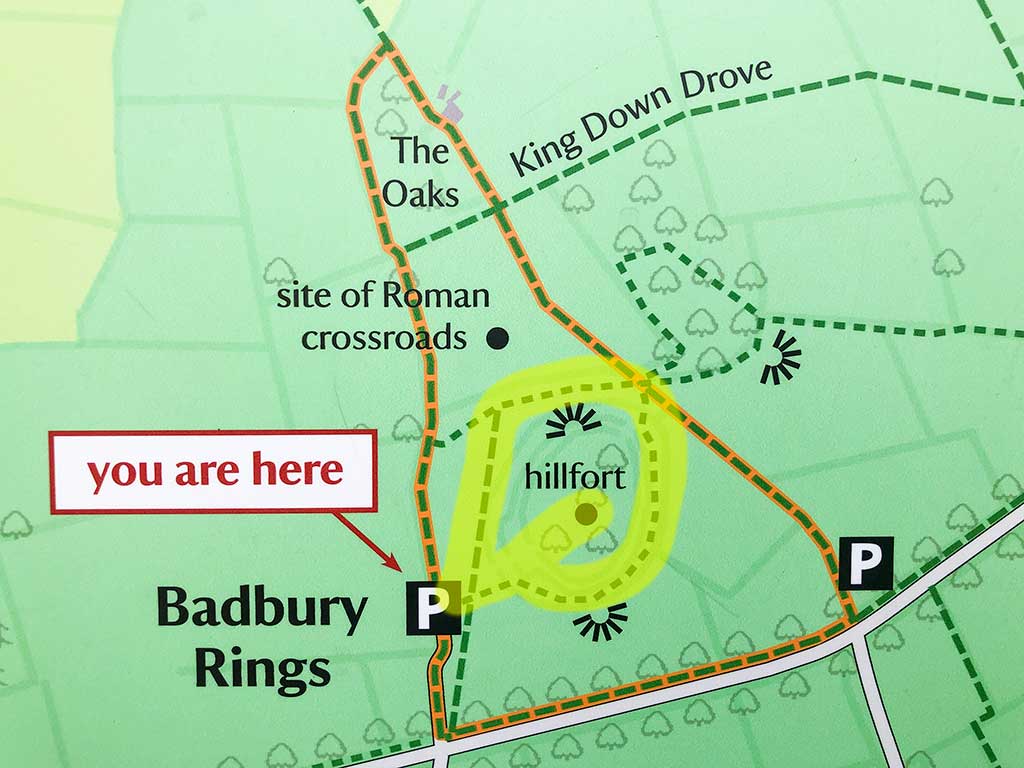
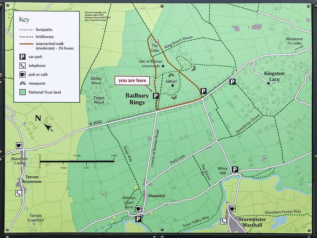
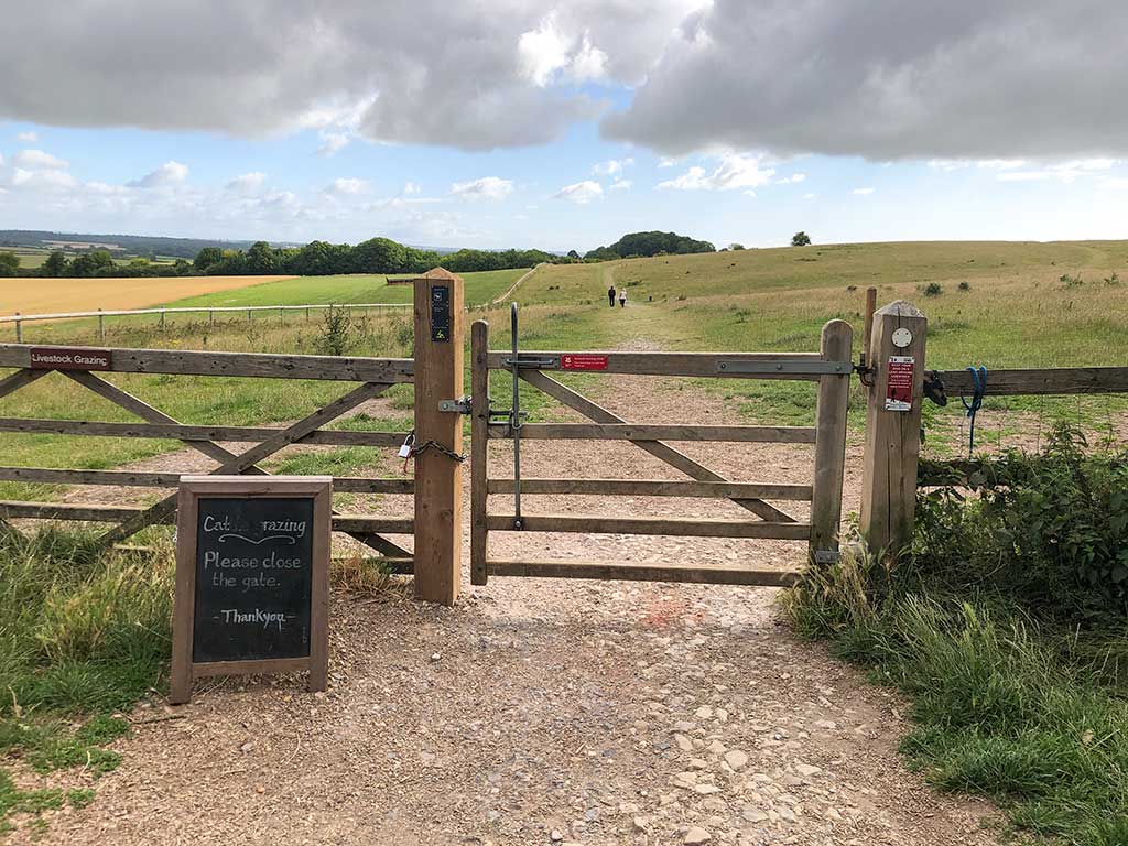
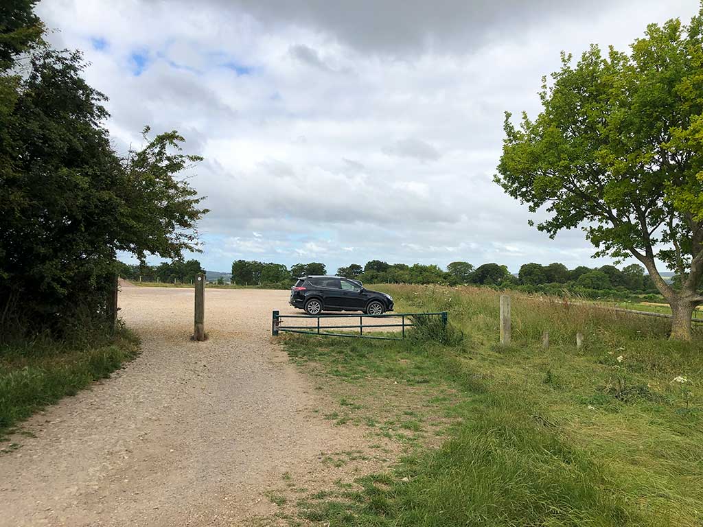
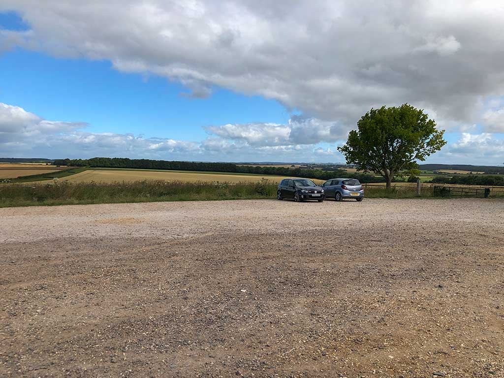
The starting point for this short walk is the Badbury Rings National Trust car park. Post code DT11 9JL (w3w) (Google Maps) Parking for National Trust members is free. For non-members it’s £1 for up to 2 hours or £3 all day (subject to change). In the car park you’ll find an information board showing a map of the area and footpaths. You’ll also find information about the history of the hill fort. I’ve copied this info below.
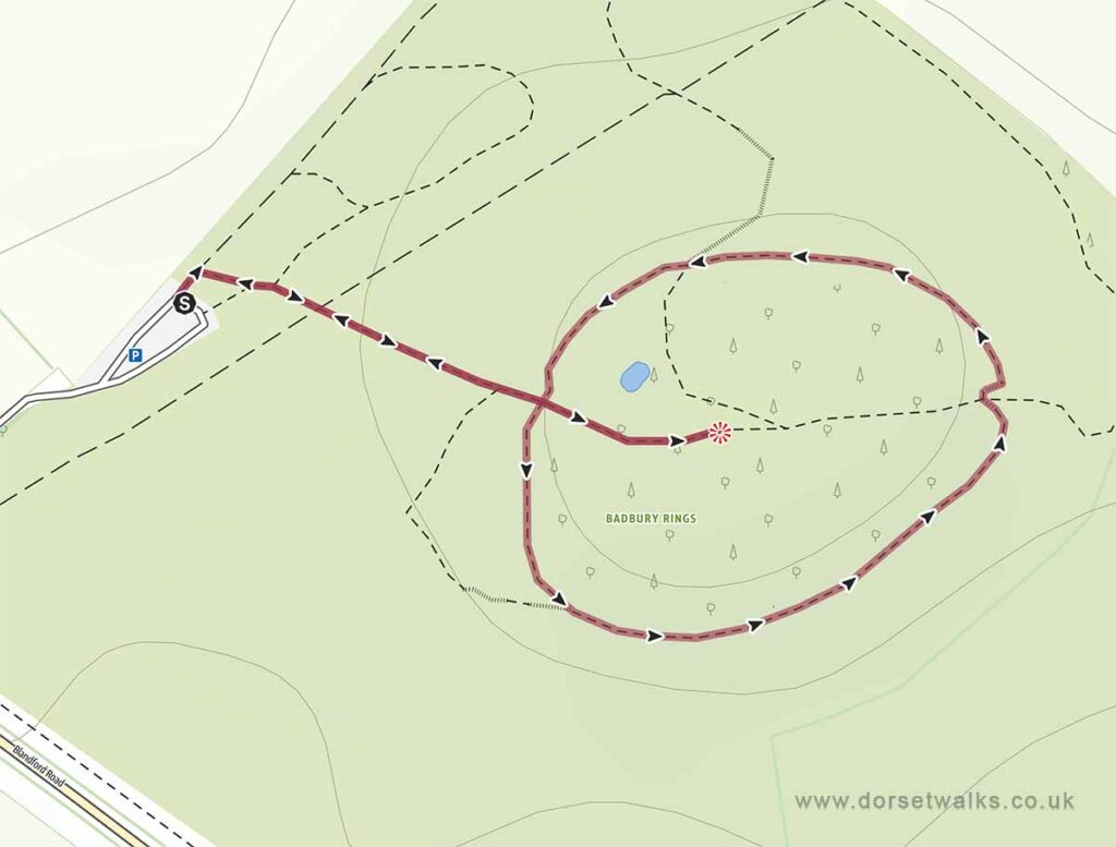
On the map below I’ve highlighted the route of this easy stroll around Badbury Rings in yellow. The longer route shown in orange is a very popular walk and takes about 1 hour 30 minutes (3.1 miles / 5km). I’ll include details of this longer route on this website soon, I’ve done it a couple of times but didn’t take many photos. You can view more information about this walk on the National Trust web page https://www.nationaltrust.org.uk/kingston-lacy/trails/walk-at-badbury-rings-and-high-wood-kingston-lacy
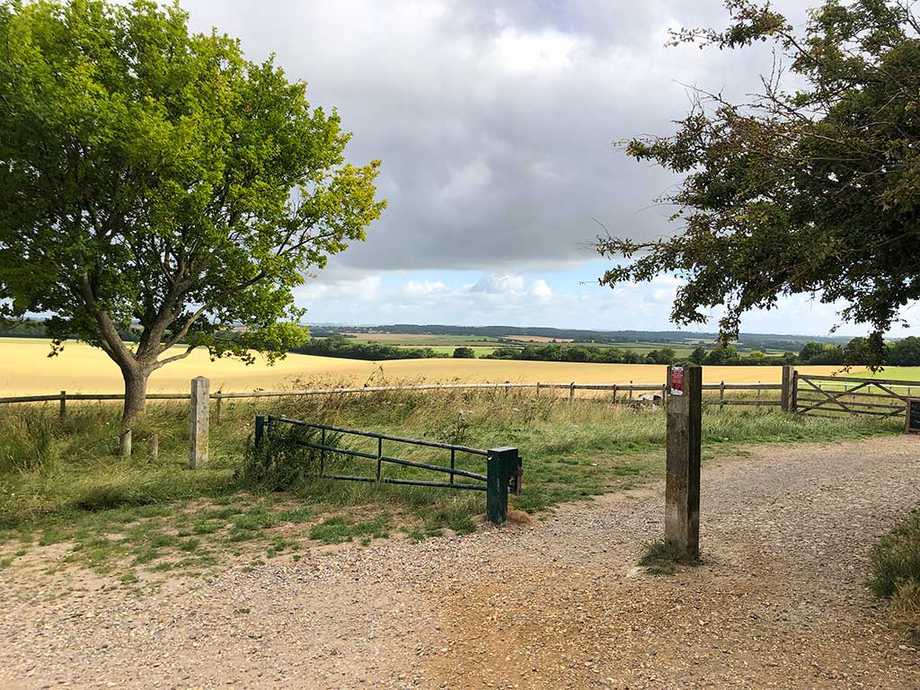
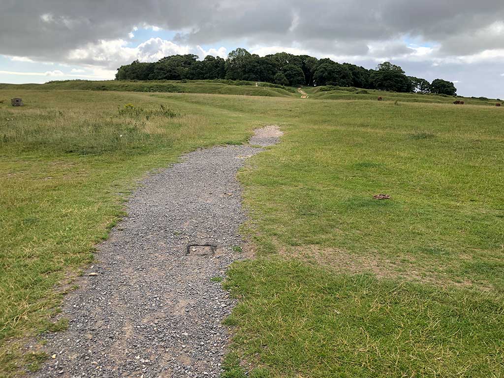
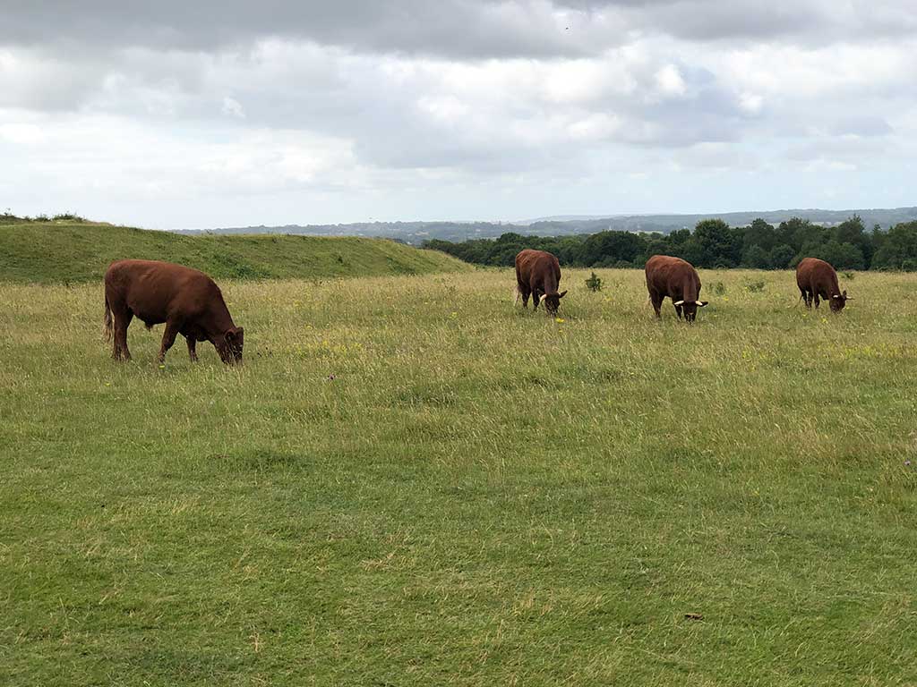
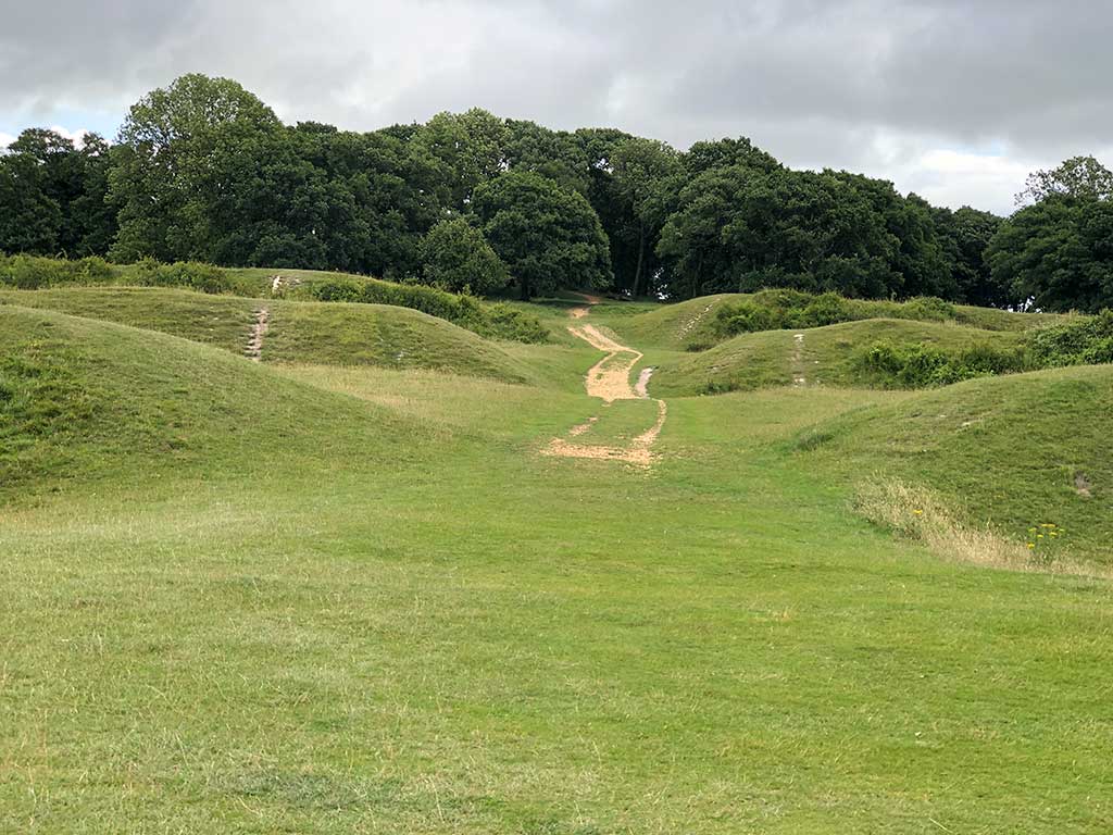
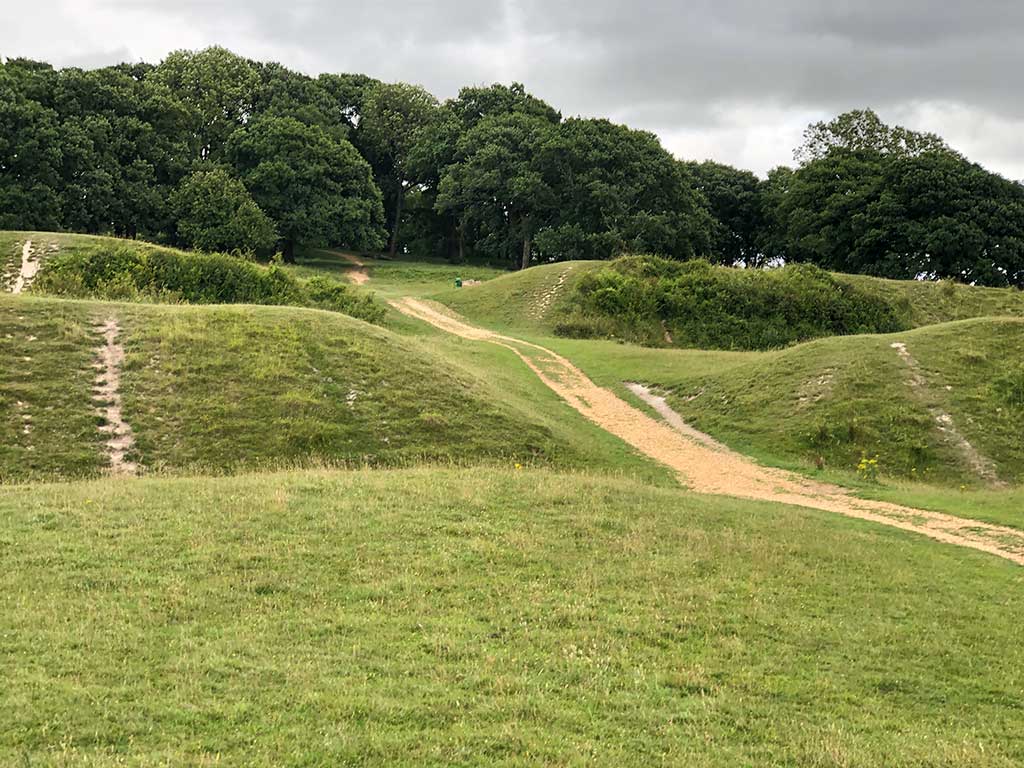
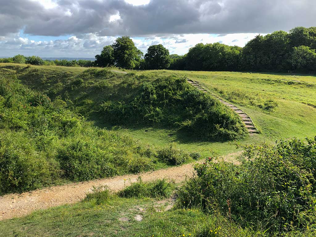
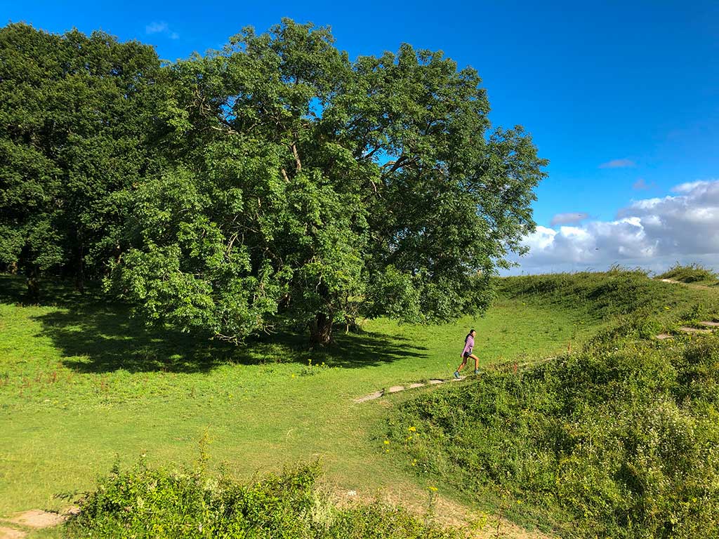
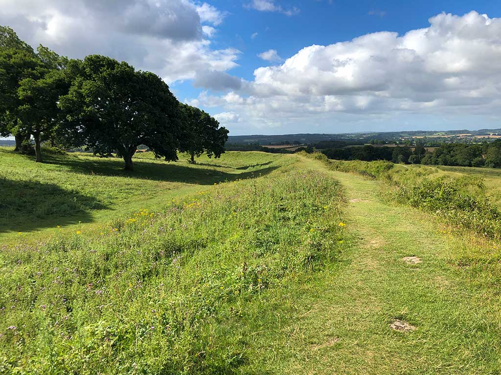
Route of this walk is highlighted in yellow. You don’t have to keep to the same route, just enjoy exploring the ancient hill fort. You can see from the map that there are plenty of good walks in the area. I’ve listed details and links to these walks at the end of this page.Photo of the information board in the car park. The walk starts from the northern corner of the car park.Go through the gate and turn right towards the hill fort.Looking back at the car parkHead towards the rings of the hill fort. The path is easy to follow.You’ll frequently find livestock grazing in the fields. On this occasion we had to walk past some rather scary looking bulls but they seemed docile and just ignored us. I think these are Red Ruby Devon cattle. which belong to the Kingston Lacy Estate. The National Trust just love putting bulls in fields. I’ve never heard of any problems with livestock on any walks in Dorset but if you have a dog make sure it is kept on a short lead at all times.
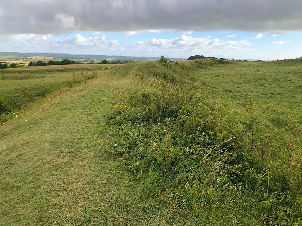
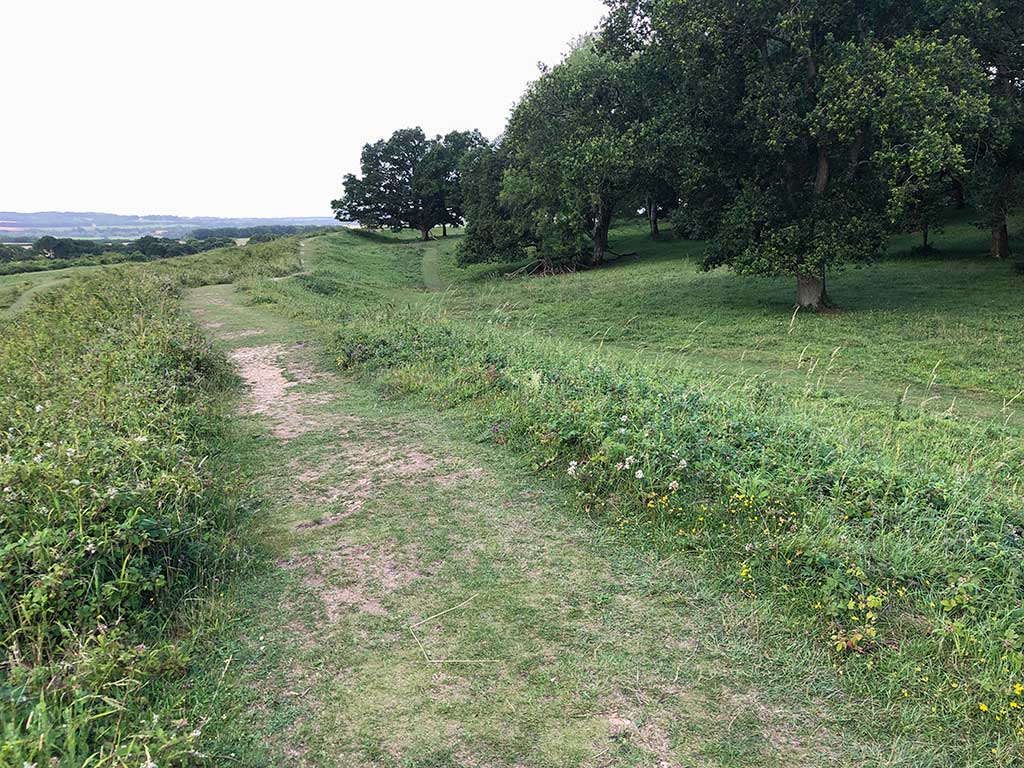
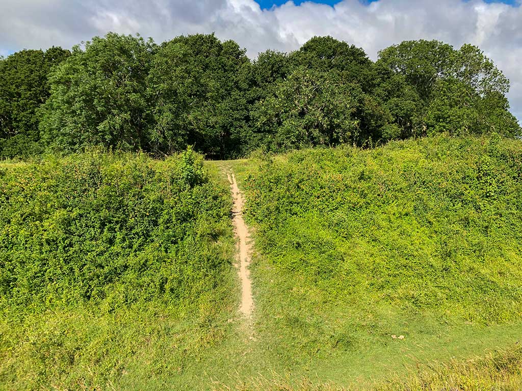
On this walk we just headed for the centre of the hill fort in amongst the trees. Later we then came back out by the same path and then followed the inner ring all the way round in an anti-clockwise direction.
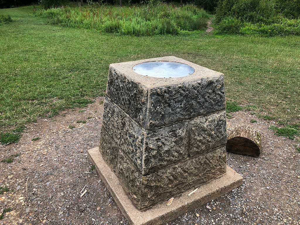
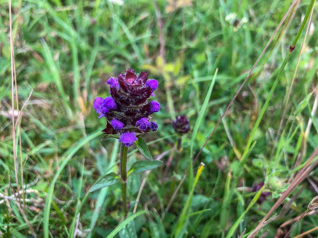
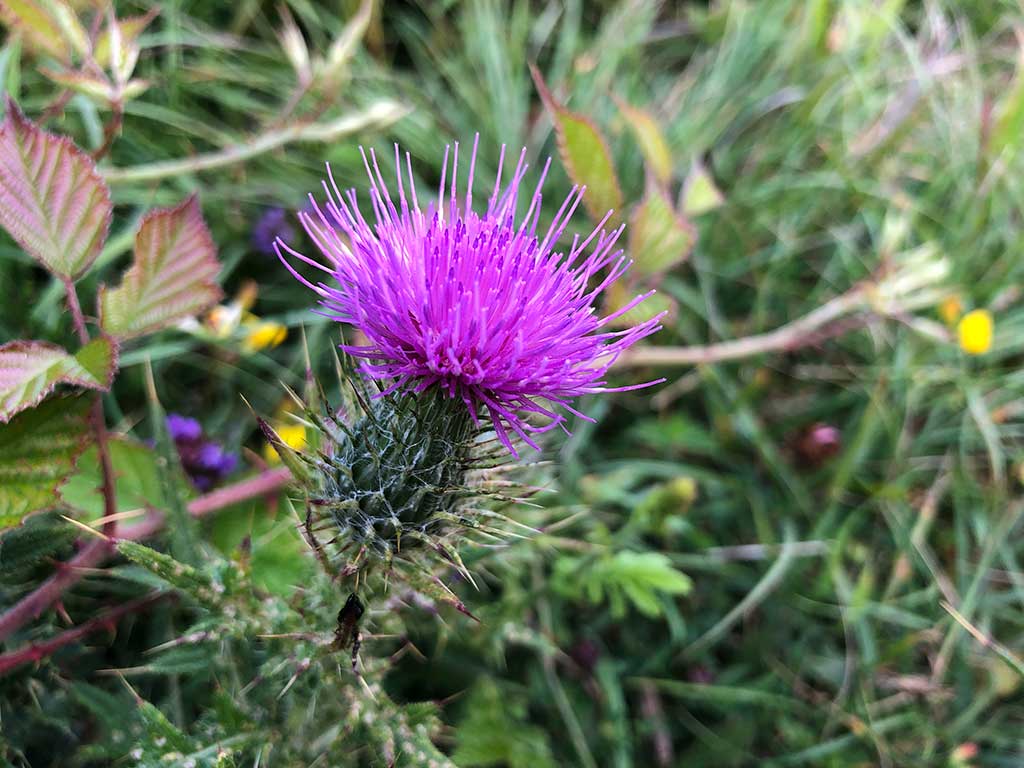
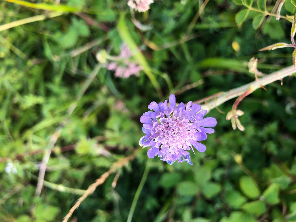
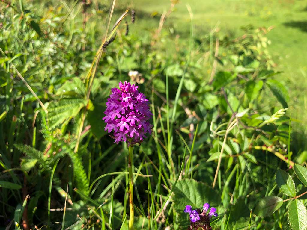
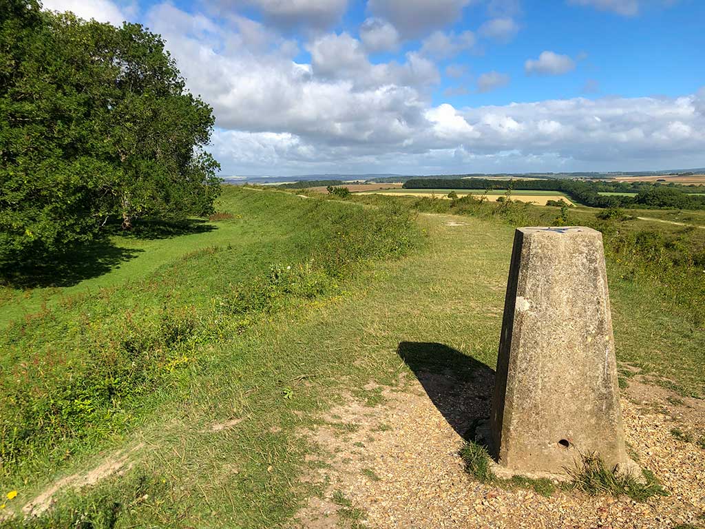
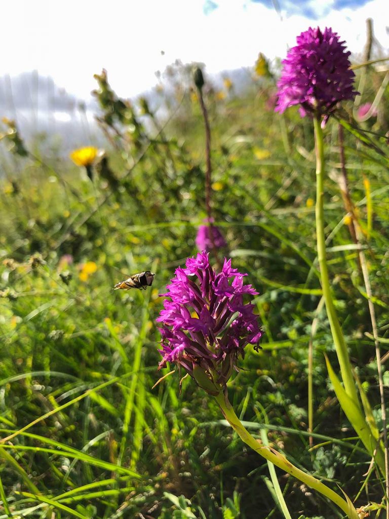
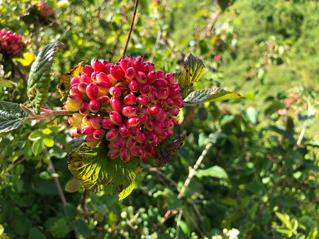
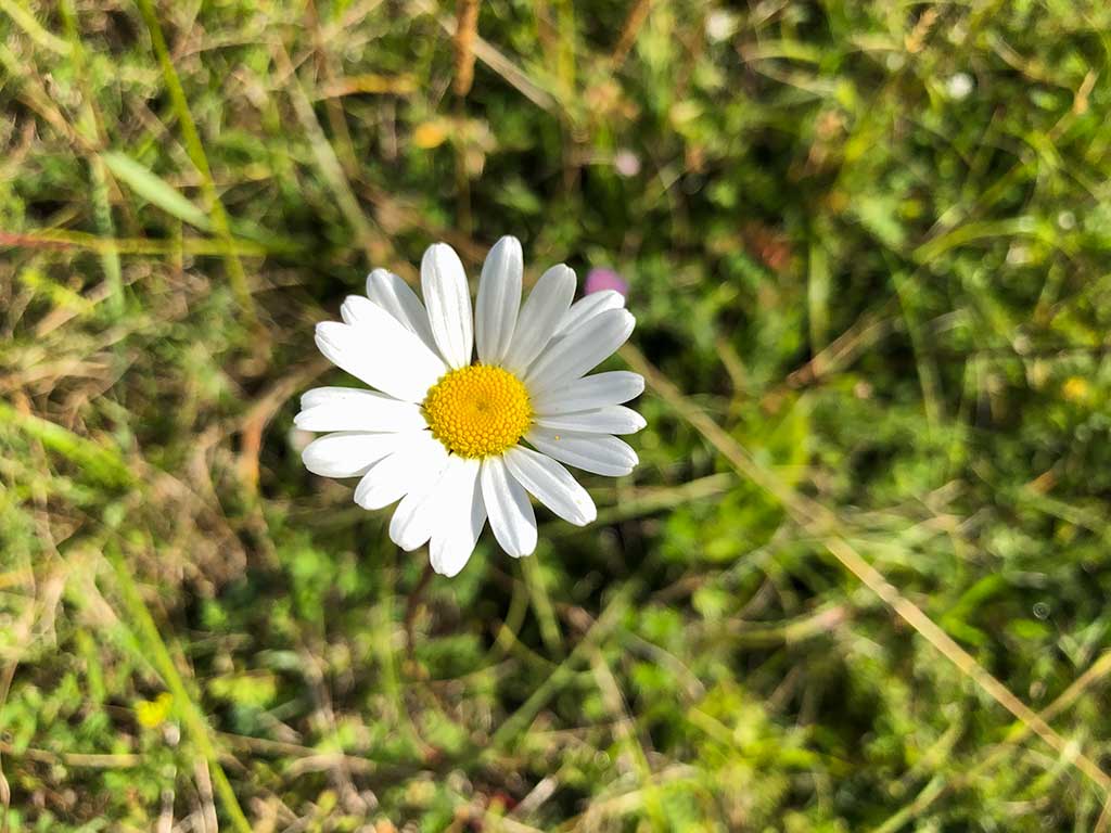
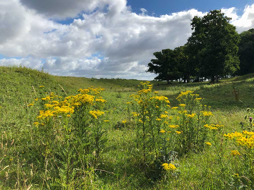
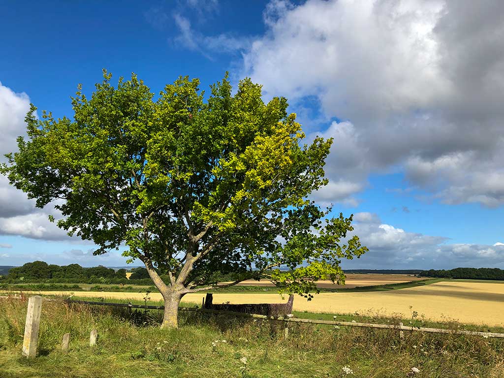
In the centre of the hill fort is a marker post. Walking around the inner ring.Self-heal (Prunella vulgaris). As its name suggest selfheal has a long tradition of being used as a herbal medicine for everything from healing woulds and stopping bleeding to treating sore throats, mouth ulcers and inflammatory bowel disease. However, no scientific evidence for any of these claims can be found.Spear Thistle (Cirsium vulgare). Despite its “weed” status the seeds of the Spear thistle are attractive to birds and the flowers are a nectar source for butterflies and bees.Field Scabious (knautia arvensis). The word scabious is derived from the latin word scabere meaning “to scratch”. In medieval times Scabious plants were believed to relieve the itch of scabies and other skin conditions including sores caused by the bubonic plague. Scabious has a very long flowering period and so is a valuable nectar source for bees and butterflies. Finches and linnets love the seeds of this plant. Another name for this plant is gypsy rose.Pyramid OrchidOn the opposite side to the car park is a trig point. (w3w). A Triangulation point (also known as a trigonometrical point) is a fixed surveying station used in map making. The brass plate on the top of the pillar is at 95.355m above sea-level. More than 6,500 trig pillars were built across the country between 1936 and 1962 by the surveyors at Ordinance Survey. The pillar was used to provide a solid base for a theodolite – an optical instrument used to measure angles accurately between other trig points in the area.Wayfaring tree (Viburnum lantana). This is a small tree found in hedgerows and woodland edges and has a preference to chalky soils. It often grows close to footpaths which is how it derives its name. It has creamy flowers in May and June followed by red berries, as shown in the photo, that eventually ripen to black. The berries are particularly attractive to birds and small mammals but very poisonous to humans. Traditionally its strong bendy stalks were used to tie hay bales.Oxeye daisy (Leucanthemum vulgare). Also known as Ox-eye, dog daisy, moon daisy or Marguerite. It is the largest native member of the daisy family. The plant was used in traditional medicines to treat various health problems, such as coughs and asthma. The flower heads have also been used to make tea. The ancient Greeks dedicated this flower to Artemis, Olympian goddess of the hunt, the moon and chastity.Common Ragwort (Jacobaea vulgaris). Mainly considered as a weed, frequently found on waste ground or in paddocks where it can be harmful to horses and livestock. The yellow flowers are highly attractive to bees and other insects and a favourite of the cinnabar moth. The cinnabar moth caterpillars are black and yellow and can sometimes be seen covering the plant. By eating the plant the caterpillars absorb alkaloids and become distasteful to predators. The plant is rated in the top 10 for nectar production.Back at the car park.
National Trust walks near Badbury Rings and on the Kingston Lacy Estate.
Links are to the relevent National Trust web page showing the route description and a map.
Walk at Badbury Rings and High Wood, Kingston Lacy – Click Here
Walk at Badbury Rings and The Oaks, Kingston Lacy – Click Here
Walk at Pamphill and Cowgrove, Kingston Lacy – Click Here