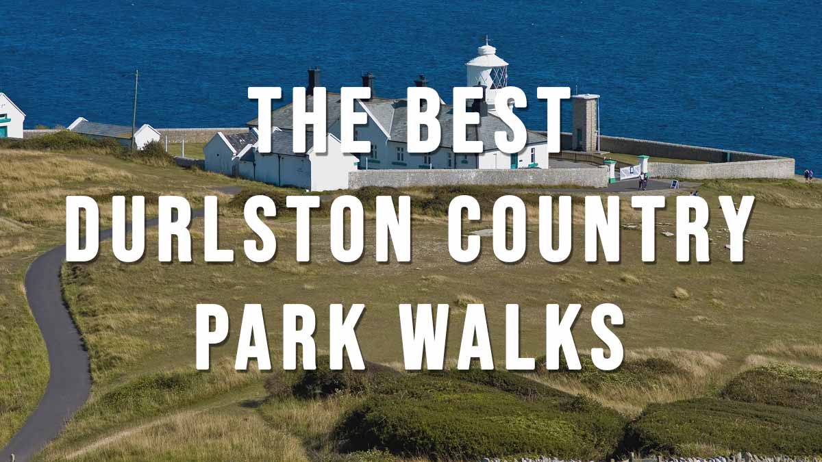
The Best Durlston Country Park Walks includes 3 coastal walks in and around Durlston Country Park which is located just 1 mile south from Swanage (we’ve also included a circular walk from Swanage to Durlston if you prefer to start any of these walks in Swanage)
Durlston Country Park is a stunning 320 acre National Nature Reserve consists of beautiful clifftop walks with stunning views, a recently renovated Victorian Durlston Castle with its historic Great Globe, a visitor centre, cafe and Anvil Point Lighthouse.
Official website:
https://www.durlston.co.uk/
https://www.durlston.co.uk/parking
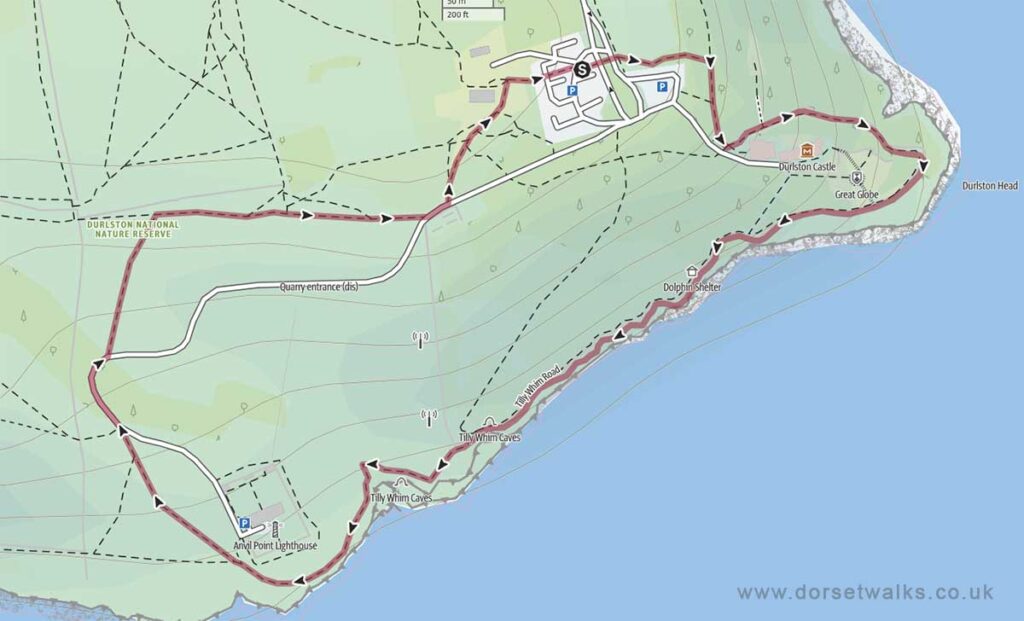
1. Durlston Country Park to Anvil Point Lighthouse Circular Walk
Distance: 1.4 miles circular
Difficulty: Easy
Estimated time: 1 hour
Total ascent 446ft, Highest point 282ft
Starting point: Durlston Country Park Car Park BH19 2JL (Google map)
OS Map: Explorer OL15 Purbeck & South Dorset
Link to GPS route map
https://www.outdooractive.com/
https://www.alltrails.com/
https://explore.osmaps.com/
Base map © OpenStreetMap
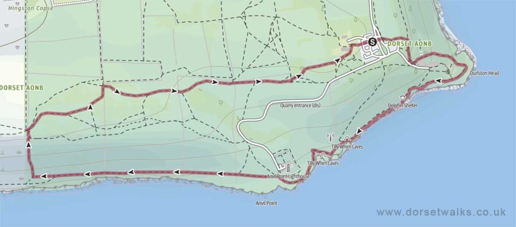
2. Durlston Country Park Circular Walk
Distance: 2.3 miles circular
Difficulty: Easy
Estimated time: 1 hours 25 mins
Total ascent 745ft, Highest point 322ft
Starting point: Durlston Country Park Car Park BH19 2JL (Google map)
OS Map: Explorer OL15 Purbeck & South Dorset
Link to GPS route map
https://www.outdooractive.com/
https://www.alltrails.com/
https://explore.osmaps.com/
Base map © OpenStreetMap
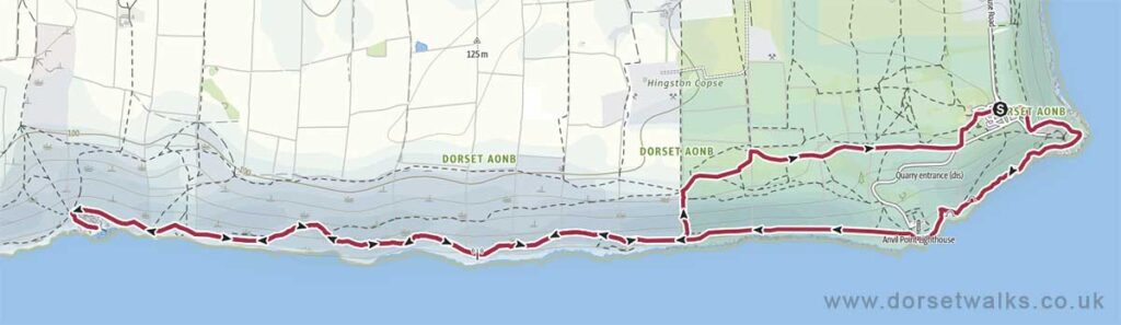
3. Durlston to Dancing Ledge Coast Path Walk
Distance: 5.6 miles (out and back)
Difficulty: Easy
Estimated time: 3 hours 30 mins
Total ascent 1818ft, Highest point 322ft
Starting point: Durlston Country Park Car Park BH19 2JL (Google map)
OS Map: Explorer OL15 Purbeck & South Dorset
Link to GPS route map
https://www.outdooractive.com/
https://www.alltrails.com/
https://explore.osmaps.com/
Base map © OpenStreetMap
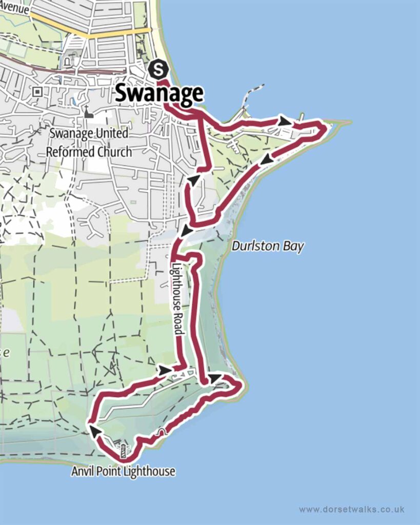
4. Swanage to Durlston Country Park
Distance: 4.3 miles (circular)
Difficulty: Easy
Estimated time: 2 hours 15 minutes
Total ascent 548ft, Highest point 285ft
Starting point: King Alfred Memorial, Shore Road, Swanage, BH18 1DD
OS Map: Explorer OL15 Purbeck & South Dorset
Link to GPS route map
https://www.outdooractive.com/
https://www.alltrails.com/
https://explore.osmaps.com/
Base map © OpenStreetMap