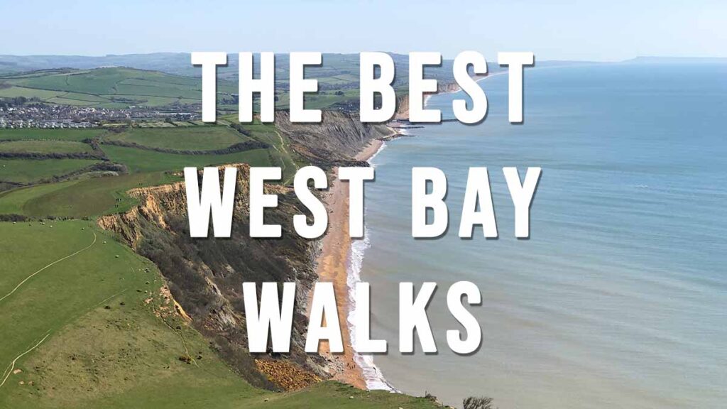
A selection of the best Dorset coast walks listed from East to West along the coast
Highcliffe to Mudeford Quay
5.8 miles, Circular walk, Easy
Route: Highcliffe Cliff Top Car Park – Highcliffe Beach – Highcliffe Castle – Steamer Point Nature Reserve – Friars Cliff Beach – Avon Beach – Mudeford Quay – Rtn
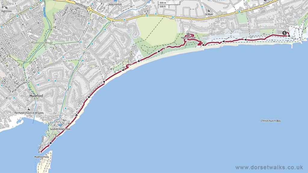
Base map © OpenStreetMap
Stanpit Marsh
1.6 miles Circular Easy
Route: Stanpit Marsh Nature Reserve near Christchurch
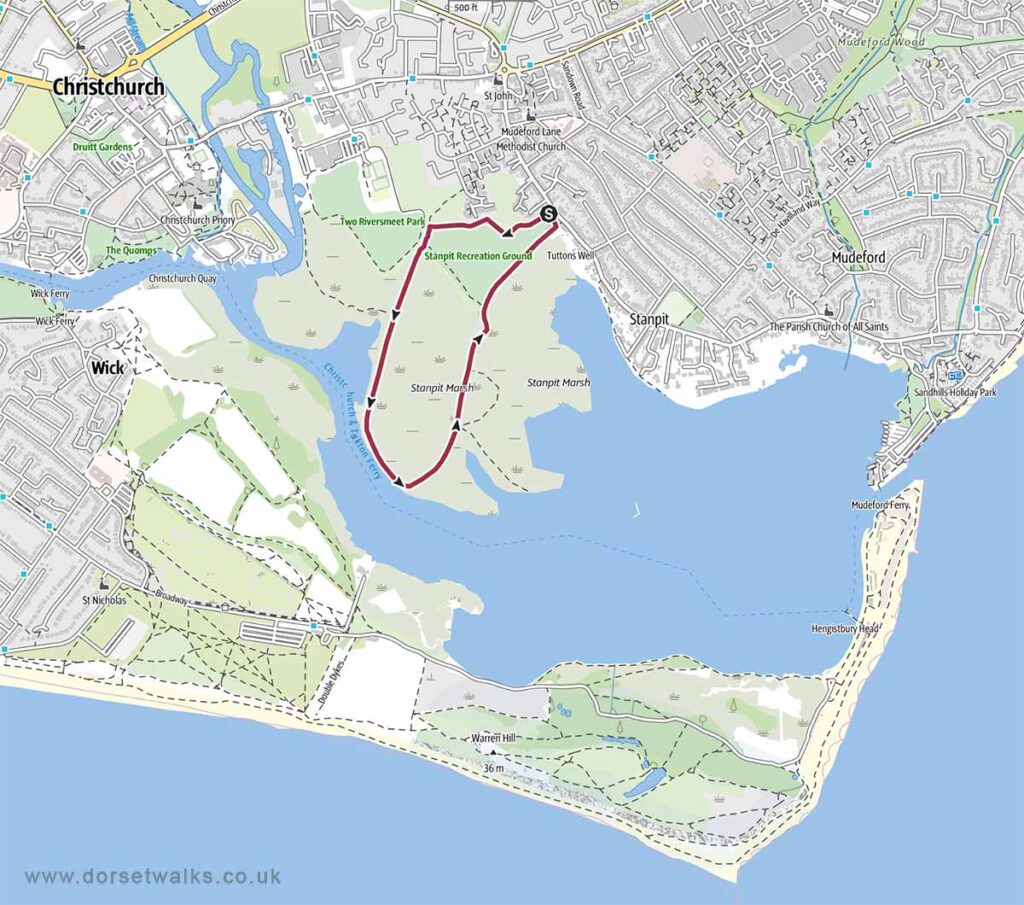
Base map © OpenStreetMap
The Best Hengistbury Head Walks

Hengistbury Head Beach
4.2 miles Circular Easy
Route: Hengistbury Head Car Park – Hengistbury Head Beach – Mudeford Sandbanks
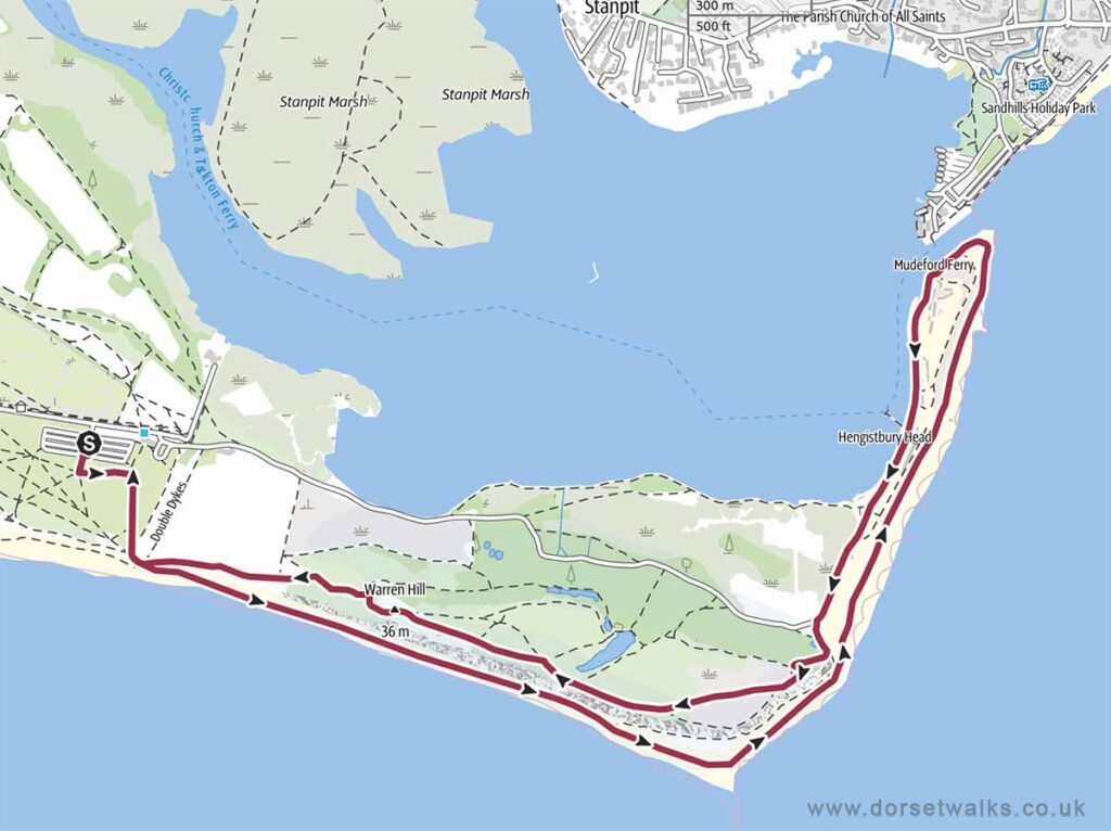
Base map © OpenStreetMap
Mudeford Sandbanks to Bournemouth Pier Walk
7 miles, One-way, Easy
Route: Mudeford Sandbank – Hengistbury Head – Southbourne Beach – Fisherman’s Walk – Boscombe Pier – Bournemouth Pier

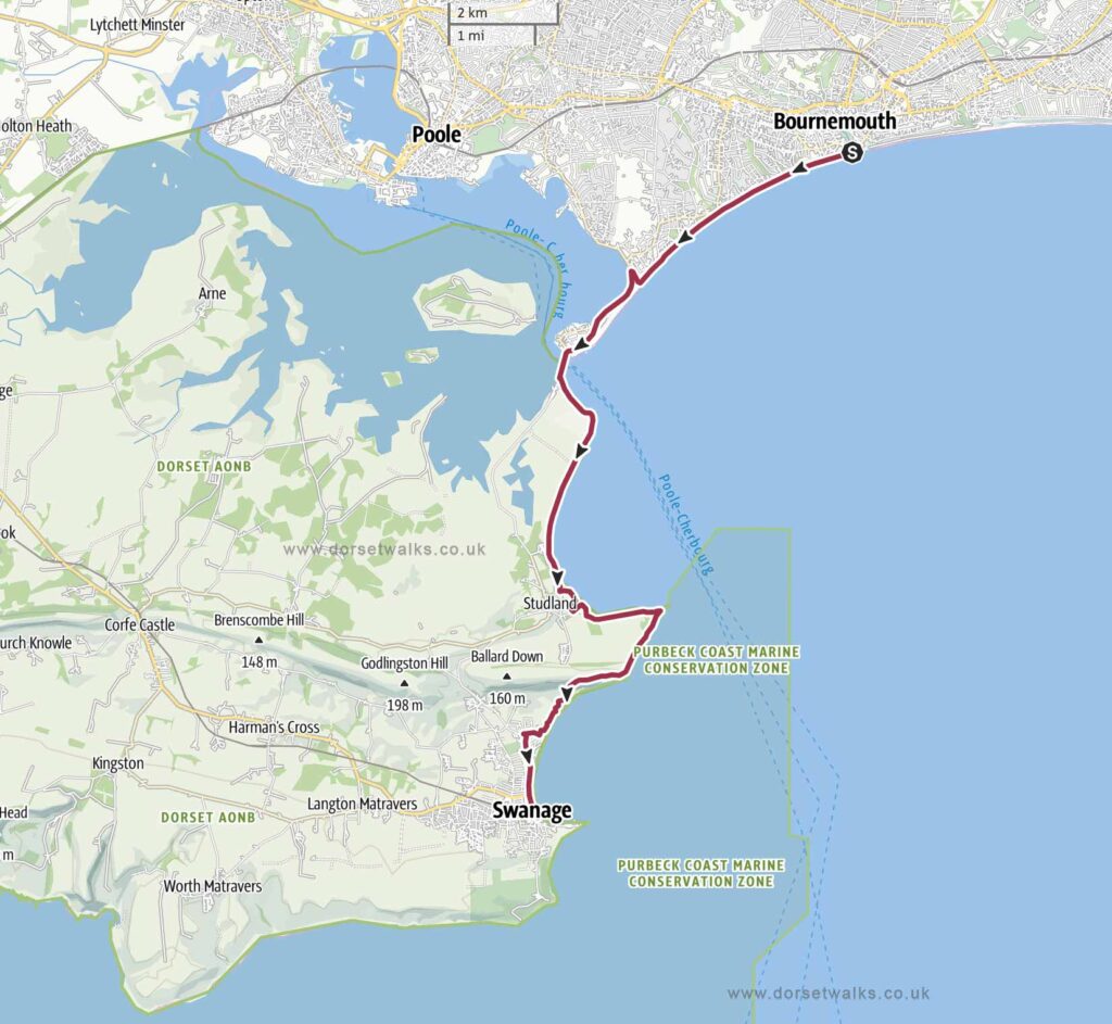
Bournemouth to Swanage Walk
12.2 miles, one-way, medium
Route: Bournemouth Pier – Durley Chine – Alum Chine – Branksome Chine – Canford Cliffs Beach – Sandbanks – Poole Harbour – Sandbanks Ferry – Shell Bay – Studland Beaches – Studland Village (Banks Arms Pub) – Old Harry Rocks – Ballard Down – Swanage
The Best Studland Walks

Studland to Old Harry Rocks
4 miles Circular Easy
Route: Studland Village (NT car park) – Banks Arms Pub – Old Harry Rocks
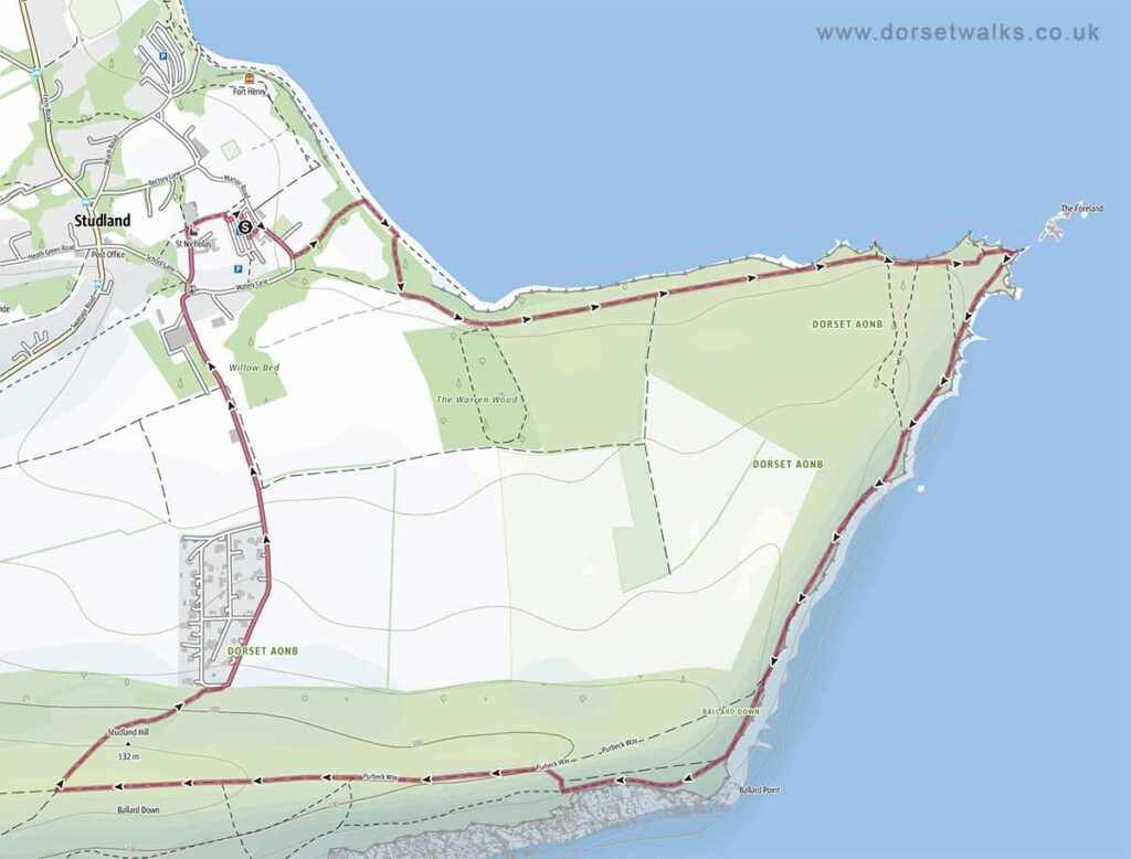
Base map © OpenStreetMap
The Best Swanage Walks
Swanage to Kingston Walk (via Swyre Head)
The Best Durlston Country Park Walks

The Best Worth Matravers Walks
Worth Matravers to Seacombe and Winspit
2.9 miles, Circular
Route: Worth Matravers – Seacombe Cliffs – Winspit Quarry
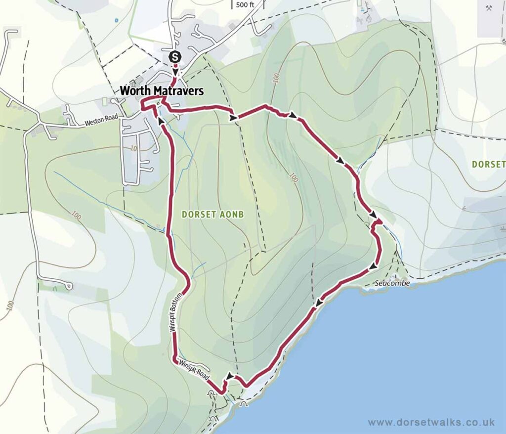
Base map © OpenStreetMap
Worth Matravers to Winspit and St. Aldhelm’s Head
4.4 miles, Circular
Route: Worth Matravers – Winspit Quarry – St. Aldhelm’s Head (Chapel & Radar Memorial)
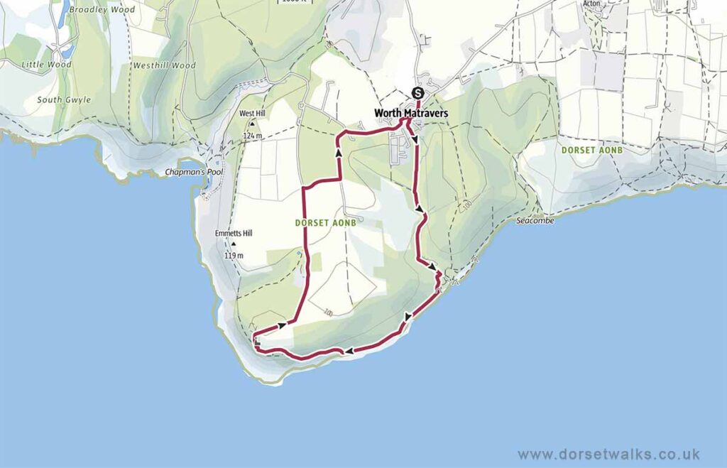
Base map © OpenStreetMap
Worth Matravers to St. Aldhelm’s Head and Chapmans Pool
2.9 miles Circular
Route: Worth Matravers (Renscombe car park) – St. Aldhelm’s Head (Chapel & Radar Memorial) – Emmetts Hill – Chapmans Pool view point
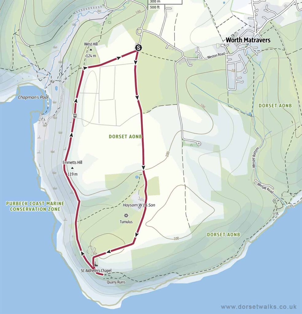
Base map © OpenStreetMap
The Best Kingston Walks

Kingston to Swyre Head
2 miles Circular Easy
Route: Swyre Head car park (near Kingston) – Swyre Head
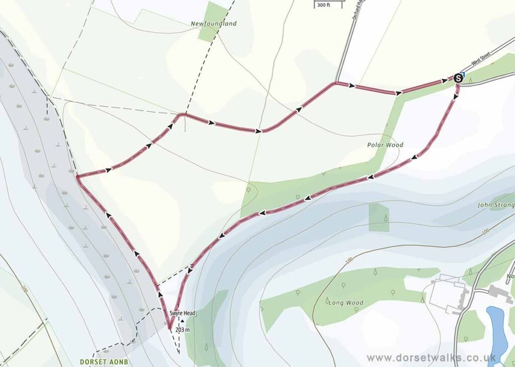
Base map © OpenStreetMap
The Best Kimmeridge Walks

The Best Lulworth Cove Walks

Lulworth Cove to Durdle Door
2.1 miles, Out and Back, Easy
Route: Lulworth Cove car park – South West Coast Path – Man O War Bay – Durdle Door
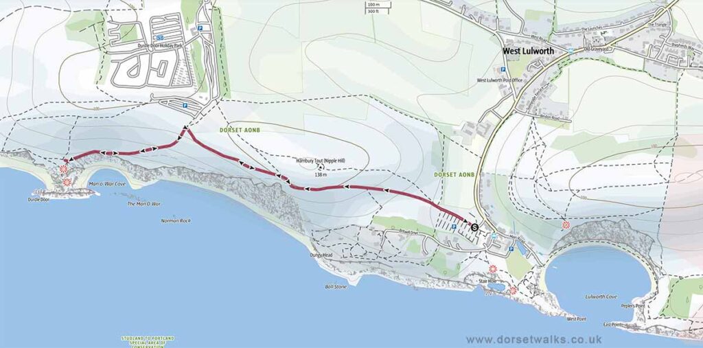
Base map © OpenStreetMap
Durdle Door to White Nothe
5.6 miles, Circular, Medium
Route: Durdle Door car park – South West Coast Path – White Nothe
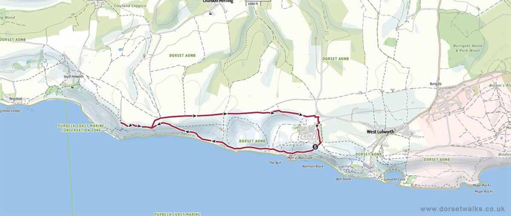
Base map © OpenStreetMap
The Best Abbotsbury Walks

Abbotsbury to St Catherine’s Chapel and Chesil Beach
3.2 miles circular, Easy
Route: Abbotsbury Village – St Catherine’s Chapel – Chesil Beach
Can easily be combined with a visit to Abbotsbury Swannery or Abbotsbury Subtropical Gardens
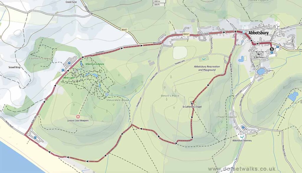
Base map © OpenStreetMap
The Best Seatown Walks

Seatown to Golden Cap and Langdon Hill
4.1 miles, Circular, Medium
Route: Seatown Beach car park – Golden Cap – St Gabriel’s Chapel – Langdon Hill
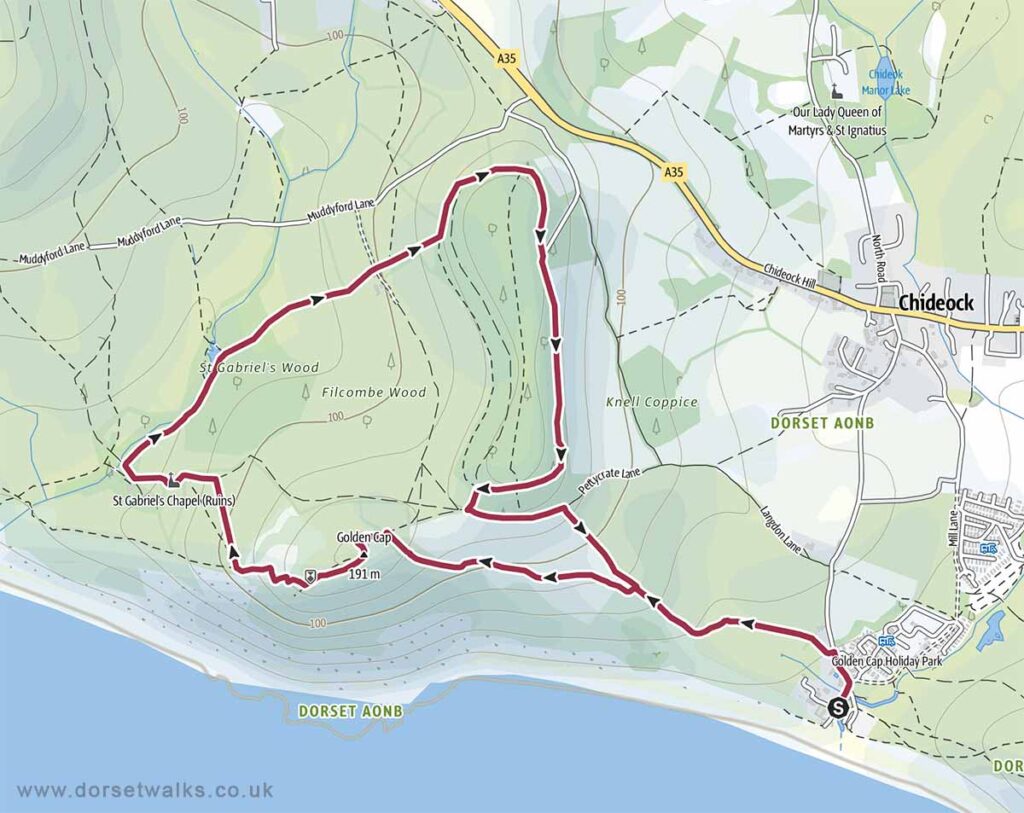
Base map © OpenStreetMap
Seatown to Thorncombe Beacon
2.5 miles, Circular, Medium
Route: Seatown Beach car park – Thorncombe Beacon
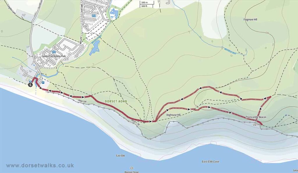
Base map © OpenStreetMap
The Best West Bay Walks
