
The Best Studland Walks covers 7 of my favourite walks starting in the sleepy seaside village of Studland which is located 2 miles north of Swanage and 4.6 miles east of Corfe Castle.
Further details and photos of the village can be found at https://www.dorsetguide.com/studland/
The majority of the walks listed below start at the main National Trust South Beach Car Park Sat Nav postcode BH19 3AU. (Google map) (what3words). This car park is free to National Trust members or £3 for up to 2 hours and £5 all day (prices subject to change).
An alternative place to park is the National Trust Knoll Beach Car Park BH19 3AQ
(Google map) (what3words) which is a large car park popular with visitors to Knoll Beach (fills up quickly in the summer). The Studland to South Haven Beach Walk starts here. For a route map between both car parks see https://www.outdooractive.com/ (1.8 miles round trip)
Please do not park in the narrow lanes around Studland village or in side roads as it leads to congestion and can also prevent fire engines gaining access to the heathland in the event of heath fires during the summer.
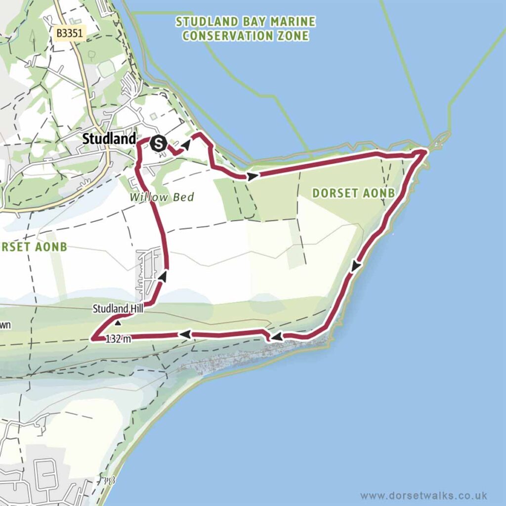
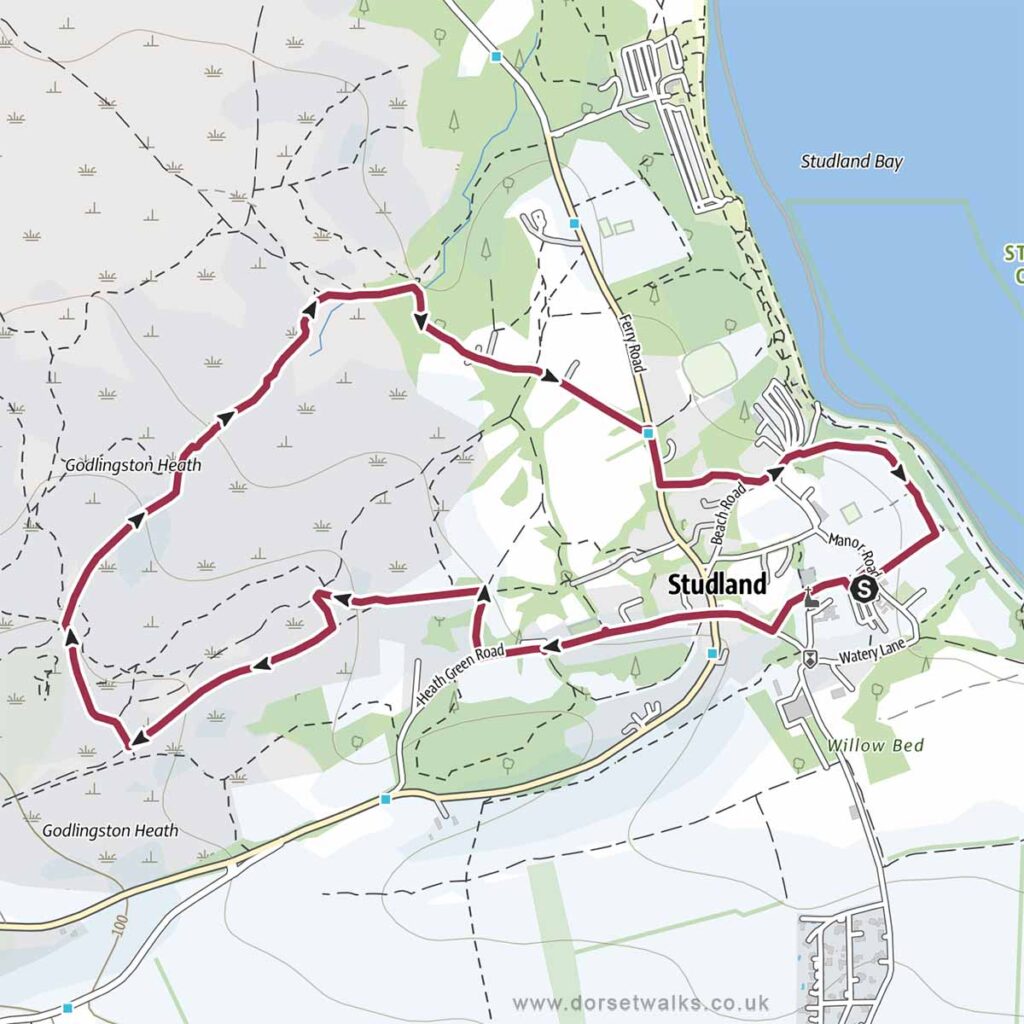
1. Studland to Old Harry Rocks Walk
Distance: 4 miles (circular)
Difficulty: Easy
Estimated time: 2 hours 10 minutes
Total ascent 965ft, Highest point 446ft
Starting point: National Trust South Beach Car Park BH19 3AU
OS Map: Explorer OL15 Purbeck & South Dorset
*** Route description and photos ***
Link to GPS route map
https://www.outdooractive.com/
https://www.alltrails.com/
https://explore.osmaps.com/
https://www.google.com/maps/
Base map © OpenStreetMap
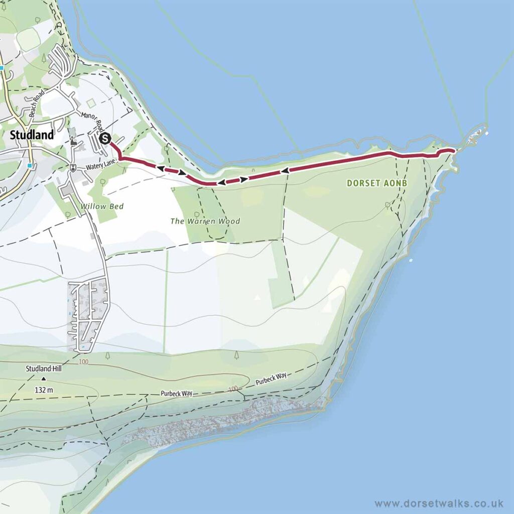
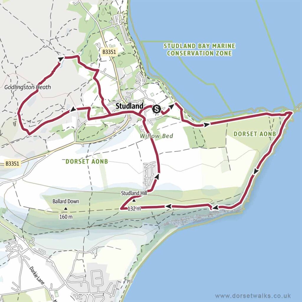
2. Studland to Old Harry Rocks Express Walk
Distance: 2.2 miles (there and back)
Difficulty: Easy
Estimated time: 1 hour
Total ascent 105ft, Highest point 98ft
Starting point: National Trust South Beach Car Park BH19 3AU
OS Map: Explorer OL15 Purbeck & South Dorset
Link to GPS route map
https://www.outdooractive.com/
https://www.alltrails.com/
https://explore.osmaps.com/
https://www.google.com/maps/
Base map © OpenStreetMap
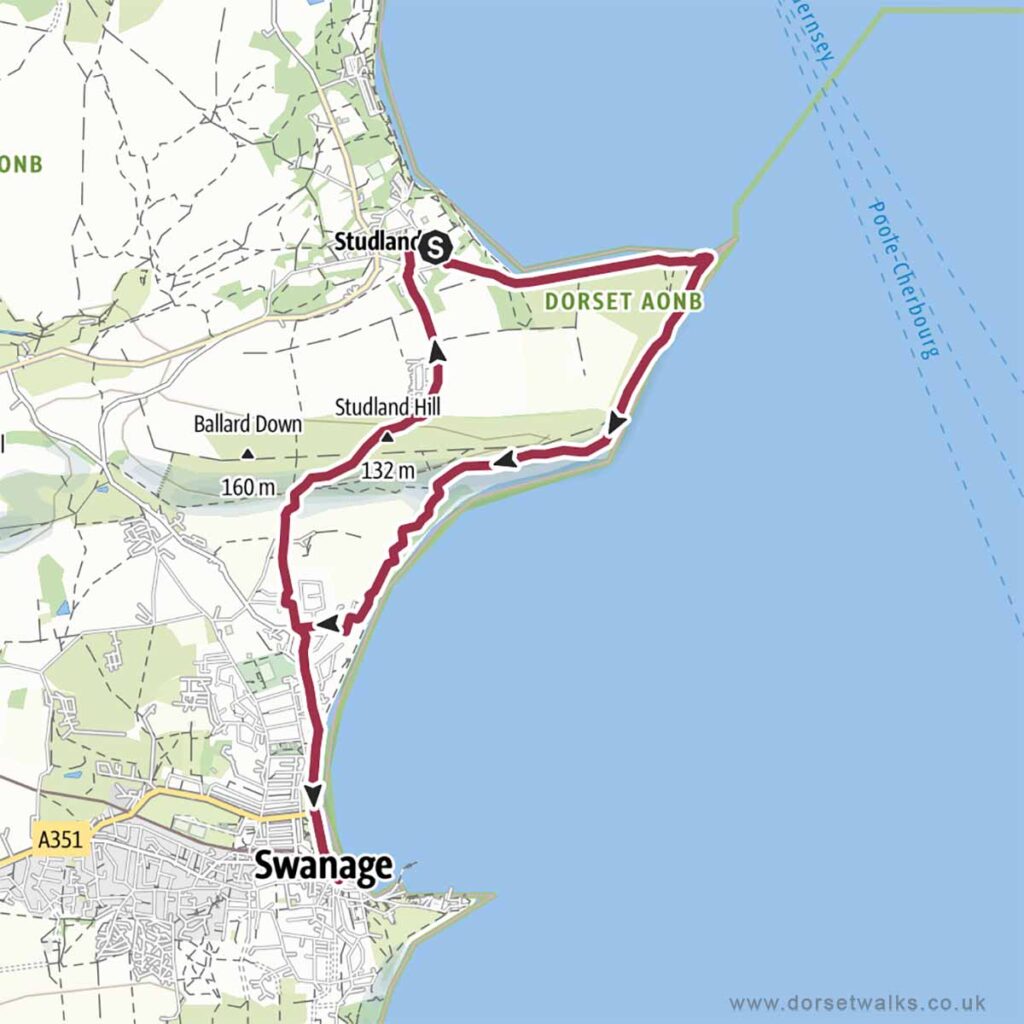
3. Studland to Swanage Walk (via Old Harry Rocks)
Distance: 7.4 miles (circular)
Difficulty: Easy
Estimated time: 3 hours 45 minutes
Total ascent 1335ft, Highest point 446ft
Starting point: National Trust South Beach Car Park BH19 3AU
OS Map: Explorer OL15 Purbeck & South Dorset
Link to GPS route map
https://www.outdooractive.com/
https://www.alltrails.com/
https://explore.osmaps.com/
https://www.google.com/maps/
Base map © OpenStreetMap
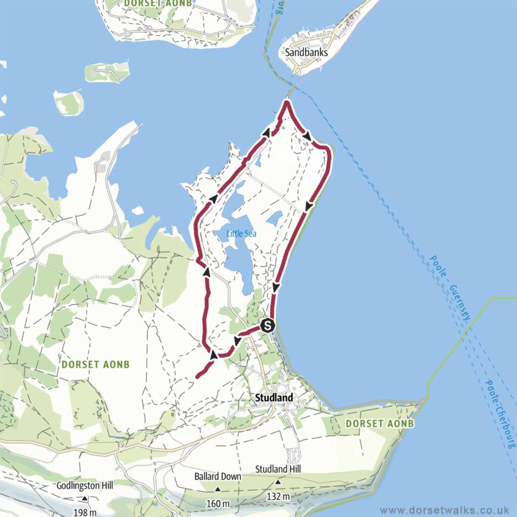
4. Studland to South Haven Point Walk (via the Agglestone Rock)
Distance: 6 miles (circular)
Difficulty: Easy
Estimated time: 2 hours 25 minutes
Total ascent 164ft, Highest point 161ft
Starting point: National Trust Knoll Beach Car Park BH19 3AQ
OS Map: Explorer OL15 Purbeck & South Dorset
Link to GPS route map
https://www.outdooractive.com/
https://www.alltrails.com/
https://explore.osmaps.com/
https://www.google.com/maps/
Base map © OpenStreetMap
5. Studland to Agglestone Rock Walk
Distance: 3.2 miles (circular)
Difficulty: Easy
Estimated time: 1 hour 20 minutes
Total ascent 236ft, Highest point 46ft
Starting point: National Trust South Beach Car Park BH19 3AU or
National Trust Middle Beach Car Park BH19 3AX
OS Map: Explorer OL15 Purbeck & South Dorset
Link to GPS route map
https://www.outdooractive.com/
https://www.alltrails.com/
https://explore.osmaps.com/
https://www.google.com/maps/
Base map © OpenStreetMap
6. Studland to Old Harry Rocks and Agglestone Rock Walk
Distance: 6.7 miles (circular)
Difficulty: Moderate
Estimated time: 3 hours 20 minutes
Total ascent 1234ft, Highest point 446ft
Starting point: National Trust South Beach Car Park BH19 3AU
OS Map: Explorer OL15 Purbeck & South Dorset
Link to GPS route map
https://www.outdooractive.com/
https://www.alltrails.com/
https://explore.osmaps.com/
https://www.google.com/maps/
Base map © OpenStreetMap
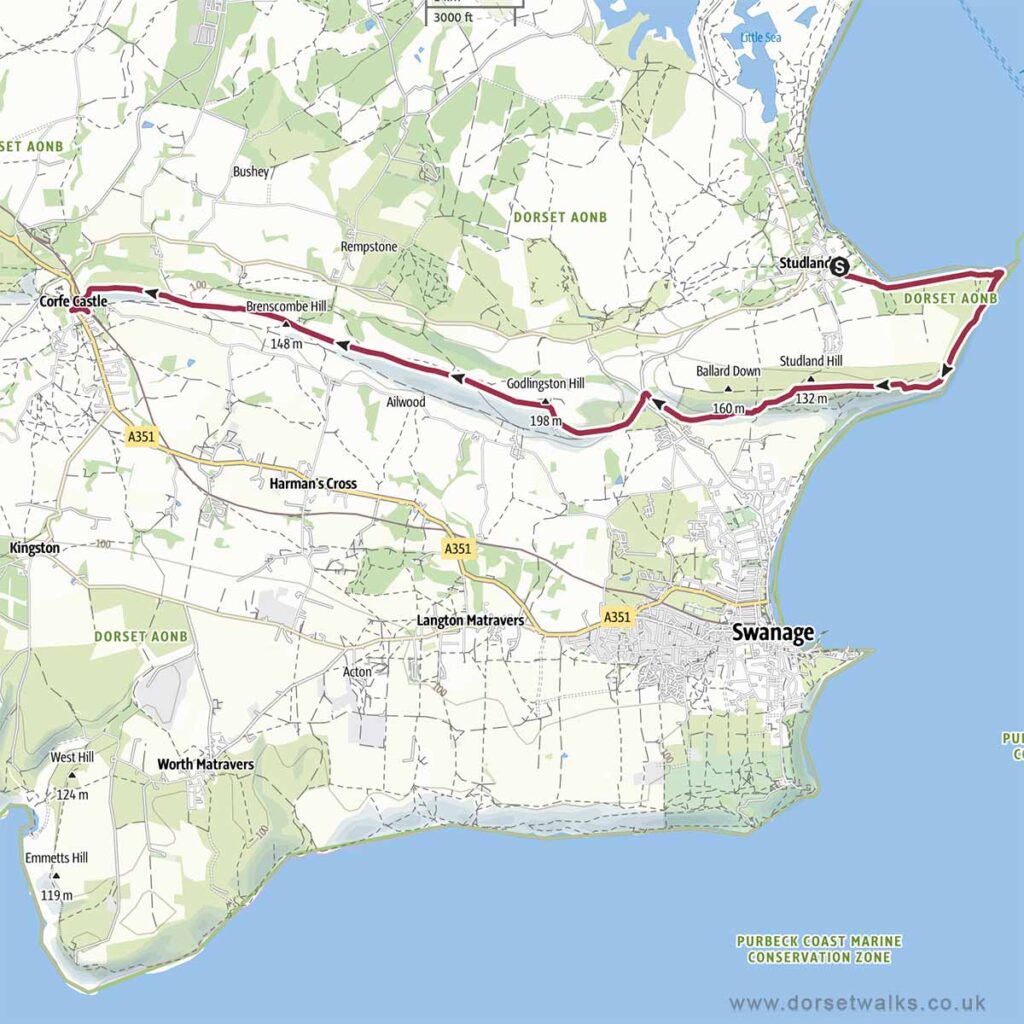
7. Studland to Corfe Castle Walk
* for a really excellent day out this walk can be combined with a ride on a steam train from Corfe Castle to Swanage and then walking back from Swanage to Studland (add an extra 3 miles) or just take the bus back from Swanage to Studland. See details below.
Distance: 8 miles (one-way)
Difficulty: Easy to moderate
Estimated time: 4 hours
Total ascent 1424ft, Highest point 646ft
Starting point: National Trust South Beach Car Park BH19 3AU
OS Map: Explorer OL15 Purbeck & South Dorset
Link to GPS route map
https://www.outdooractive.com/
https://www.alltrails.com/
https://explore.osmaps.com/
https://www.google.com/maps/
This is a one-way walk from Studland South Beach Car Park to Corfe Castle. Obviously you then have the dilemma of how to get back to Studland. For a really great day out you could take a steam train from Corfe Castle to Swanage (book in advance at https://www.swanagerailway.co.uk) and then either take a bus from Swanage to Studland on the Purbeck Breezer 50 (https://www.morebus.co.uk/) or walk back. The walk from Swanage Railway station to Studland is 3 miles and takes about 1 hour 25 minutes. For a route map see https://www.outdooractive.com/ or Google maps
Base map © OpenStreetMap