Colmers Hill Walk

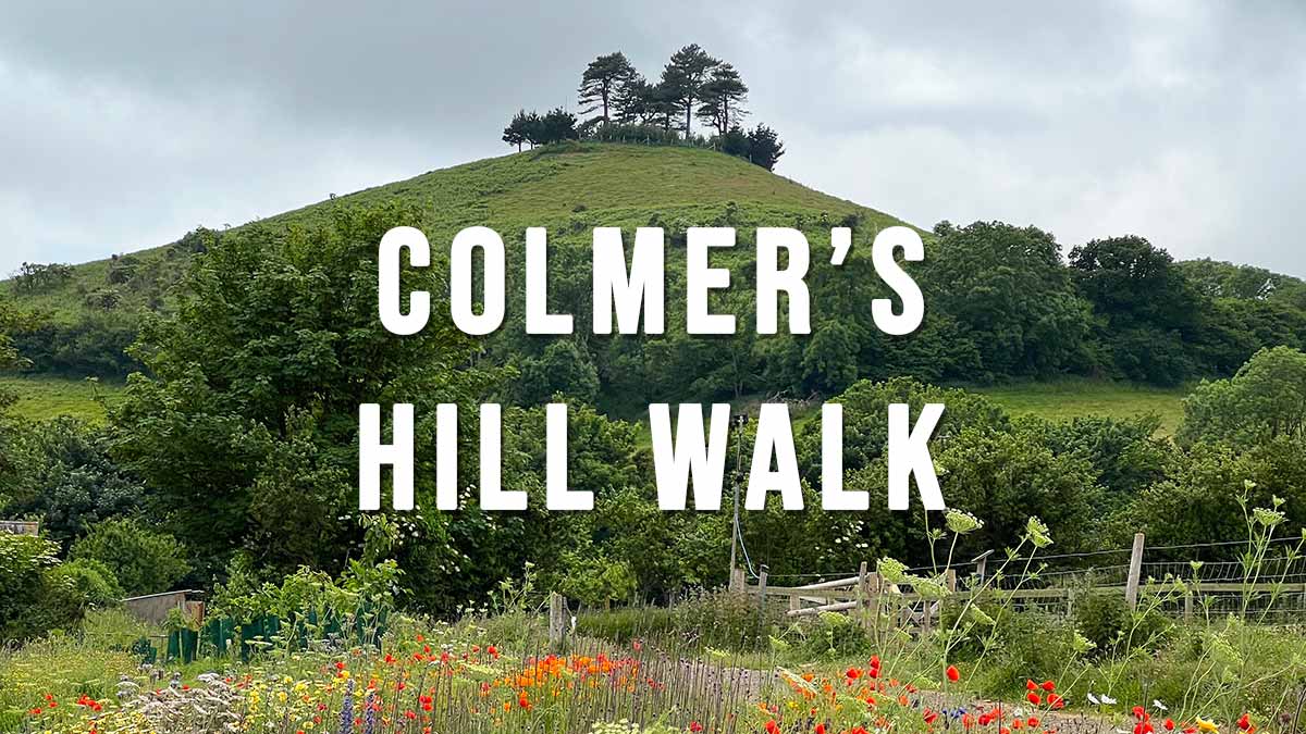
Colmers Hill is one of the most recognisable scenes in the West Dorset landscape, this iconic conical-shaped hill rises 417 feet above the village of Symondsbury on the edge of Bridport. It has been part of the Symondsbury Estate for over one hundred years and is open to the public with a permissive path up to the top. There are several walks in the area, the shorter Colmers Hill Walk is described below.

Distance: 1.6 miles Circular
Difficulty: Easy
Estimated Time: 1 hour
Ascent: 295ft, Highest Point 417ft
OS Map: OS Explorer 116 Lyme Regis & Bridport
Date of Walk: June 202

Continue reading “Colmers Hill Walk”

Maiden Castle Walk

Maiden Castle is the largest Iron Age hill fort in Britain and lies just outside Dorchester. It is owned by English Heritage but entrance is free, so is the car park. This short Maiden Castle Walk is an easy stroll around the banks and ditches of the hill fort offering beautiful views of rolling south Dorchester countryside.

Distance: 1.9 miles
Difficulty: Easy
Estimated time: 1 hour
Date of walk: 31 August 2022

Continue reading “Maiden Castle Walk”

Swyre Head Walk

Swyre Head is the highest point of the Purbeck Hills. The hill commands extensive views of Dorset’s Jurassic Coast including St. Aldhelm’s Head and Chapmans Pool to the east and Clavell Tower, Kimmeridge and as far as the Isle of Portland and Weymouth Bay to the west. To the north you can see Corfe Castle and Poole Harbour.

Distance: 2 miles,
Difficulty: easy,
Estimated time: 1 hours 10 minutes
Total ascent 214ft, Max elevation 671ft

Continue reading “Swyre Head Walk”

Stanpit Marsh Walk

Stanpit Marsh is a local Nature Reserve and Site of Special Scientific Interest on the north side of Christchurch Harbour just below where the River Avon and River Stour meet. This walk takes you through salt marsh and freshwater marsh with reed beds absolutely teeming with wildflowers, butterflies and birds. The marsh is also home to semi-wild New Forest ponies that graze on the grassland.

Distance: 1.6 miles
Difficulty: easy,
Estimated time: 45 minutes
Total ascent 7ft, Highest point 13ft

Continue reading “Stanpit Marsh Walk”

Hod Hill Walk

Dorset’s largest hill fort and home to a wide variety of wild flowers, birds and butterflies. The fort sits at 143 m (469 ft) above sea level and commands wide ranging views over rural Dorset and the meandering River Stour below.

Distance: 1.5 miles
Difficulty: easy (uneven ground and uphill sections)
Estimated time: 1 hour
Date of Walk: June 2020

Continue reading “Hod Hill Walk”

Studland to Old Harry Rocks Walk

The Studland to Old Harry Rocks walk is an easy circular walk starting at Studland village and following the chalky coastal cliffs along to Old Harry Rocks and then on to Ballard Point. The walk offers great views of Studland Bay and its sandy beaches backed by dunes. The last half of the walk takes you up onto Ballard Down and the Purbeck Way. From here you can see the town of Swanage to the south and Poole Harbour and Brownsea Island to the north.

Distance: 4 miles (circular)
Difficulty: easy
Estimated time: 1 hour 30 minutes
Total ascent 965ft, Highest point 446ft
Date of walk: June 2020

Continue reading “Studland to Old Harry Rocks Walk”