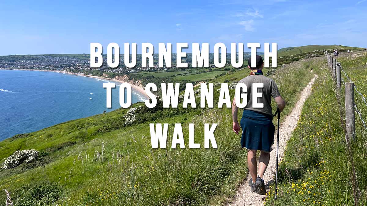
The Bournemouth Pier to Swanage Walk is a stunning 12.2 miles coastal walk along some of Britain’s best beaches. Highlights include Bournemouth Pier, Sandbanks Beach, Poole Harbour, Sandbanks Ferry, Shell Bay, Studland Beaches, Old Harry Rocks, Ballard Down and Swanage.
A Morebus Purbeck Breezer 50 bus service operates between Bournemouth Pier and Swanage allowing you to return to Bournemouth after the walk. https://www.morebus.co.uk/services/WDBC/50
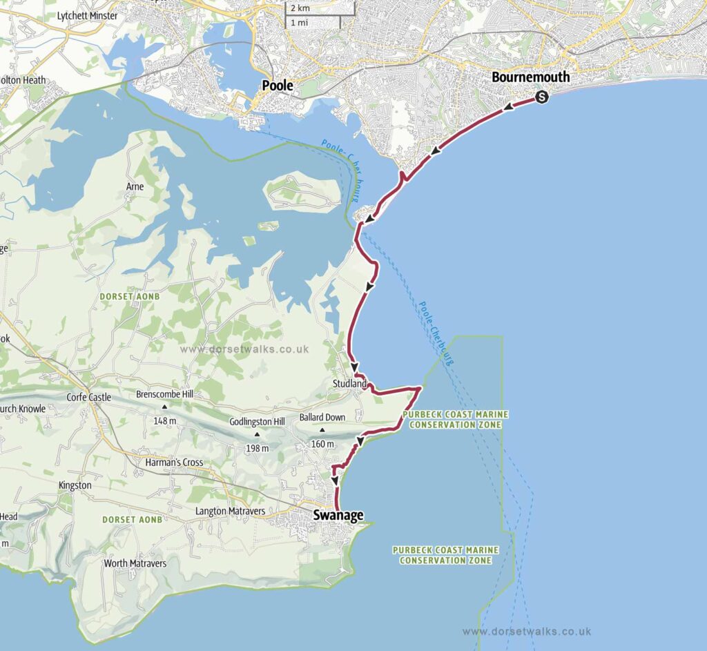
Distance: 12.2 miles one-way Difficulty: Medium Estimated time: 5 hours 35 minutes Total ascent 984ft, Highest point 364ft Starting point: Bournemouth Pier (Google map) OS Map: Explorer OL15 Purbeck & South Dorset Date of Walk: 28th May 2023
Bournemouth Pier to Swanage Walk 12.2 miles one-way
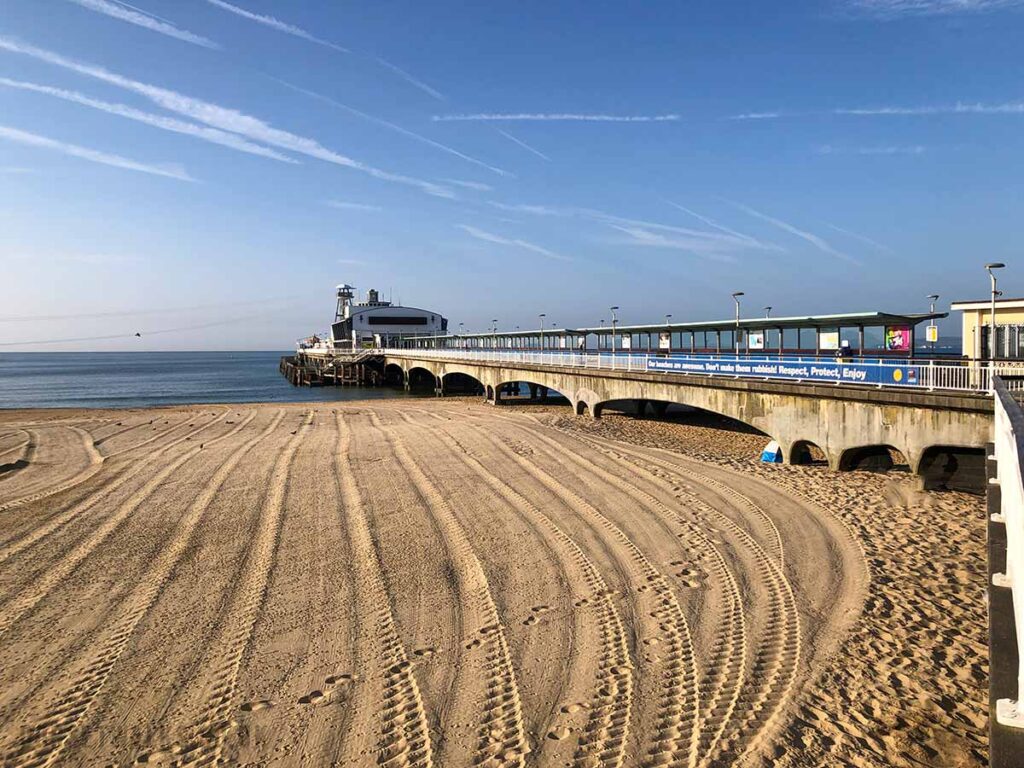
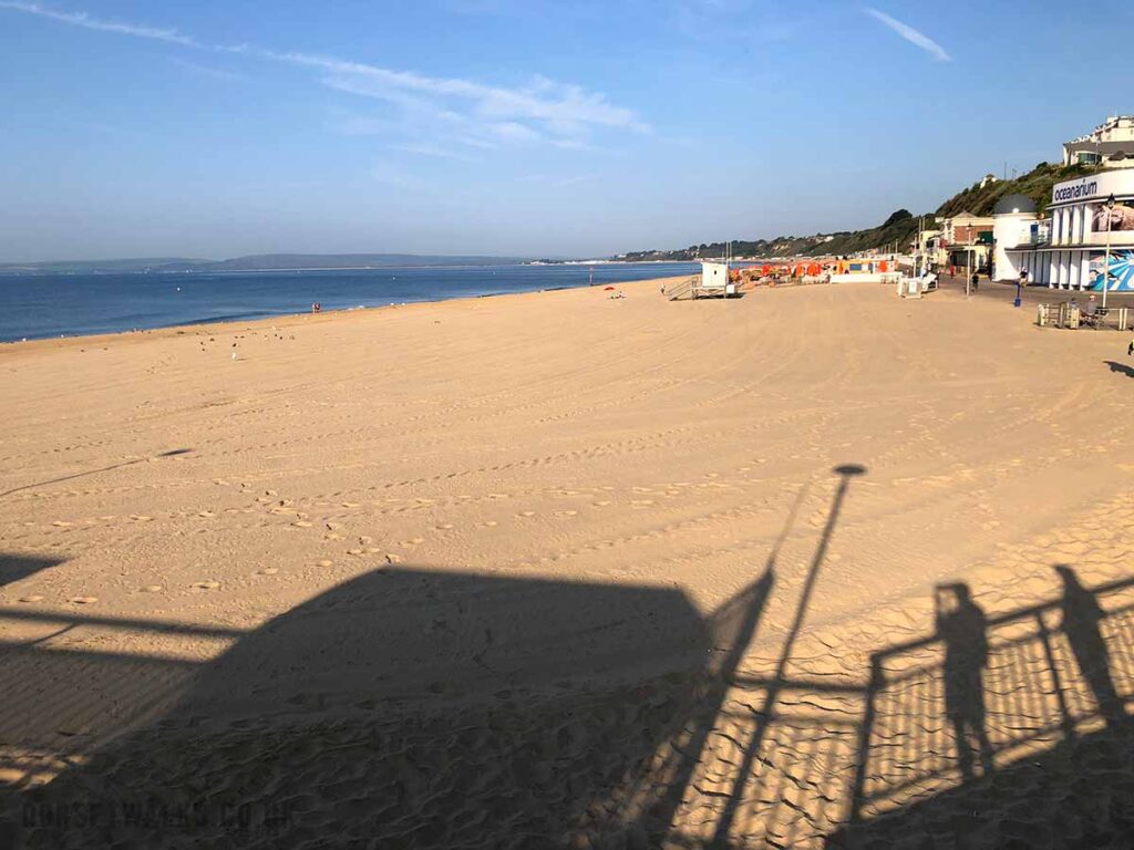
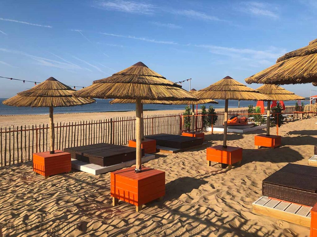
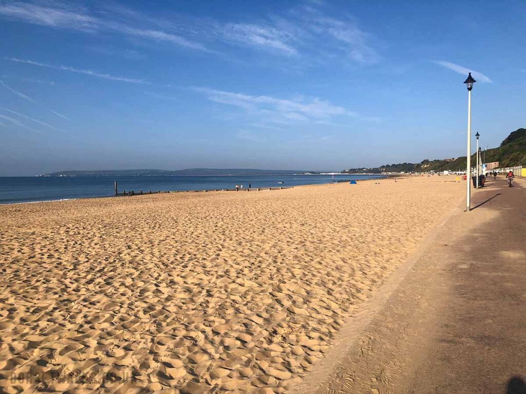
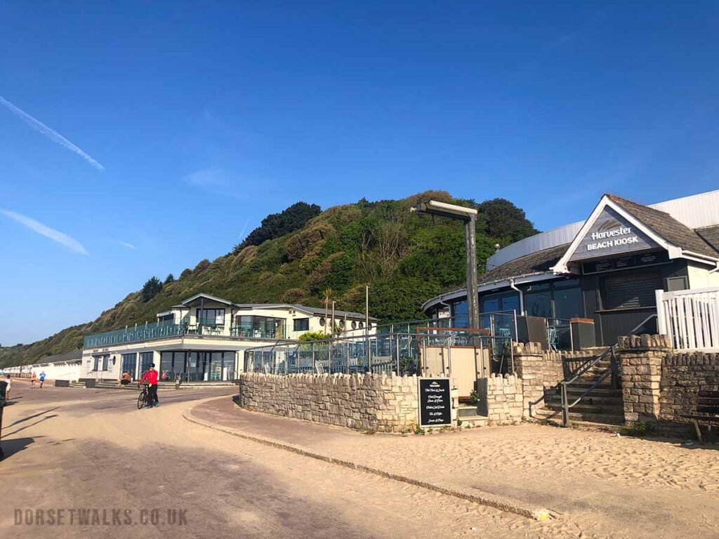
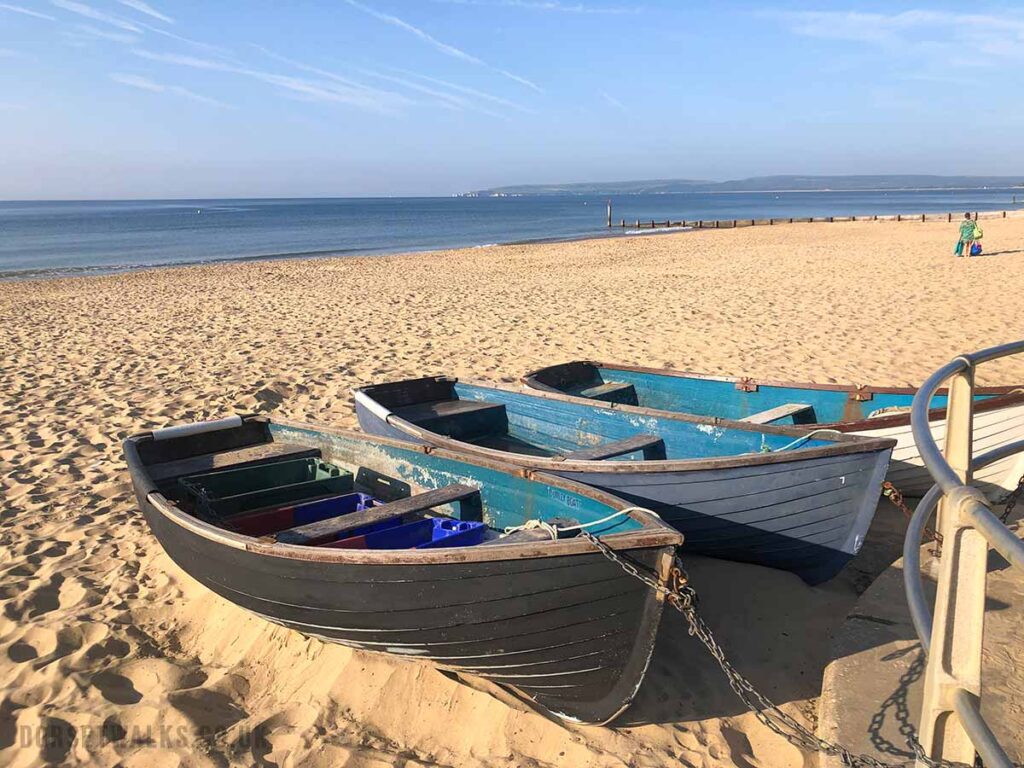
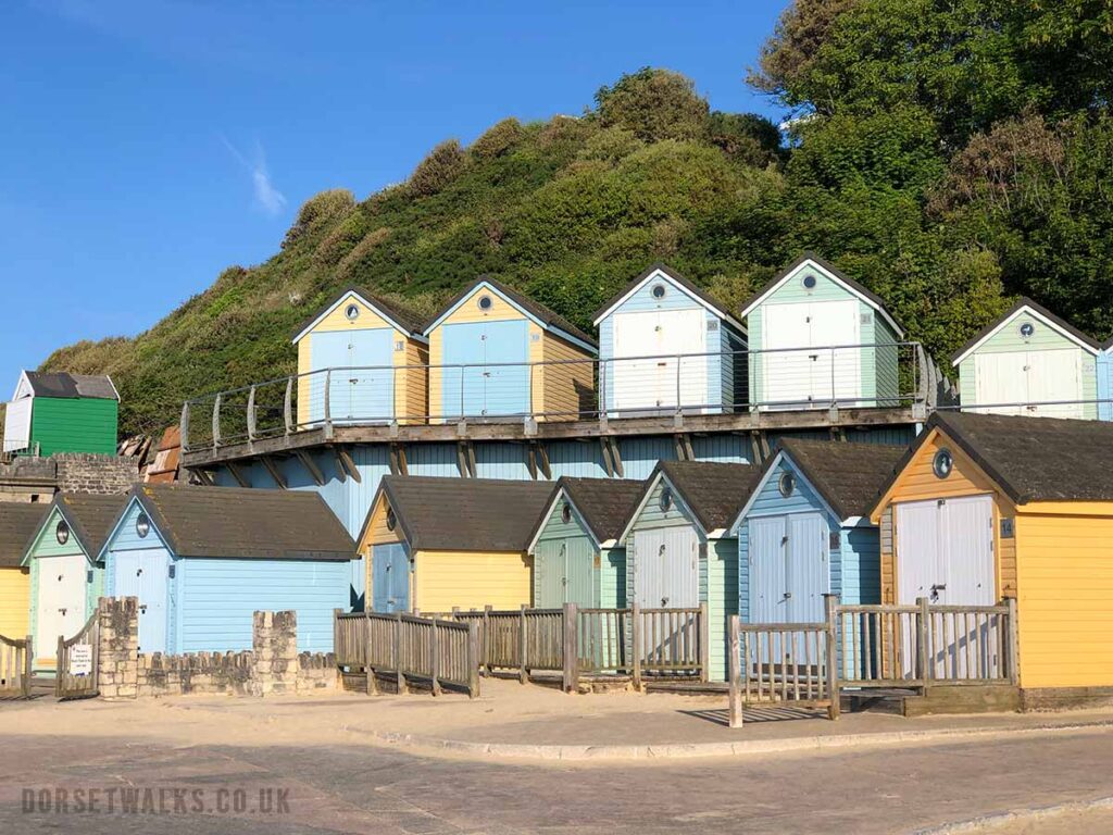
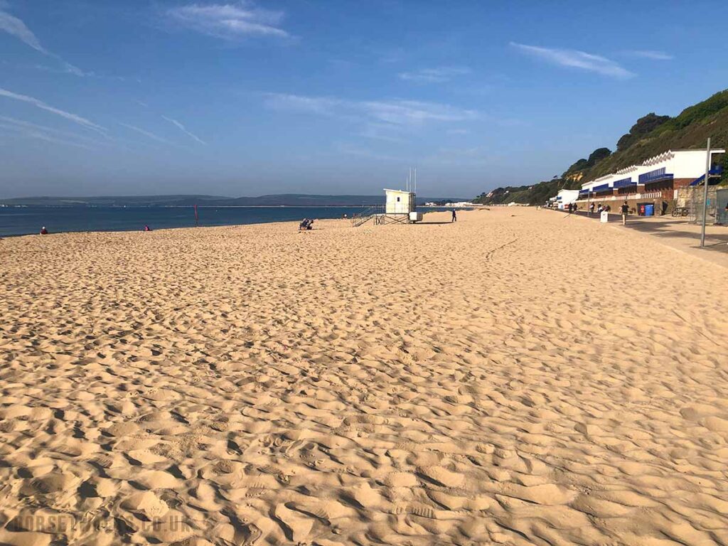
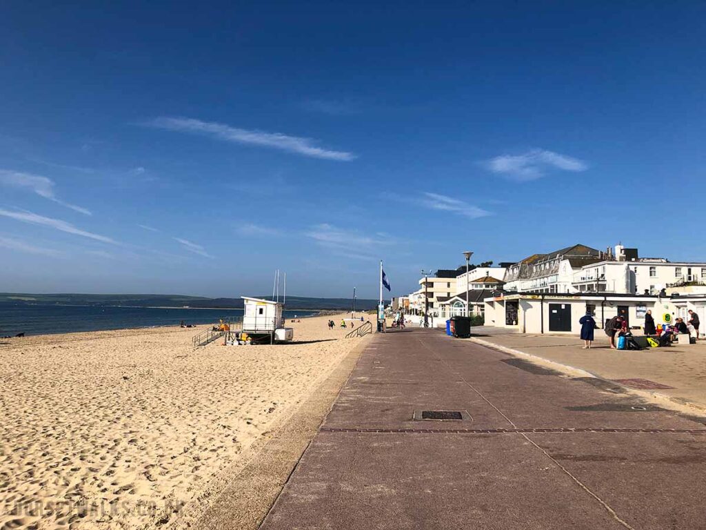
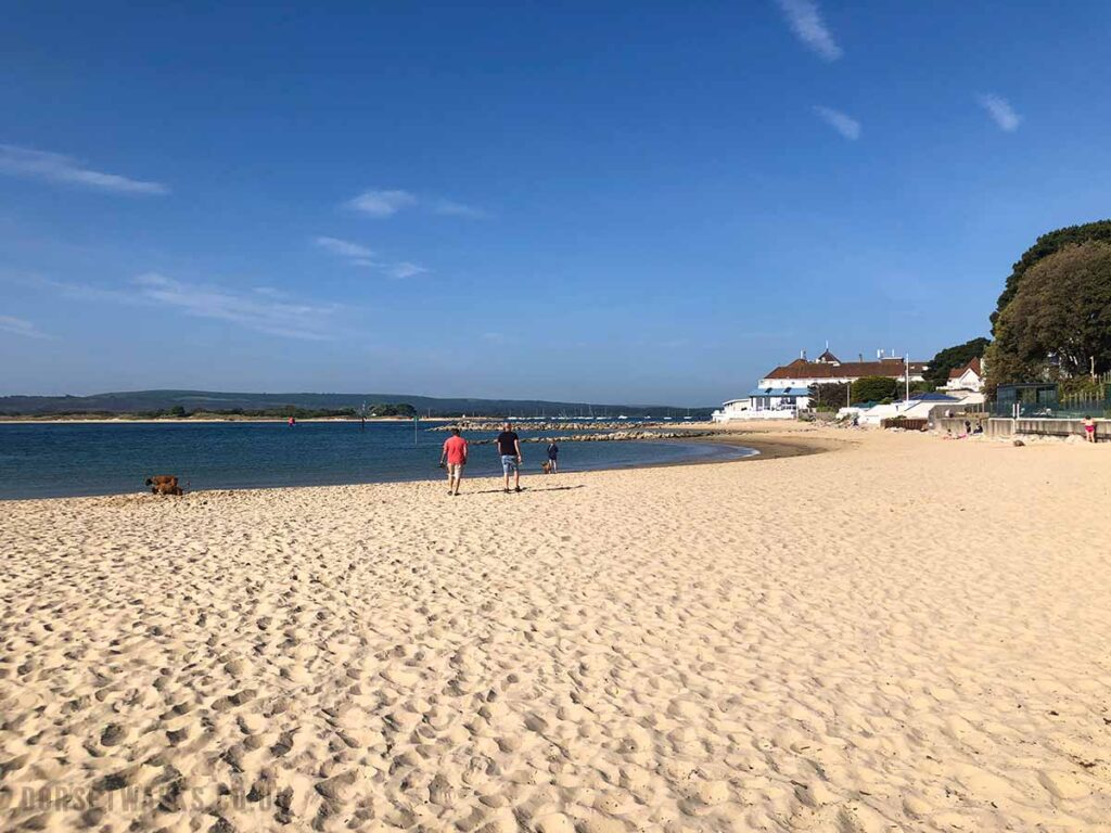
The walk starts at Bournemouth Pier (Google map)View from Bournemouth Pier looking west towards SandbanksSun umbrellas at W Beach, an outdoor bar/restaurant/beach club 100m west of Bournemouth Pier https://www.wbeach.co.ukThe beach between Bournemouth Pier and Durley Chine Beach. On the horizon in the middle of the photo are the white buildings at Sandbanks Beach and on the far left are the white chalk cliffs of Old Harry Rocks and the start of the Jurassic Coast. Just behind Old Harry Rocks, out of view, is Swanage Bay which is our destination for the day.Cafe and restaurants at Durley Chine Beach. There are also public toilets.Fishing boats on the beach. In the distance is Old Harry Rocks.Beach huts at Alum Chine BeachView looking west along Branksome Chine Beach. Beach huts at Canford Cliffs Chine BeachSandbanks Shore Road Beach. The promenade stops here.
When you arrive at Sandbanks Shore Road Beach the beachside promenade stops and you have a couple of options to continue on your walk to Sandbanks Ferry. The map above shows the route turning right down Shore Road until you meet Banks Road. You then turn left and follow Banks Road along the edge of Poole Harbour until you arrive at Sandbanks Ferry. I would recommend this route if you are new to the area as the views of Poole Harbour are a nice contrast to the beach. This route also takes you past a Tesco Express where you can stock up on supplies and ice cream which are cheaper than the beach cafes.
Alternatively you can just carry straight on and walk along the beach all the way to Sandbanks Ferry.
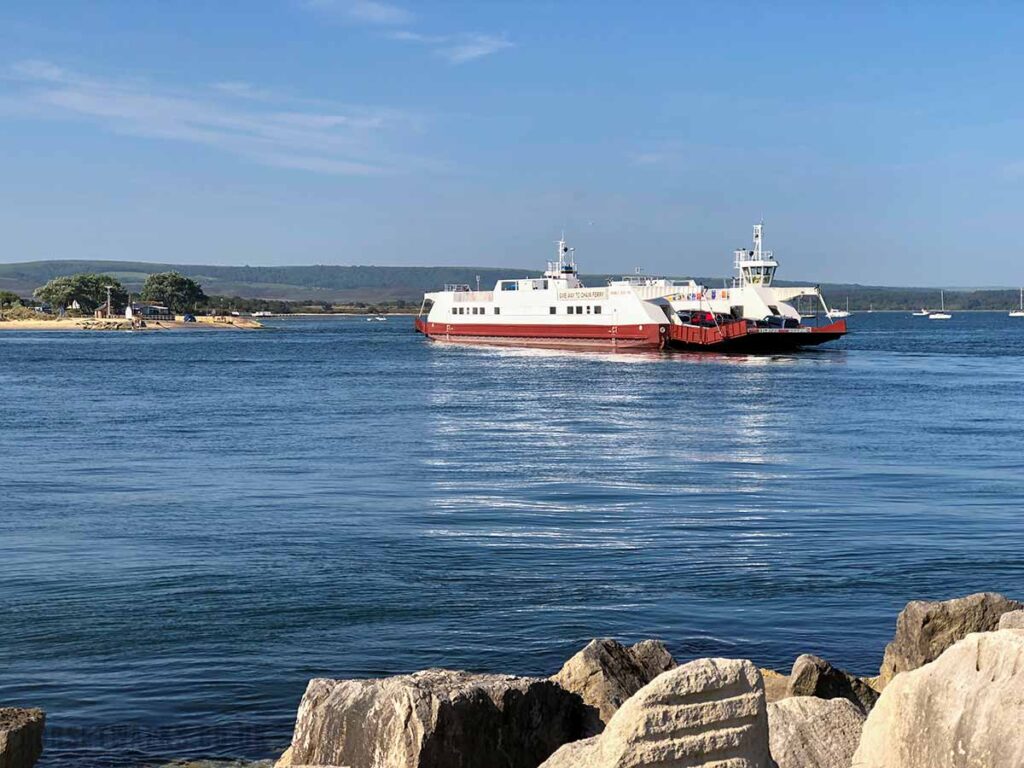
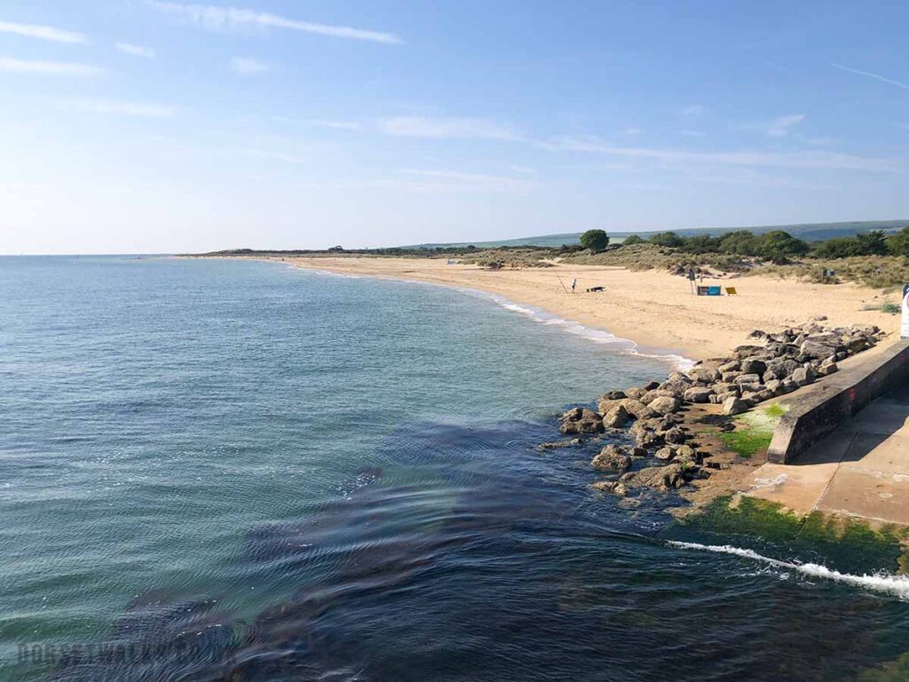
I’ve continued along Sandbanks Beach until reaching the Haven Hotel. There is then a narrow path that skirts the boundary of the hotel and brings you to the Sandbanks Ferry. The Sandbanks Ferry crosses the mouth of Poole Harbour and connects Sandbanks Peninsula with Shell Bay Beach on the Studland Peninsula.
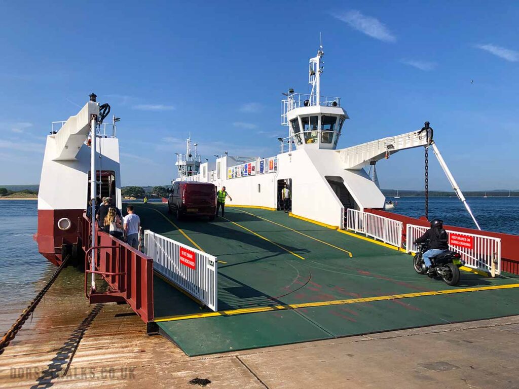
Take the Sandbanks Ferry to Shell Bay Beach on the Studland Peninsula. The price of the ferry for pedestrians is £1 from Sandbanks to Shell Bay. You can’t pre-book your ticket. The first ferry departs at 7am and then every 20 minutes thereafter until 11pm. You can buy a ticket at a small booth on the quayside or from a ticket machine. I paid cash. I read on their website that you can also pay by cash or card on the ferry itself if the booth is closed. Pedestrians only have to pay one-way. It’s free for pedestrians to come back from Studland to Sandbanks. For more info see https://www.sandbanksferry.co.uk/
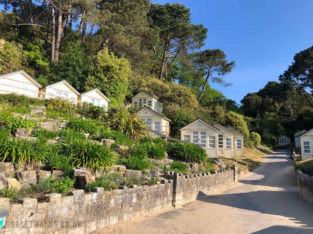
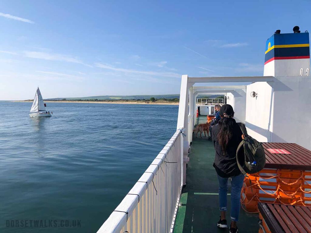
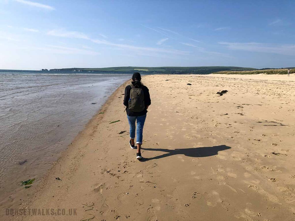
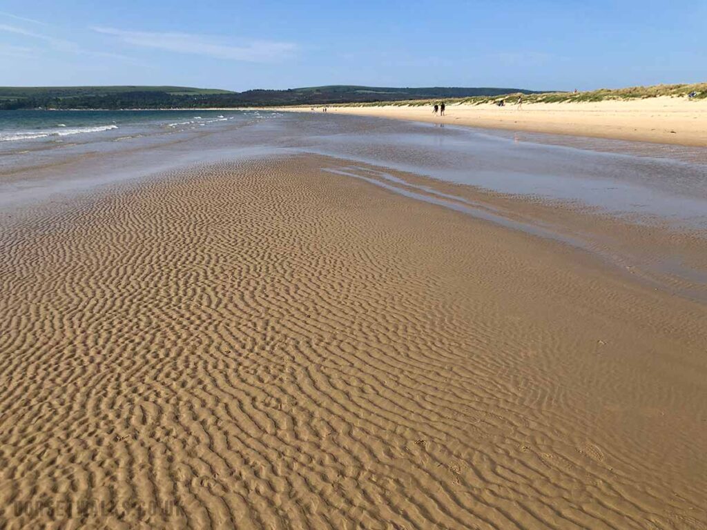
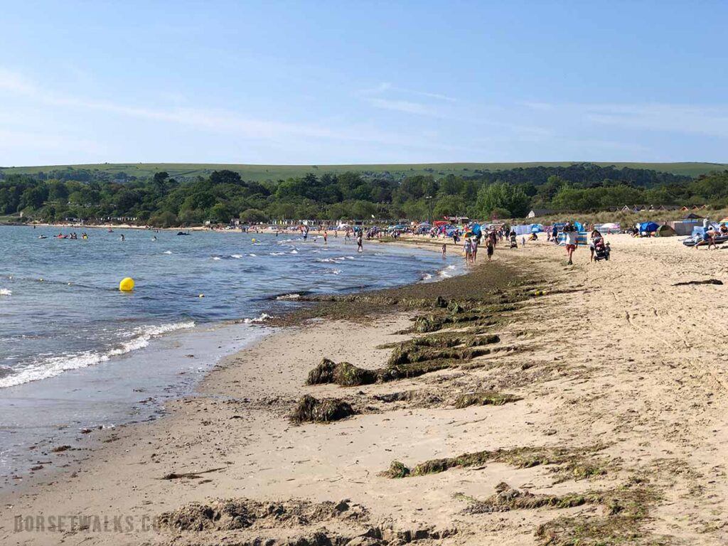
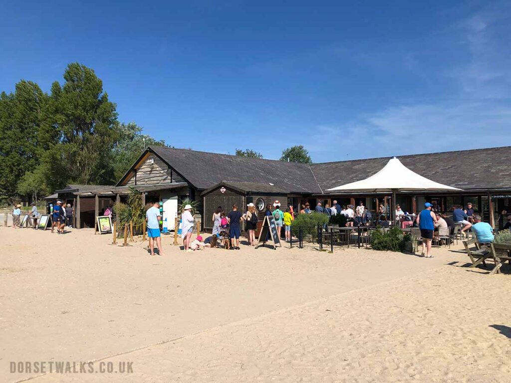
The Sandbanks Ferry. No need to book in advance, £1 per pedestrian. Taking the ferry across to Studland. You can see Shell Bay Beach approaching on the left. Shell Bay Beach. The walk follows the beach all the way to Studland.Walking along Studland Beach. About 200m after you have rounded the Shell Bay Beach peninsula you come to Studland Nudist Beach so don’t be shocked if you see nudists on this section of the beach. Most will be sunning themselves by the sand dunes but often there’ll be a few standing on the edge of the water. After the nudist beach you’ll arrive at Knowle Beach. On the day that we did the walk Knowle Beach had a lot of seaweed on the beach. This is normal, it’s perfectly harmless, it’s not sewage even though it might smell a bit. This beach and the whole Studland Peninsula is owned by the National Trust who’s policy is to leave everything as natural as possible. There is a National Trust shop and cafe / restaurant at Knowle Beach as well as toilets and a place to fill up your water bottle for free. Continue along the beach as far as you can until coastal erosion forces you to walk up the path and through the car park at Middle Beach. In the car park there are also toilets and a cafe.
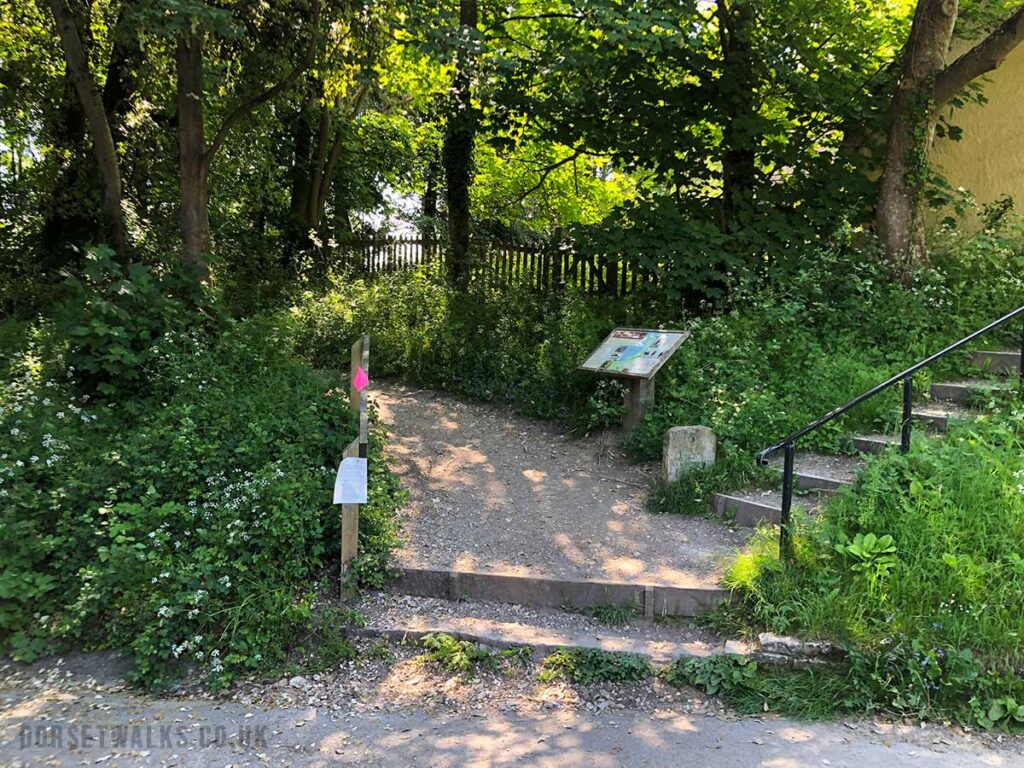
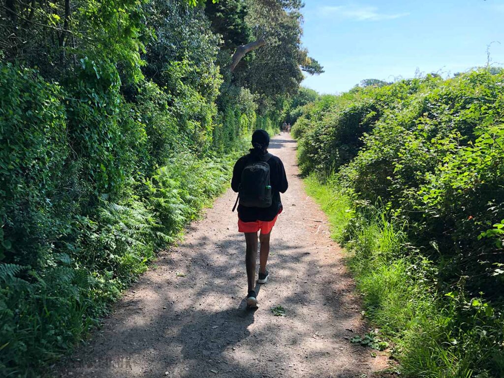
At the exit to Middle Beach Car park you’ll see a path heading off to your left. Just follow this dirt track.
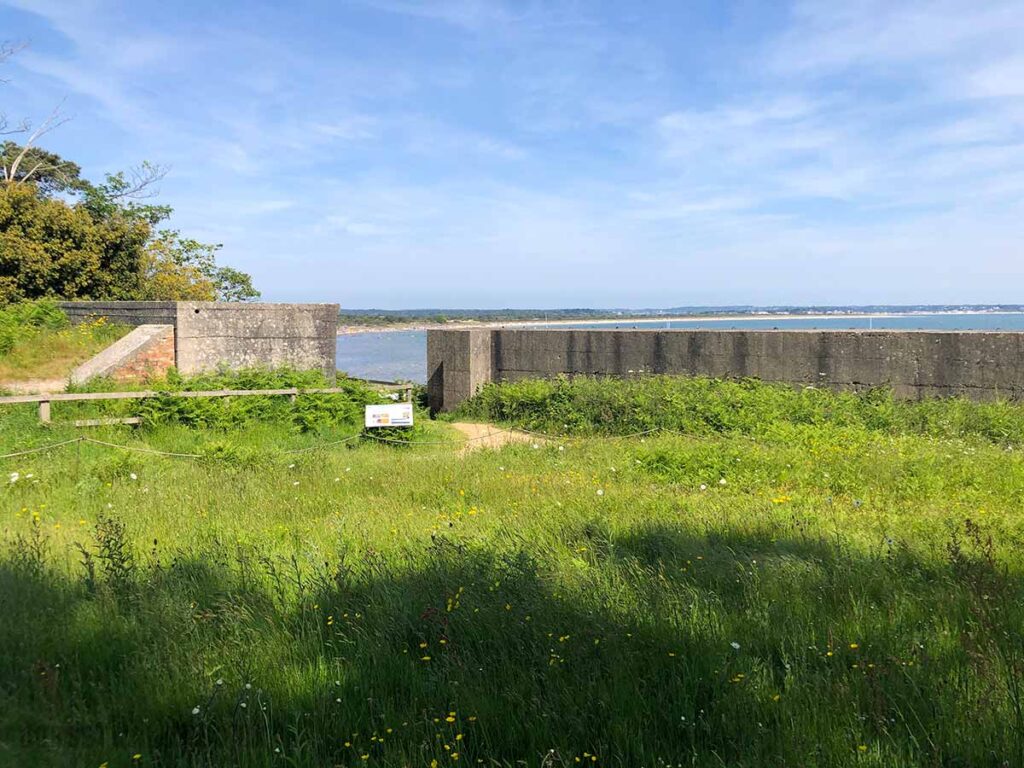
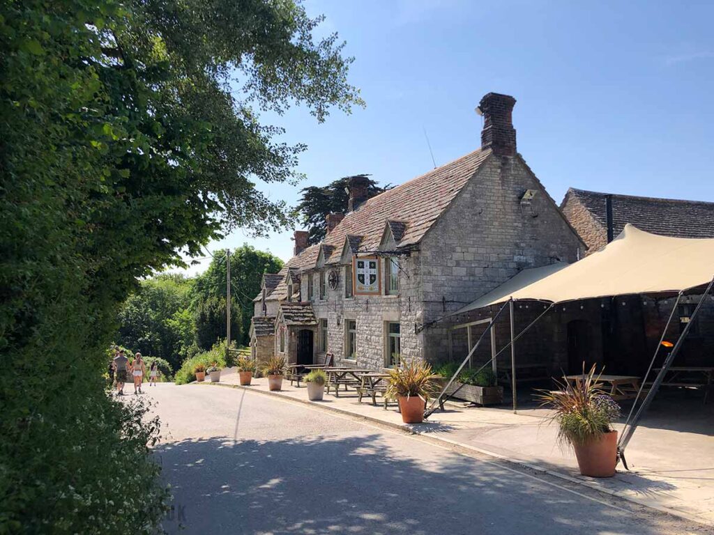
At the end of Middle Beach Car Park follow this path.The path takes you past Fort Henry. There are signs that explain it’s historical importance and contribution to Britain’s war-time defence network. About 250m after Fort Henry the path turns inland and joins the road. Turn left along the road.Follow the road past The Banks Armes Inn – https://www.bankesarms.com – great real ale and food but a bit pricey. Continue down the road.
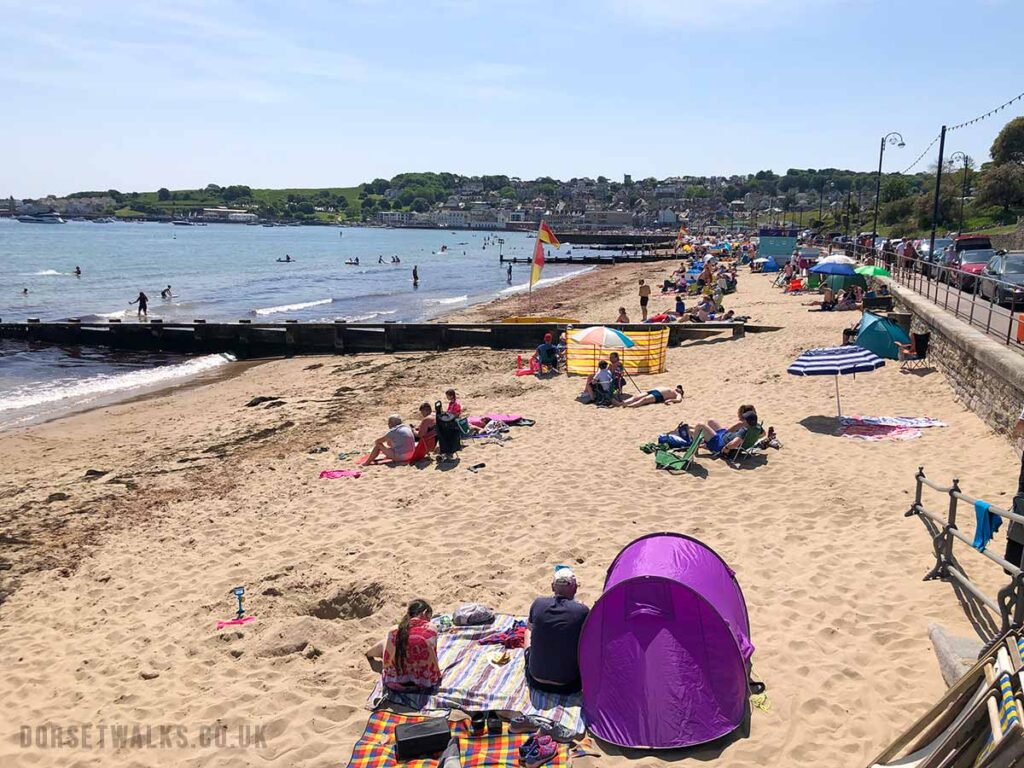
After passing the pub and at the bottom of the road you have a couple of options. The official route of the South West Coast Path takes you down a lane on your left to South Beach (the lane is about 20m before the public toilets). At the beach you turn right along the shore for 100m before following a path up the side of the hill on your right. The footpath is signposted. At the top of the hill the narrow footpath joins a larger track which you follow to you left towards Old Harry Rocks. The beach it nice so worth a visit and there is a good little cafe on the each – Joe’s Cafe South Beach.
Alternatively it’s easier just to continue past the pub and at the bottom of the road you see some public toilets on your left. Follow the track past the toilets – it will be signposted to Old Harry Rocks. Just keep on the path.
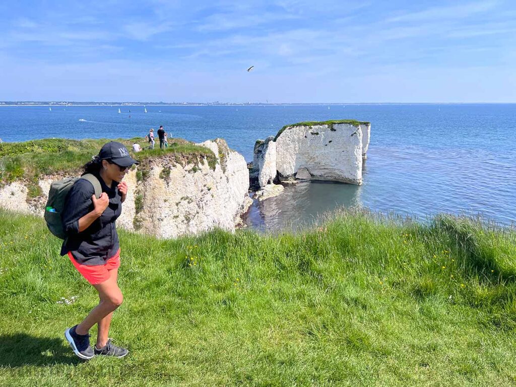
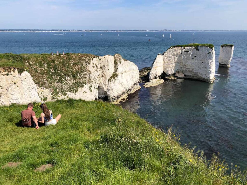
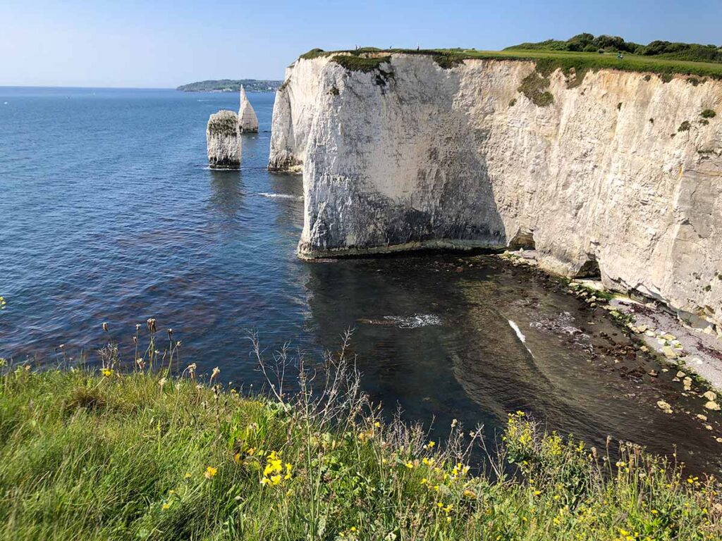
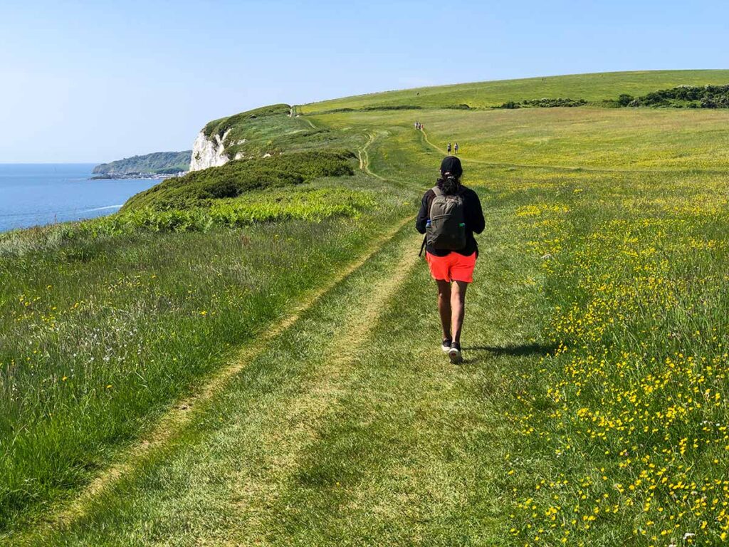
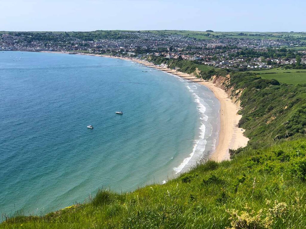
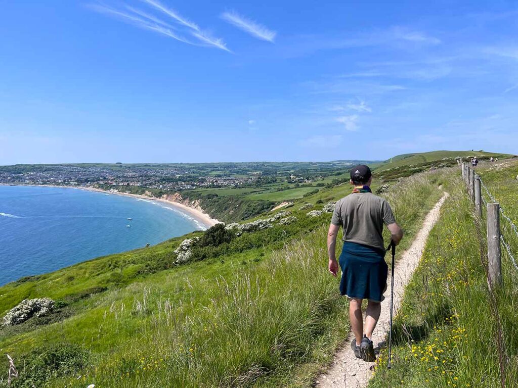
Follow the dirt track to Old Harry Rocks. The path opens out and you’ll get some great views looking back towards Studland Bay.Arriving at Old Harry Rocks. From Old Harry Rocks looking south along the Jurassic Coast towards Swanage Bay. The pointy rocks are known as The Pinnacles.Walking along Ballard Down. During late spring and summer these fields are full of wild flowers where you can frequently see orchids.Swanage Bay as viewed from Ballard Point. This is our destination.Follow the path down the hillside with constant views of Swanage on your left. Arriving at Swanage.