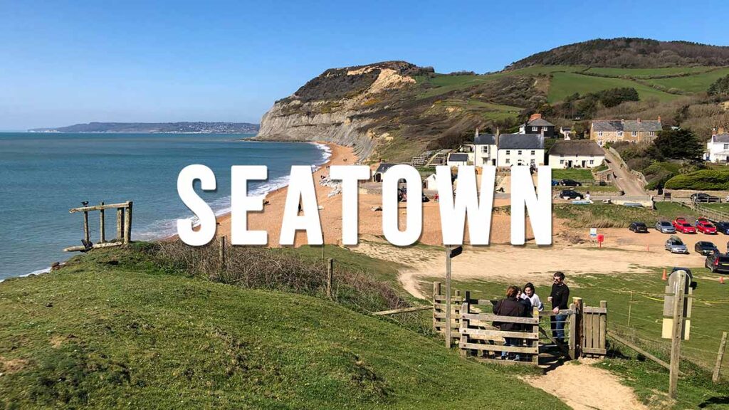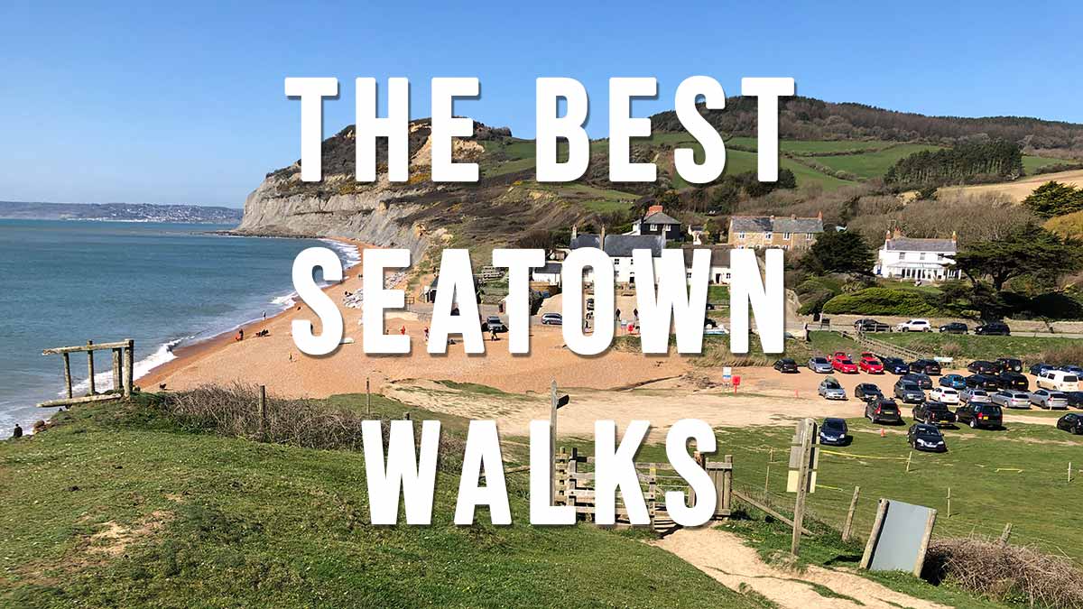
The Best Seatown Walks includes 11 stunning coastal walks starting in the small coastal hamlet of Seatown which is about 3 miles south-west of Bridport and about 7.5 miles east of Lyme Regis. Walk highlights include the Golden Cap which, at 191 m / 627 ft, is the highest point on the entire south coast of Great Britain.
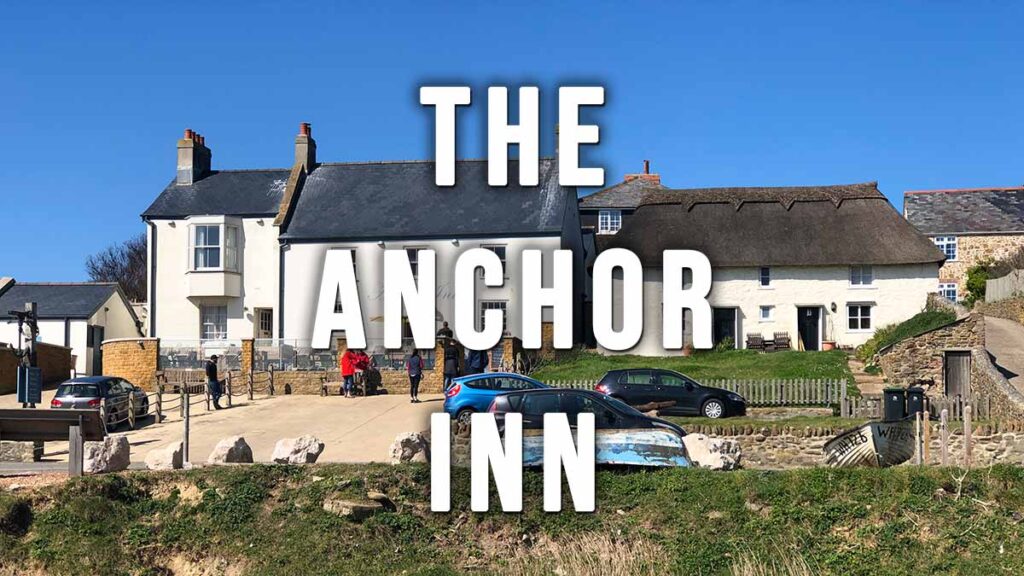
The starting point for all of the walks listed below is the beachside car park adjacent to the Anchor Inn pub (recommended). This is a good-sized private car park which costs £5 all day. SAT NAV DT6 6JU (Google maps) (w3w). For more info on the pub see our post The Anchor Inn
If you are a member of the National Trust and want to save yourself a fiver then you can start some of the walks at the Langdon Hill National Trust car park DT6 6SF (Google maps)(w3w)
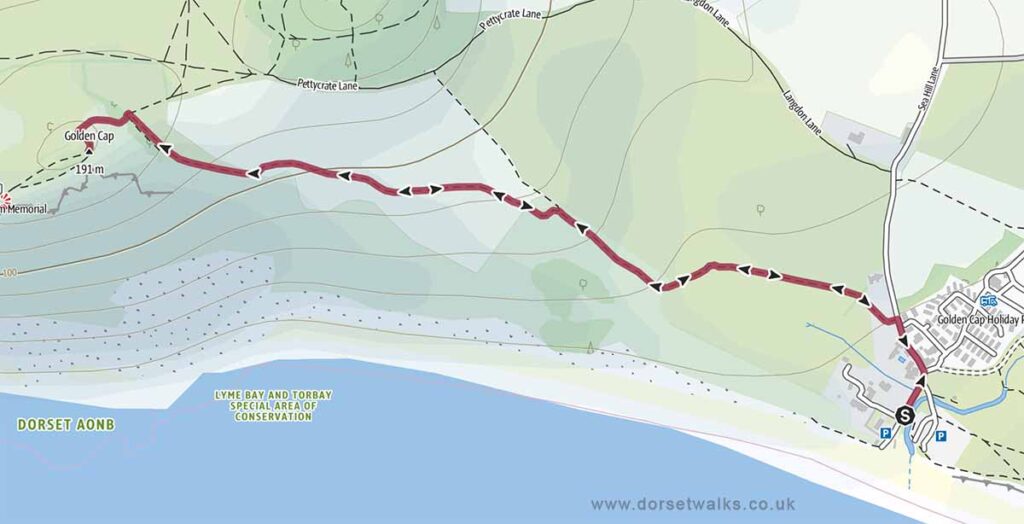
1. Seatown to Golden Cap Walk
Distance: 2.1 miles (out and back)
Difficulty: Easy
Estimated time: 1 hour 10 minutes
Total ascent 600 ft, Highest point 627 ft
Starting point: Anchor Inn Beach Car Park £5 all day DT6 6JU
OS Map: Explorer 116 Lyme Regis & Bridport
Link to GPS Route Map
https://www.outdooractive.com/
https://www.alltrails.com/
https://explore.osmaps.com/
Base map © OpenStreetMap
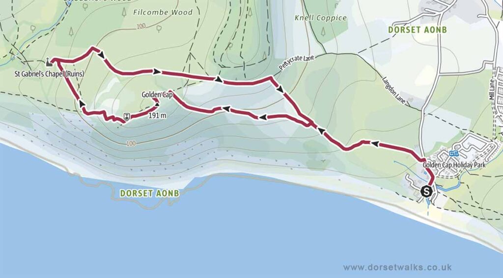
2. Seatown to Golden Cap and St Gabriels Chapel Walk
Distance: 2.9 miles (circular)
Difficulty: Easy
Estimated time: 1 hour 35 minutes
Total ascent 863 ft, Highest point 627 ft
Starting point: Anchor Inn Beach Car Park £5 all day DT6 6JU
OS Map: Explorer 116 Lyme Regis & Bridport
Link to GPS Route Map
https://www.outdooractive.com/
https://www.alltrails.com/
https://explore.osmaps.com/
Base map © OpenStreetMap
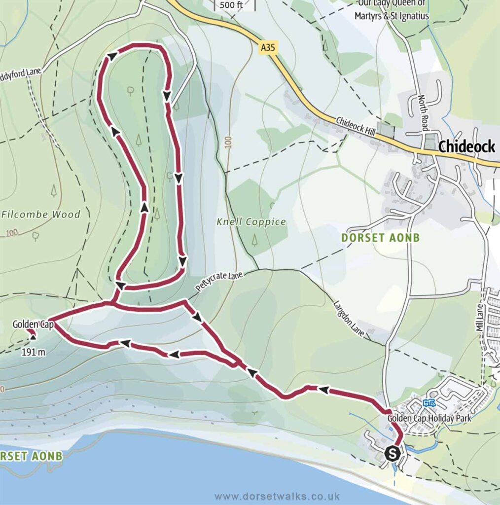
3. Seatown to Golden Cap and Langdon Hill Walk
Distance: 3.5 miles (circular)
Difficulty: Easy
Estimated time: 1 hour 50 minutes
Total ascent 600 ft, Highest point 627 ft
Starting point: Anchor Inn Beach Car Park £5 all day DT6 6JU
OS Map: Explorer 116 Lyme Regis & Bridport
Link to GPS Route Map
https://www.outdooractive.com/
https://www.alltrails.com/
https://explore.osmaps.com/
Base map © OpenStreetMap
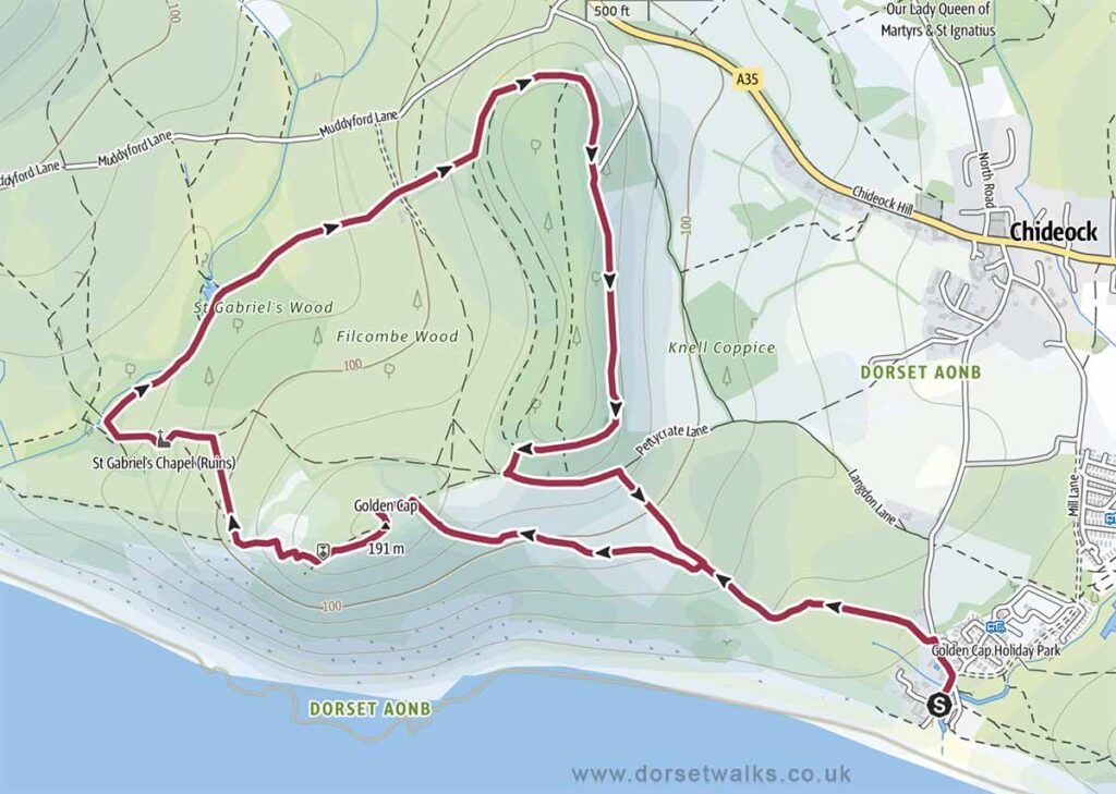
4. Seatown to Golden Cap, St Gabriels Chapel and Langdon Hill Walk
Distance: 4.1 miles (circular)
Difficulty: Easy
Estimated time: 2 hours 10 minutes
Total ascent 971 ft, Highest point 627 ft
Starting point: Anchor Inn Beach Car Park £5 all day DT6 6JU
OS Map: Explorer 116 Lyme Regis & Bridport
*** Route description and photos ***
Link to GPS Route Map
https://www.outdooractive.com/
https://www.alltrails.com/
https://explore.osmaps.com/
Base map © OpenStreetMap
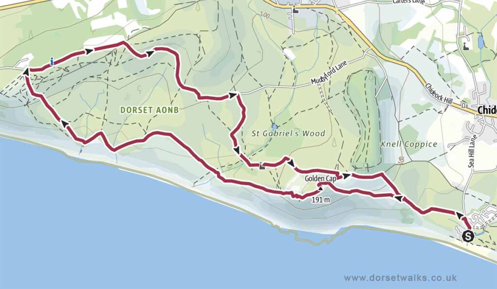
5. Seatown to Golden Cap and Stonebarrow Walk
Distance: 6.6 miles (circular)
Difficulty: Easy to moderate
Estimated time: 3 hours 25 minutes
Total ascent 1519 ft, Highest point 627 ft
Starting point: Anchor Inn Beach Car Park £5 all day DT6 6JU
OS Map: Explorer 116 Lyme Regis & Bridport
Link to GPS Route Map
https://www.outdooractive.com/
https://www.alltrails.com/
https://explore.osmaps.com/
Base map © OpenStreetMap
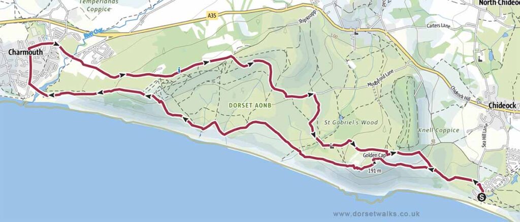
6. Seatown to Golden Cap and Charmouth Walk
Distance: 8.9 miles (circular)
Difficulty: Moderate
Estimated time: 4 hours 30 minutes
Total ascent 2001 ft, Highest point 627 ft
Starting point: Anchor Inn Beach Car Park £5 all day DT6 6JU
OS Map: Explorer 116 Lyme Regis & Bridport
Link to GPS Route Map
https://www.outdooractive.com/
https://www.alltrails.com/
https://explore.osmaps.com/
Base map © OpenStreetMap
7. Seatown to Thorncombe Beacon Walk
Distance: 2.5 miles (circular)
Difficulty: Easy
Estimated time: 1 hour 20 minutes
Total ascent 653 ft, Highest point 515 ft
Starting point: Anchor Inn Beach Car Park £5 all day DT6 6JU
OS Map: Explorer 116 Lyme Regis & Bridport
*** Route description and photos ***
Link to GPS Route Map
https://www.outdooractive.com/
https://www.alltrails.com/
https://explore.osmaps.com/
Base map © OpenStreetMap
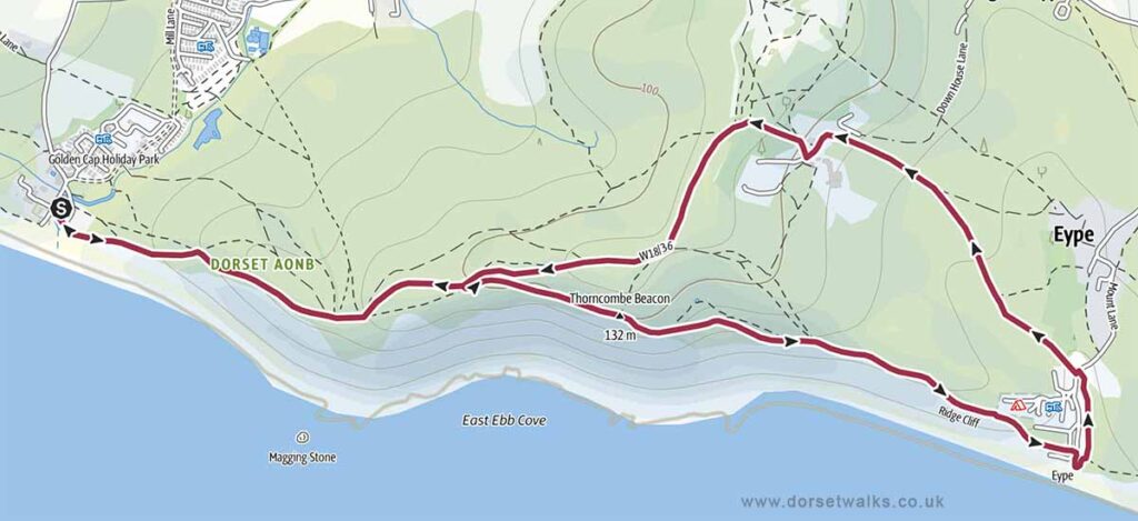
8. Seatown to Eype Beach Walk
Distance: 4.3 miles (circular)
Difficulty: Easy
Estimated time: 2 hours 15 minutes
Total ascent 899 ft, Highest point 515 ft
Starting point: Anchor Inn Beach Car Park £5 all day DT6 6JU
OS Map: Explorer 116 Lyme Regis & Bridport
Link to GPS Route Map
https://www.outdooractive.com/
https://www.alltrails.com/
https://explore.osmaps.com/
Base map © OpenStreetMap
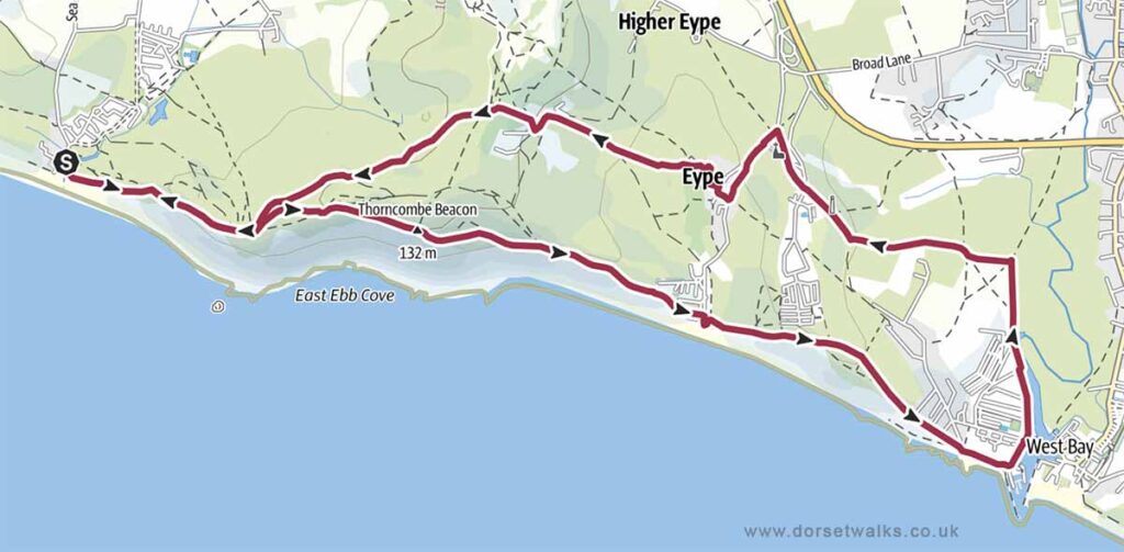
9. Seatown to West Bay Walk
Distance: 6.6 miles (circular)
Difficulty: Easy to moderate
Estimated time: 3 hours 25 minutes
Total ascent 1286 ft, Highest point 515 ft
Starting point: Anchor Inn Beach Car Park £5 all day DT6 6JU
OS Map: Explorer 116 Lyme Regis & Bridport
Link to GPS Route Map
https://www.outdooractive.com/
https://www.alltrails.com/
https://explore.osmaps.com/
Base map © OpenStreetMap
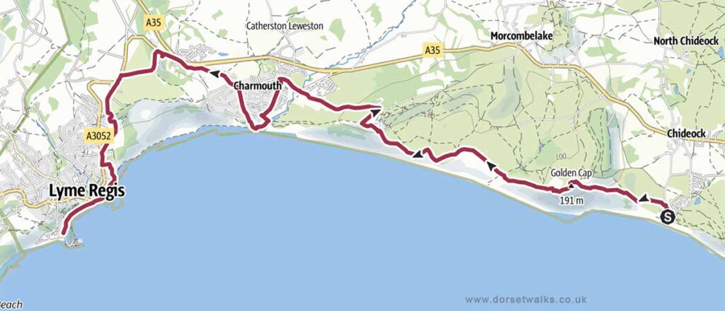
10. Seatown to Lyme Regis Walk (South West Coast Path)
Distance: 8.4 miles (circular)
Difficulty: Moderate
Estimated time: 4 hours 15 minutes
Total ascent 1703 ft, Highest point 627 ft
Starting point: Anchor Inn Beach Car Park £5 all day DT6 6JU
OS Map: Explorer 116 Lyme Regis & Bridport
Link to GPS Route Map
https://www.outdooractive.com/
https://www.alltrails.com/
https://explore.osmaps.com/
Base map © OpenStreetMap
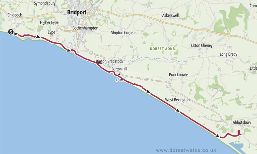
11. Seatown to Abbotsbury Walk (South West Coast Path)
Distance: 12.3 miles (circular)
Difficulty: Moderate
Estimated time: 5 hours 55 minutes
Total ascent 1165 ft, Highest point 515 ft
Starting point: Anchor Inn Beach Car Park £5 all day DT6 6JU
OS Map: Explorer 116 Lyme Regis & Bridport
Link to GPS Route Map
https://www.outdooractive.com/
Base map © OpenStreetMap
Related Posts: