
Dorset Coast Walks is a structured guide to selected coastal walking routes along the Dorset coastline, listed from east to west. The page includes a mix of short accessible walks, circular routes and longer sections of the South West Coast Path.
The eastern coastline between Highcliffe and Studland offers flatter terrain with long beaches and easier walking. West of Studland, the Jurassic Coast becomes more rugged, with cliffs, coves and frequent ascents.
These walks are typically linear and may require transport planning, particularly for longer sections.
Each walk includes distance, route type and a short description, with links to detailed route pages including maps, parking information, public transport and step-by-step route guidance.
Dorset Coast Walks (East to West)
Highcliffe to Mudeford Quay
2.9 miles, One-way, Easy
Route: Highcliffe Cliff Top Car Park – Highcliffe Beach – Highcliffe Castle – Steamer Point Nature Reserve – Friars Cliff Beach – Avon Beach – Mudeford Quay
Description: Easy coastal walk combining cliff-top paths and long sandy beaches, with open views towards Christchurch Harbour and the Isle of Wight.
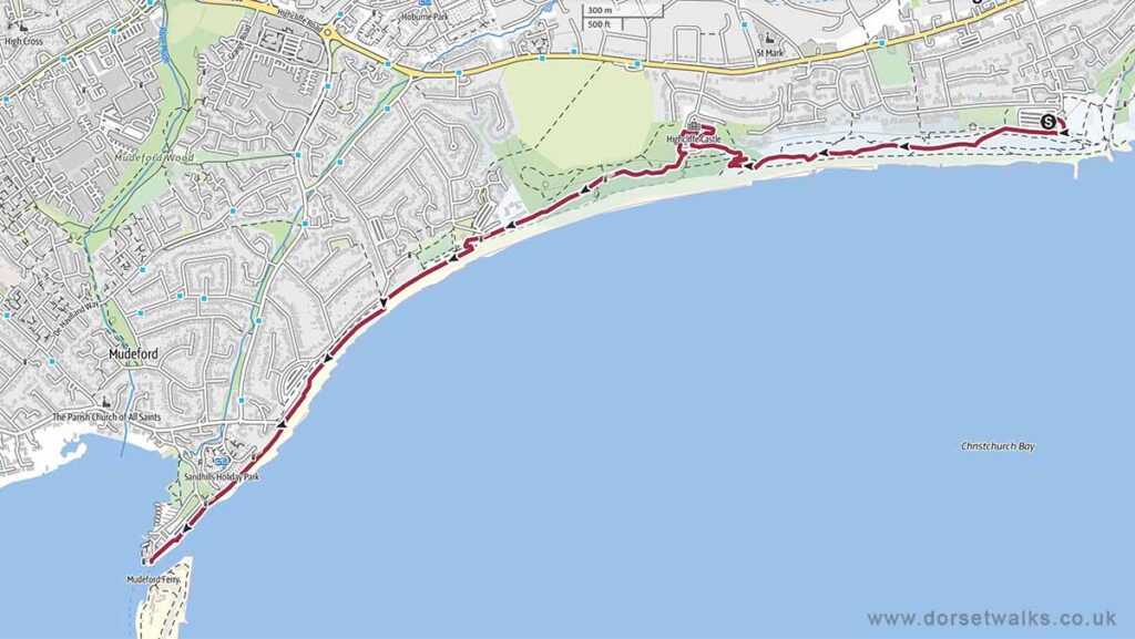
Base map © OpenStreetMap
Stanpit Marsh
1.6 miles, Circular, Easy
Route: Stanpit Marsh Nature Reserve
Description: Flat and open walk across salt marsh and estuary channels, with wide skies, birdlife and views towards Christchurch Harbour.
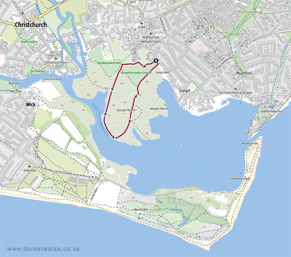
Base map © OpenStreetMap
Hengistbury Head Beach
4.2 miles, Circular, Easy
Route: Hengistbury Head Car Park – Hengistbury Head Beach – Mudeford Sandbanks – Hengistbury Head
Description: Varied coastal walk across heathland, dunes and headland, with expansive views over Christchurch Harbour and the coastline.
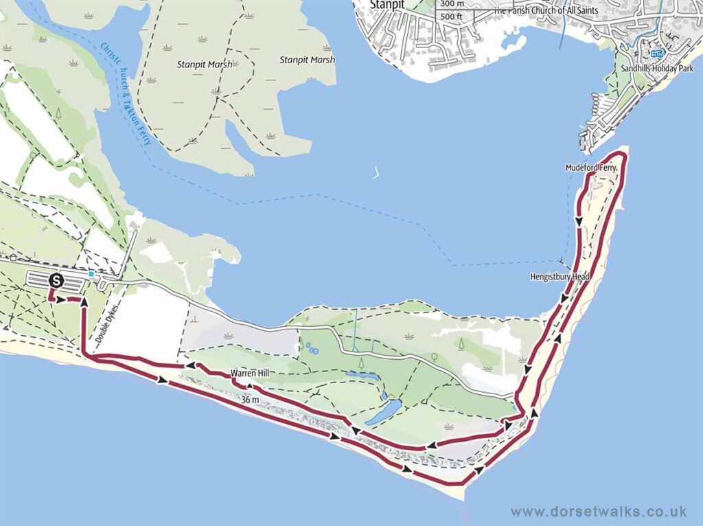
Base map © OpenStreetMap
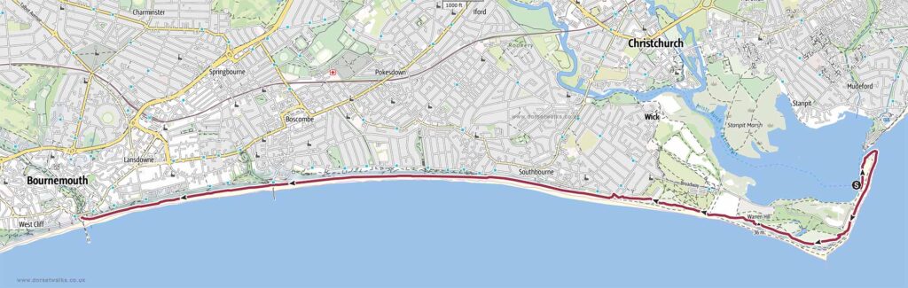
Mudeford Sandbanks to Bournemouth Pier Walk
7 miles, One-way, Easy
Route: Mudeford Sandbank – Hengistbury Head – Southbourne Beach – Fisherman’s Walk – Boscombe Pier – Bournemouth Pier
Description: Long, level walk along continuous sandy beaches and promenade, with uninterrupted sea views and easy navigation throughout.
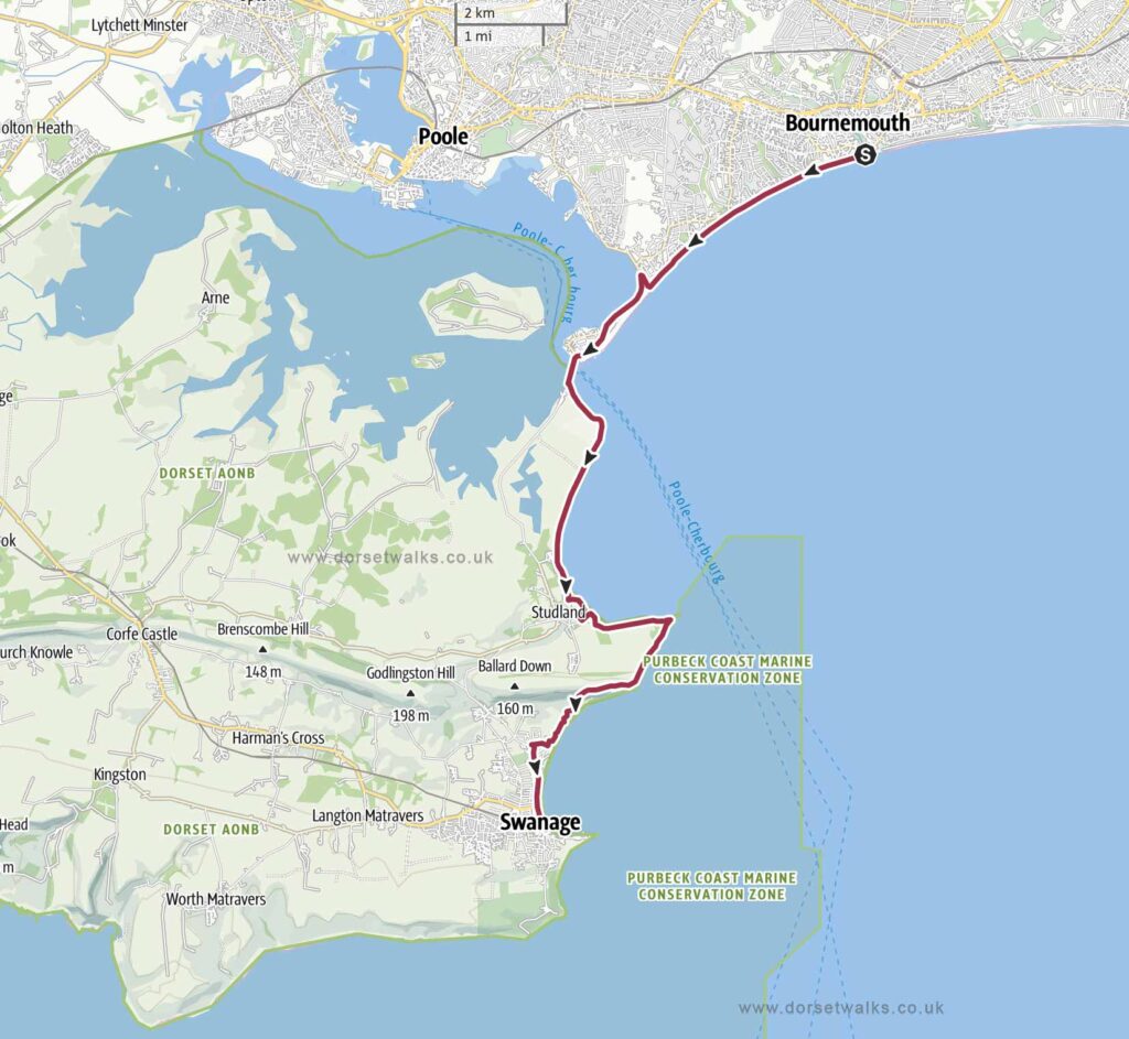
Bournemouth to Swanage Walk
12.2 miles, One-way, Medium
Route: Bournemouth Pier – Durley Chine – Alum Chine – Branksome Chine – Canford Cliffs Beach – Sandbanks – Poole Harbour – Sandbanks Ferry – Shell Bay – Studland Beaches – Studland Village (Banks Arms Pub) – Old Harry Rocks – Ballard Down – Swanage
Description: Extended coastal route transitioning from flat urban coastline to cliff-top walking, with a ferry crossing and expansive views from Ballard Down.
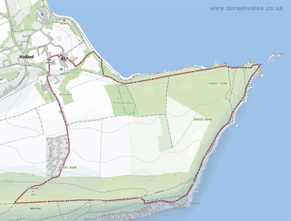
Studland to Old Harry Rocks
4 miles, Circular, Easy
Route: Studland Village (NT car park) – Banks Arms Pub – Old Harry Rocks – Studland
Description: Short coastal walk across open heath and chalk cliffs, leading to Old Harry Rocks with wide views over Swanage Bay.
Base map © OpenStreetMap
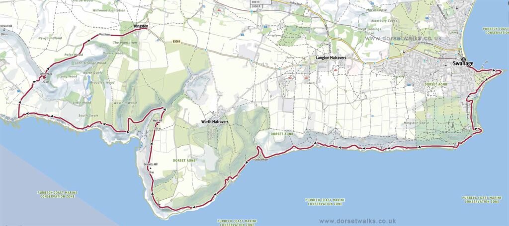
Swanage to Kingston Walk (via Swyre Head)
14.5 miles, One-way, Medium
Route: Swanage – Durlston Country Park – Dancing Ledge – Seacombe and Winspit Quarries – St Aldhelms Head – Chapman’s Pool – Houns Tout – Swyre Head – Kingston.
Description: Challenging cliff-top route with frequent ascents, passing quarries, remote bays and high viewpoints across the Purbeck coastline.
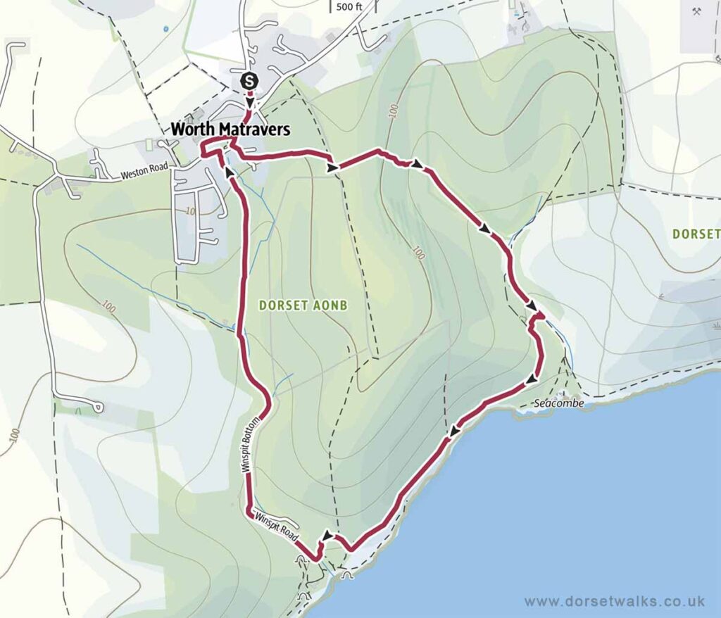
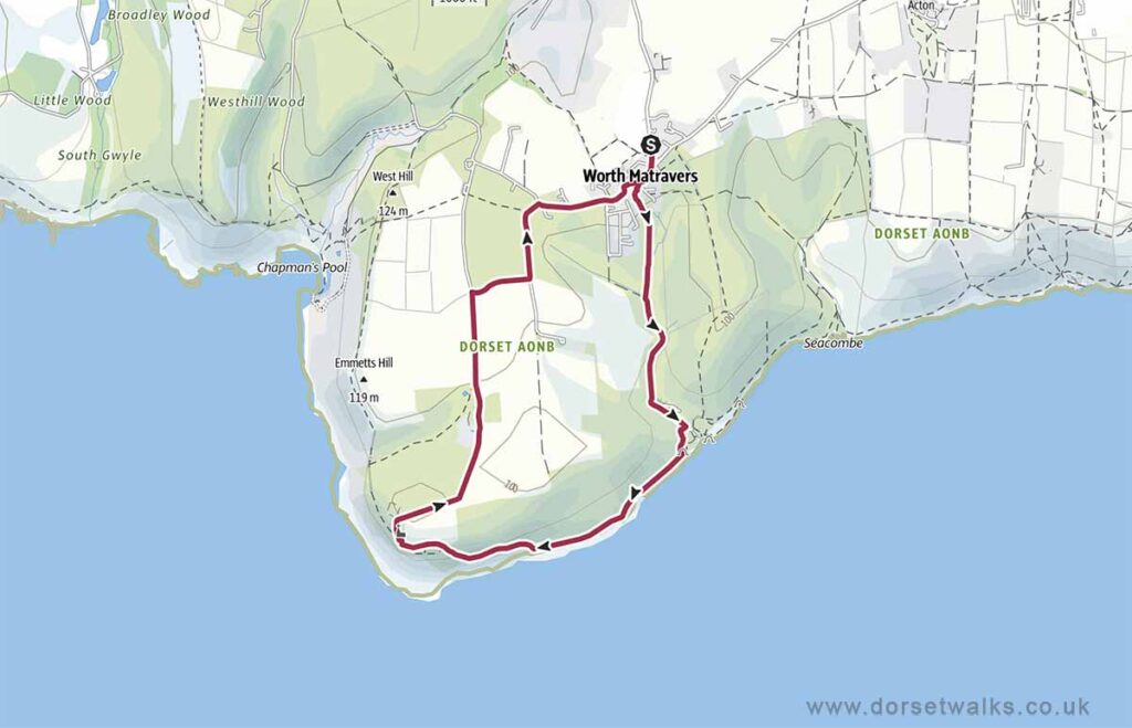
Worth Matravers to Seacombe and Winspit
2.9 miles, Circular, Easy
Route: Worth Matravers – Seacombe Cliffs – Winspit Quarry – Worth Matravers
Description: Short coastal walk across open farmland to quarry cliffs, with dramatic sea views and relatively gentle terrain.
Base map © OpenStreetMap
Worth Matravers to Winspit and St. Aldhelm’s Head
4.4 miles, Circular, Easy
Route: Worth Matravers – Winspit Quarry – St. Aldhelm’s Head (Chapel & Radar Memorial)
Description: Open coastal walk combining farmland and cliff paths, leading to St Aldhelm’s Head with elevated views along the coastline. This route avoids the steep steps near Emmetts Hill.
Base map © OpenStreetMap
Worth Matravers to St. Aldhelm’s Head and Chapmans Pool
2.9 miles Circular, Medium (steep section of steps)
Route: Worth Matravers (Renscombe car park) – St. Aldhelm’s Head (Chapel & Radar Memorial) – Emmetts Hill – Chapmans Pool view point – Renscombe car park
Description: Short but more demanding route with uneven ground and steep steps, linking cliff-top viewpoints with views down to Chapman’s Pool.
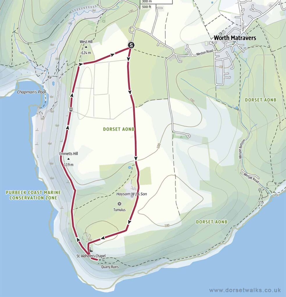
Base map © OpenStreetMap
Kingston to Swyre Head
2 miles, Circular, Easy
Route: Swyre Head car park (near Kingston) – Swyre Head
Description: Short inland walk with a steady climb to Swyre Head, offering incredible 360 degree views across Poole Harbour, the Purbeck Hills and coastline towards Kimmeridge and the Isle of Portland.
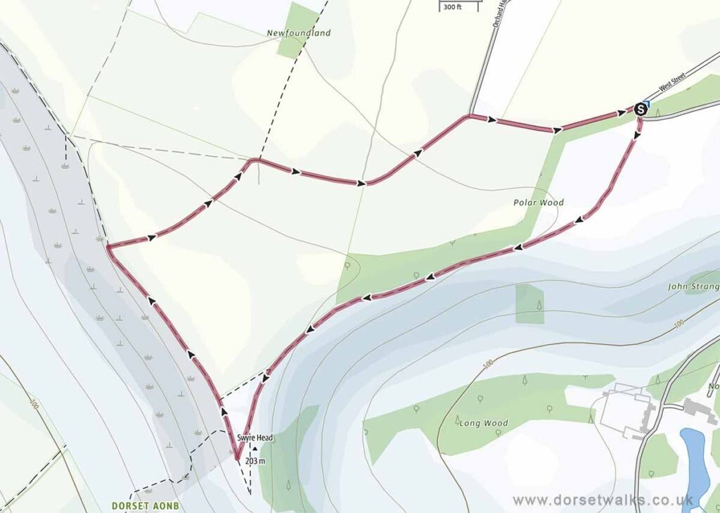
Base map © OpenStreetMap
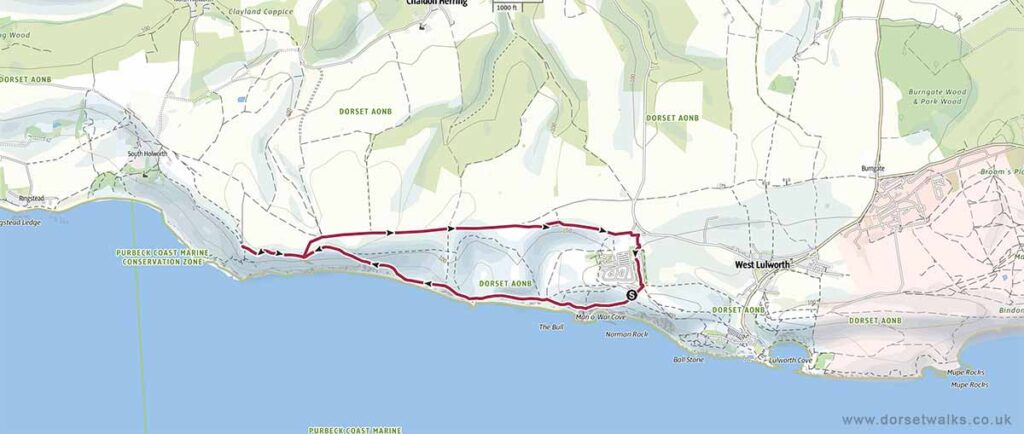
Lulworth Cove to Durdle Door
2.1 miles, Out and Back, Easy
Route: Lulworth Cove car park – South West Coast Path – Man O War Bay – Durdle Door – Rtn
Description: Short but steep coastal walk with clear paths, linking two iconic landmarks with views over Man O’ War Bay.
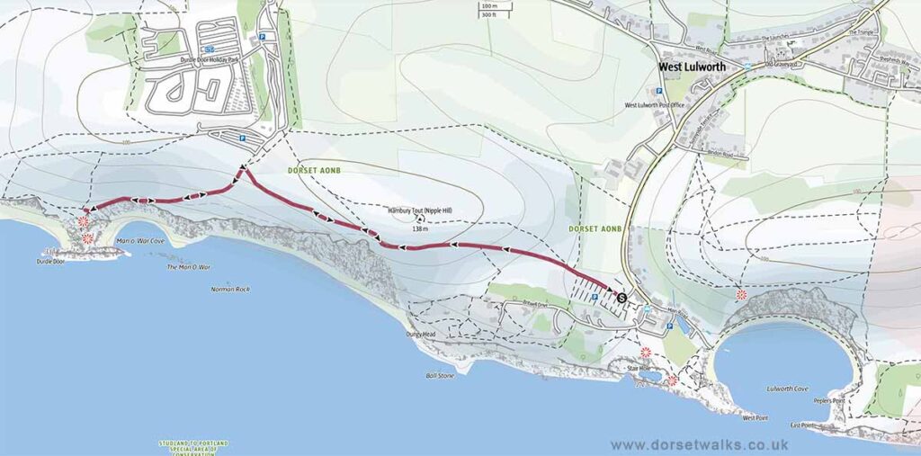
Base map © OpenStreetMap
Durdle Door to White Nothe
5.6 miles, Circular, Medium
Route: Durdle Door car park – South West Coast Path – White Nothe
Description: More demanding coastal route with sustained climbs, exposed sections and elevated views along the central Jurassic Coast.
Base map © OpenStreetMap
Abbotsbury to St Catherine’s Chapel and Chesil Beach
3.2 miles circular, Easy
Route: Abbotsbury Village – St Catherine’s Chapel – Chesil Beach
Can easily be combined with a visit to Abbotsbury Swannery or Abbotsbury Subtropical Gardens
Description: Short circular walk with a steady climb to St Catherine’s Chapel, offering views over Chesil Beach and the Fleet Lagoon.
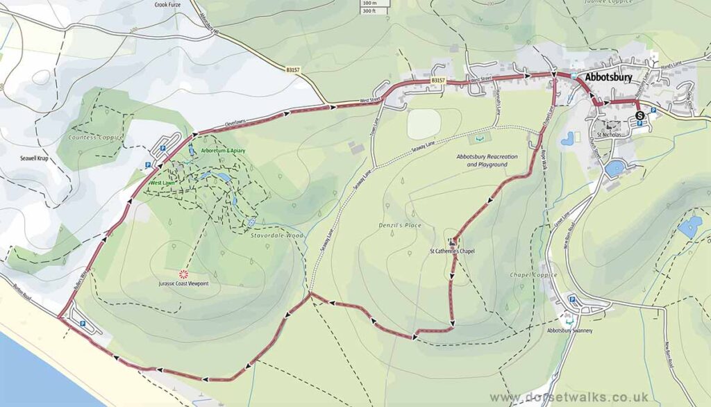
Base map © OpenStreetMap
Seatown to Thorncombe Beacon
2.5 miles, Circular, Medium
Route: Seatown Beach car park – Thorncombe Beacon – Seatown
Description: Short but steep ascent from the coast to an exposed ridge, with wide views along the western Jurassic Coast.
Base map © OpenStreetMap
Seatown to Golden Cap and Langdon Hill
4.1 miles, Circular, Medium
Route: Seatown Beach car park – Golden Cap – St Gabriel’s Chapel – Langdon Hill
Description: Steep and varied coastal walk to Golden Cap, followed by woodland paths around Langdon Hill with extensive views.
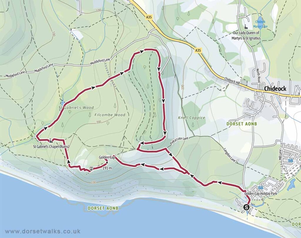
Base map © OpenStreetMap