Bournemouth offers a range of coastal and seaside walks, combining long sandy beaches, promenade paths and views across Poole Bay. The area is well suited to linear walks, with good transport links allowing routes to be completed in one direction and easily returned by bus, train or ferry.
Walks from Bournemouth connect to nearby coastal areas including Sandbanks, Studland and Swanage, following sections of the South West Coast Path and quieter shoreline routes. Terrain is generally straightforward, with a mix of paved promenades, sandy sections and occasional cliff-top paths.
These walks provide a combination of accessible shorter routes and longer coastal stretches, with consistent sea views and well-defined paths throughout.
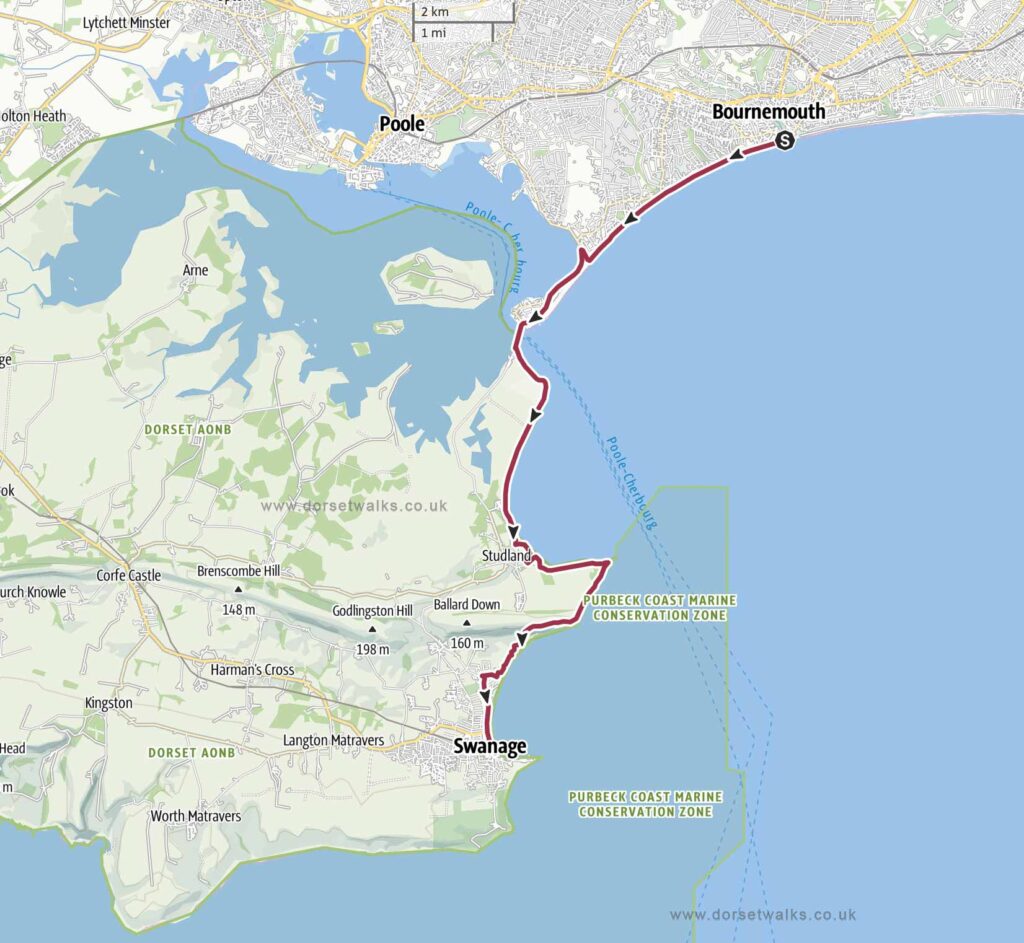
1. Bournemouth to Swanage Walk
Distance: 12.2 miles / 19.6 km (one-way)
Difficulty: Moderate
Estimated time: 5 hours 35 minutes
Total ascent 984ft / 299 m
Starting point: Bournemouth Pier (Google map)
OS Map: Explorer OL15 Purbeck & South Dorset
*** Route description and photos ***
Link to GPS route map
https://www.outdooractive.com/
https://www.alltrails.com/
https://explore.osmaps.com/
2. Bournemouth Pier to Studland Village
Distance: 8.1 miles / 13 km (one-way)
Difficulty: Moderate
Estimated time: 3 hours 15 Mins
Total ascent: 100ft / 30 m
Link to GPS route map
https://www.outdooractive.com/

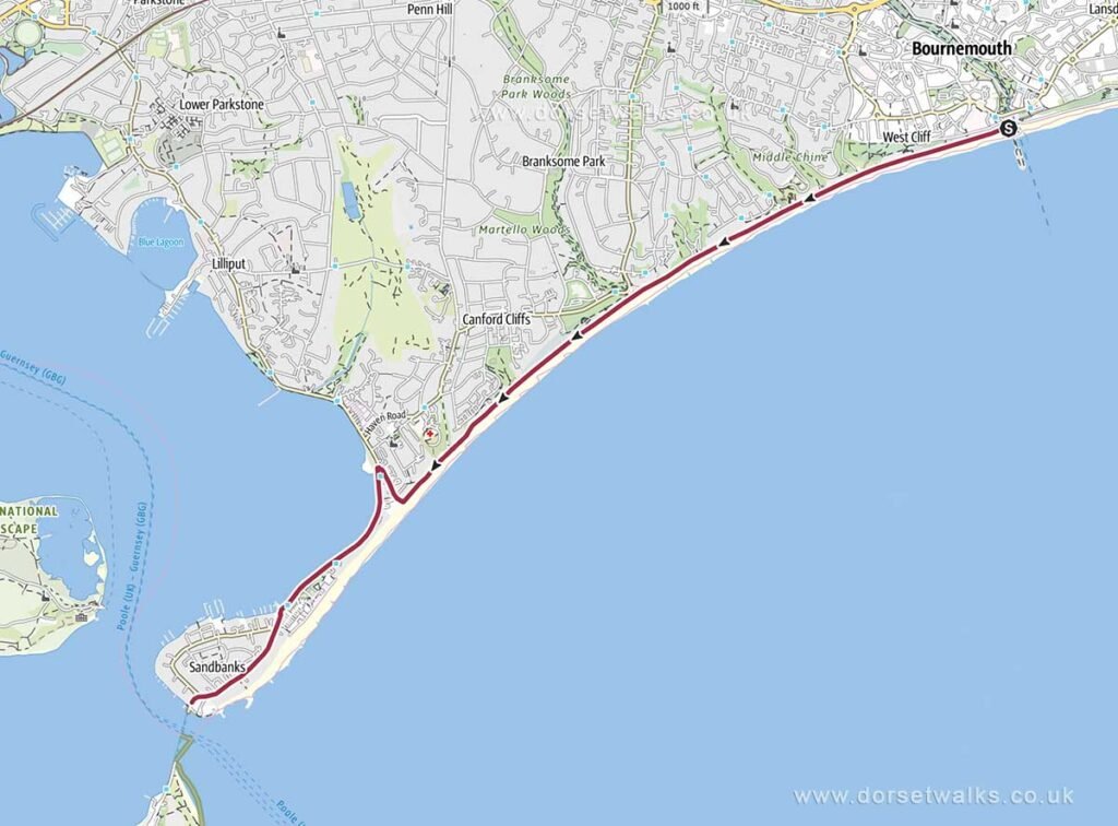
3. Bournemouth Pier to Sandbanks Ferry
Distance: 4.3 miles / 6.9 km (one-way)
Difficulty: Easy
Estimated time: 1 hour 40 mins
Total ascent: flat beach promenade
Link to GPS route map
https://www.outdooractive.com/
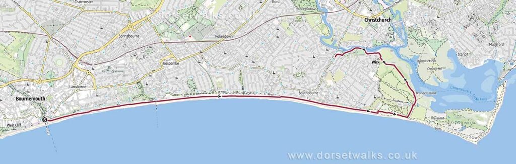
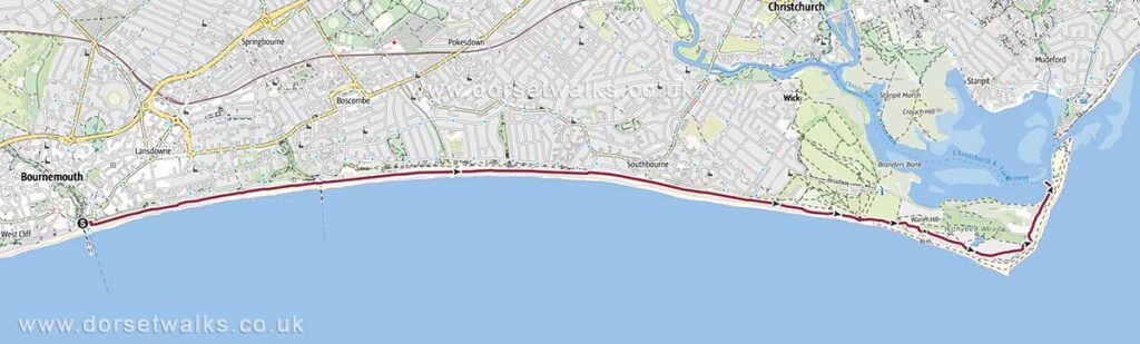
4. Bournemouth Pier to Hengistbury Head & Tuckton Bridge
Distance: 6.5 miles / 10.5 km (one-way)
Difficulty: Medium
Estimated time:2 hours 35 mins
Total ascent: Flat coastline
Link to GPS route map
https://www.outdooractive.com/
5. Bournemouth Pier to Hengistbury Head, Mudeford Sandbank & Ferry to Tuckton Bridge
Distance: 6.3 miles / 10.1 km (one-way)
Difficulty: Moderate
Estimated time: 2 hours 30 mins
Total ascent: 120 ft / 36 m
Link to GPS route map
https://www.outdooractive.com/
6. Bournemouth Gardens to Coy Pond
Distance: 4 miles / 6.4 km
Difficulty: Easy
Estimated time: 1 hour 40 mins
Total ascent: 170 ft / 51 m
Link to GPS route map
https://www.outdooractive.com/
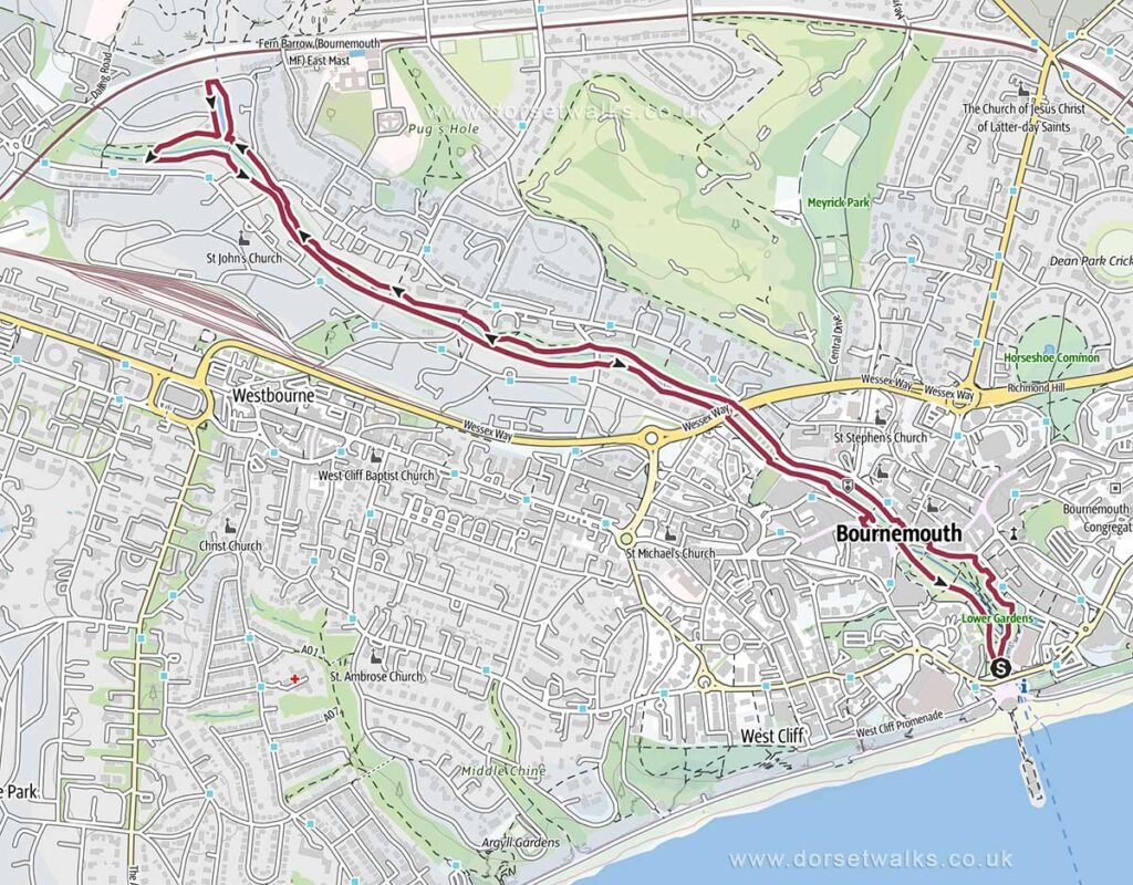
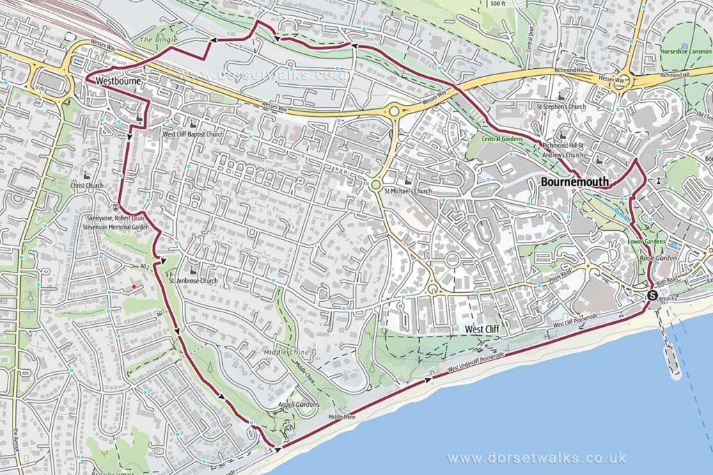
7. Bournemouth Pier, Gardens, Westbourne and Alum Chine
Distance: 4.1 miles / 6.6 km (circular)
Difficulty: Easy
Estimated time: 1 hour 45 mins
Total ascent: 220 ft / 67 m
Link to GPS route map
https://www.outdooractive.com/