

Weymouth to Abbotsbury (South West Coast Path)
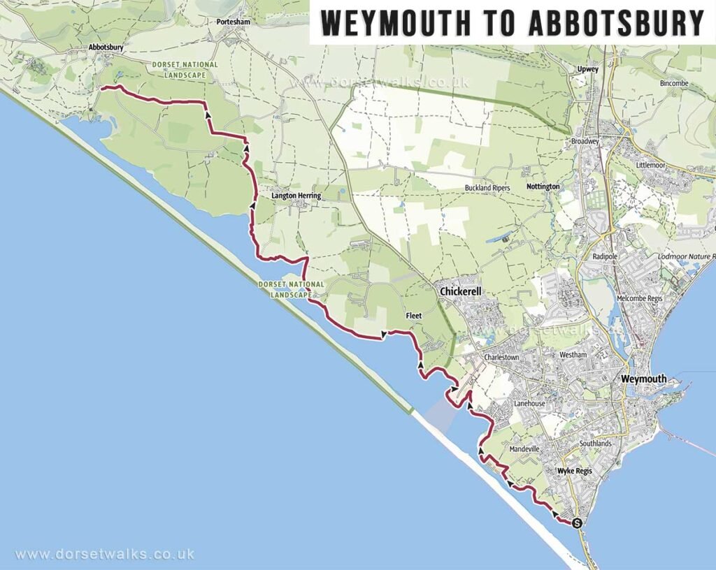
Distance: 10.8 miles / 17.4 km (one-way)
Difficulty: Difficult
Estimated time: 4 hours 30 minutes
Total ascent: 472 ft / 144 m
Starting point: Ferryman’s Way, Ferrybridge, Weymouth
Finish Point: Abbotsbury Swannery car park, Abbotsbury
OS Map: Explorer OL15 Purbeck & South Dorset
Route: Weymouth (Ferrybridge) – Chickerell Hive Point – East Fleet – Chesil Bank – Moonfleet Manor – Wyke Wood – Abbotsbury Swannery (car park)
Description: A longer and more exposed walk alongside Chesil Beach and the Fleet Lagoon, with a more open, windswept character than the cliff sections further east.
Link to GPS route map
https://www.outdooractive.com/
Weymouth (Ferrybridge) to Osmington Mills (South West Coast Path)
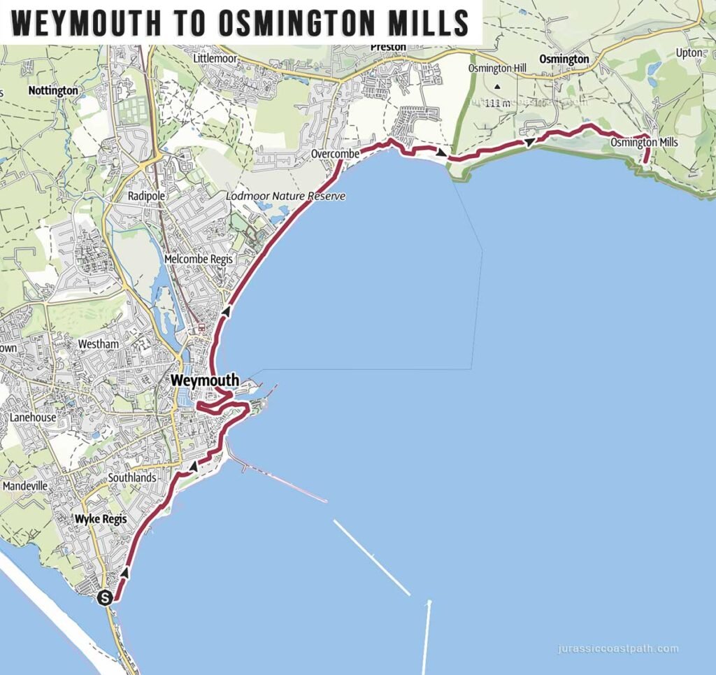
Distance: 8.1 miles / 13 km (one-way)
Difficulty: Difficult
Estimated time: 3 hours 30 minutes
Total ascent: 502 ft / 153 m
Starting point: Ferryman’s Way, Ferrybridge, Weymouth
Finish Point: Smugglers Inn, Osmington Mills
Route: Weymouth (Ferrybridge) – The Nothe – Weymouth Harbour – Weymouth Bay & seafront – Bowleaze Cove – Osmington Mills (Smugglers Inn)
Link to GPS route map
https://www.outdooractive.com/
Weymouth to Lulworth Cove
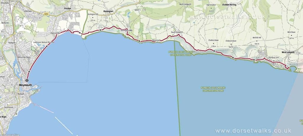
Distance: 11.3 miles / 18.2 km (one-way)
Difficulty: Difficult
Estimated time: 5 hours 45 minutes
Total ascent: 1857 ft / 566 m
Starting point: Seafront, Weymouth
Finish Point: Lulworth Cove
Route: Weymouth Bay & Seafront – Bowleaze Cove – Osmington Mills (Smugglers Inn) – Ringstead – White Nothe – Durdle Door – Lulworth Cove (Visitor Centre)
Link to GPS route map
https://www.outdooractive.com/
Isle of Portland Circuit (SWCP)
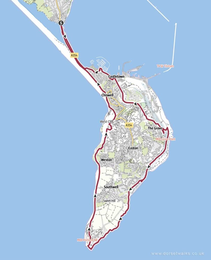
Distance: 13.7 miles / 22 km (circular)
Difficulty: Moderate
Estimated time: 6 hours 35 minutes
Total ascent: 1,155 ft / 352 m
Starting & Finish point: Ferryman’s Way, Ferrybridge, Weymouth
Route: Ferrybridge (Chesil Beach) – Portland Castle – Verne High Angle Battery – Church Ope Cove – Freshwater Bay – Portland Bill Lighthouse – Ferrybridge
Link to GPS route map
https://www.outdooractive.com/
Weymouth Seafront to Osmington Village
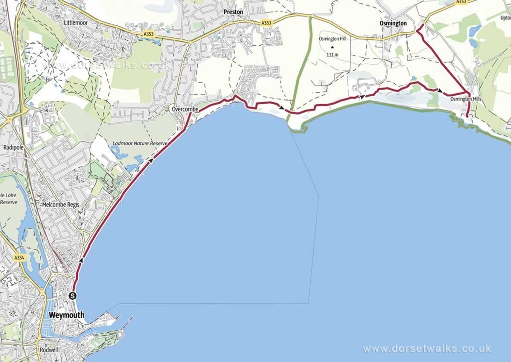
Distance: 5.9 miles / 9.5 km (one-way)
Difficulty: Moderate
Estimated time: 2 hours 35 minutes
Total ascent: 676 ft / 206 m
Starting point: Seafront, Weymouth
Finish Point: Osmington Village
Route: Weymouth Weymouth Bay & seafront – Bowleaze Cove – Osmington Mills (Smugglers Inn) – Osmington Village
Link to GPS route map
https://www.outdooractive.com/