
Durdle Door is one of the most recognisable landmarks on the Jurassic Coast, known for its natural limestone arch and dramatic coastal setting. The area offers a range of walks that explore the surrounding cliffs, bays and headlands, with routes linking key locations such as Lulworth Cove and White Nothe.
Walks from Durdle Door follow sections of the South West Coast Path, with well-defined routes across open grassland and along exposed cliff tops. The terrain varies from short, accessible paths between major viewpoints to longer routes with steeper ascents and more uneven ground.
These walks combine some of the most distinctive coastal scenery in Dorset with clear navigation and established paths, making the area suitable for both shorter visits and more extended coastal walks.
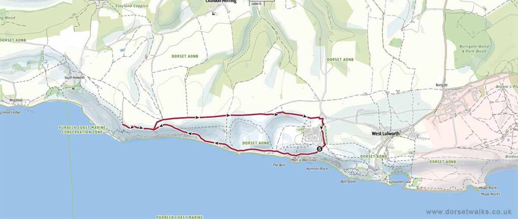
1. Durdle Door to White Nothe
Distance: 5.5 miles / 8.9 km (circular)
Difficulty: moderate (uneven ground, some steep ascents)
Estimated time: 3 hours 15 minutes,
Total ascent: 1,001 ft / 305 m
*** Detailed route description and photos ***
Link to GPS route map
https://www.outdooractive.com/
https://www.alltrails.com/
https://explore.osmaps.com/
https://www.google.com/maps/
Base map © OpenStreetMap
2. Durdle Door to Lulworth Cove
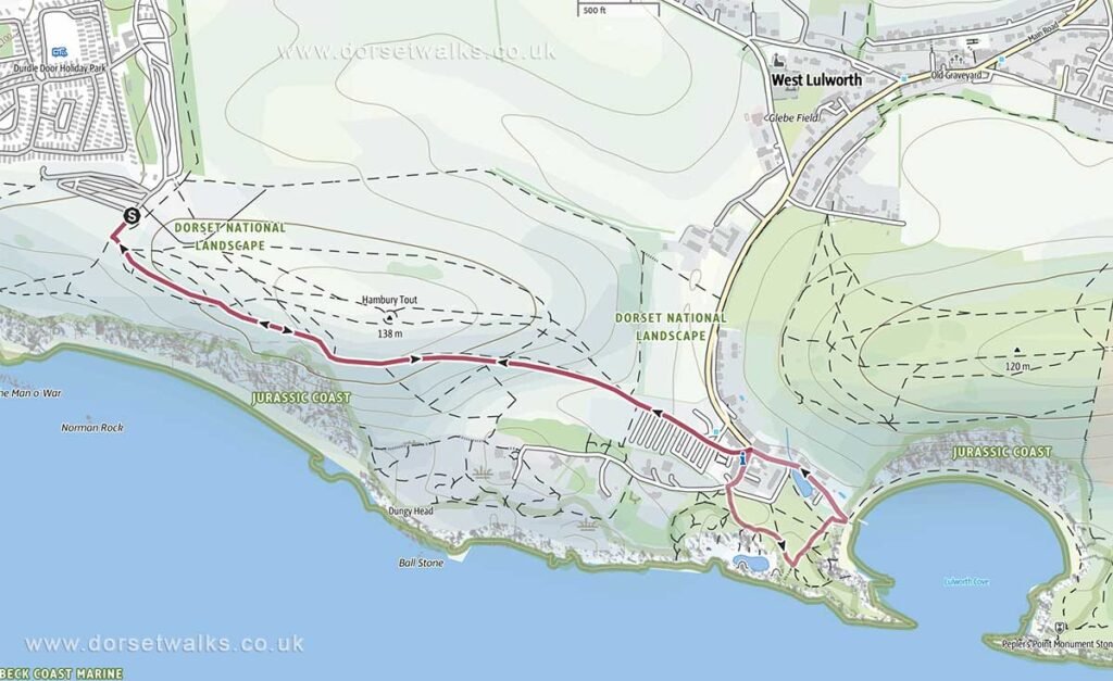
Distance: 2.1 miles / 3.4 km (there and back)
Difficulty: Easy
Estimated time: 1 hour 20 mins
Total ascent: 541 ft / 165 m
Description: This walk starts at Durdle Door Car Park and follows the South West Coast Path to Lulworth Cove visiting the Lulworth Cove Visitor Centre, Stair Hole and Lulworth Cove Beach. Return via the Main Road and then following the same path back to Durdle Door car park
Link to GPS route map
https://www.outdooractive.com/
3. Durdle Door to Lulworth Cove and West Lulworth
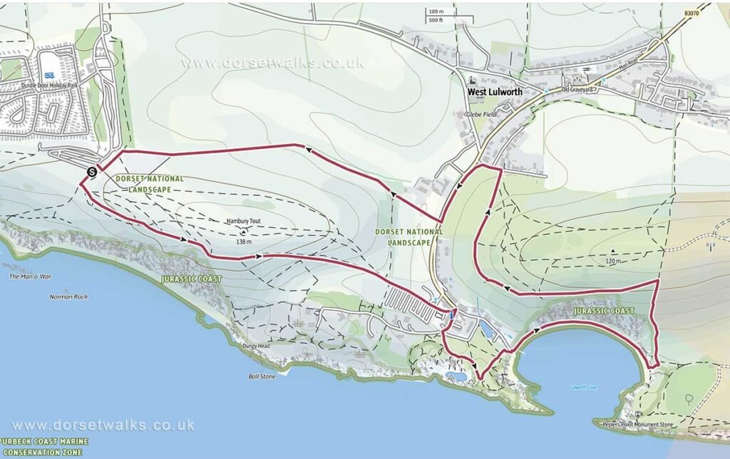
Distance: 3.1 miles / 5 km (circular)
Difficulty: Easy
Estimated time: 1 hr 40 mins
Total ascent: 748 ft / 228 m
Description: Starting at Durdle Door Car Park and following the main South West Coast Path to Lulworth Cove. Return using an alternative route via Lulworth Cove Beach, Bindon Hill and the north side of Hambury Tout.
Link to GPS route map
https://www.outdooractive.com/
4. Durdle Door to Osmington Village
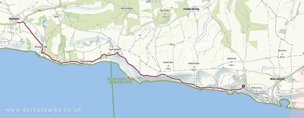
Distance: 6.4 miles / 10.3 km (one-way)
Difficulty: Moderate
Estimated time: 3 hrs 15 min
Total ascent: 1,381 ft / 421 m
Description: Durdle Door car park to Osmington village following the South West Coast Path as far as Osmington Mills. Return by bus, check bus timetable before starting this trek.
Link to GPS route map
https://www.outdooractive.com/
5. Durdle Door to Weymouth
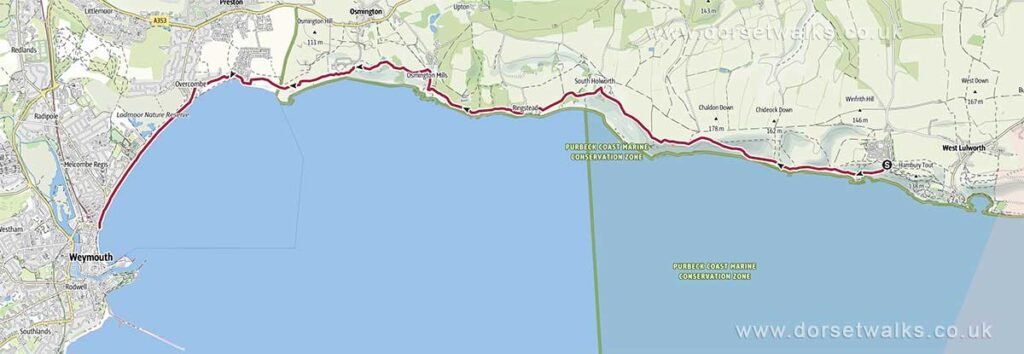
Distance: 10.1 miles / 16.3 km (one-way)
Difficulty: Difficult
Estimated time: 4 hrs 50 mins
Total ascent: 1,421 ft / 433 m
Description: Durdle Door car park to Weymouth Esplanade (Jubilee Clock Tower) following the route of the South West Coast Path / Jurassic Coast Path. Return by bus, check bus timetable before starting this trek.
Link to GPS route map
https://www.outdooractive.com/